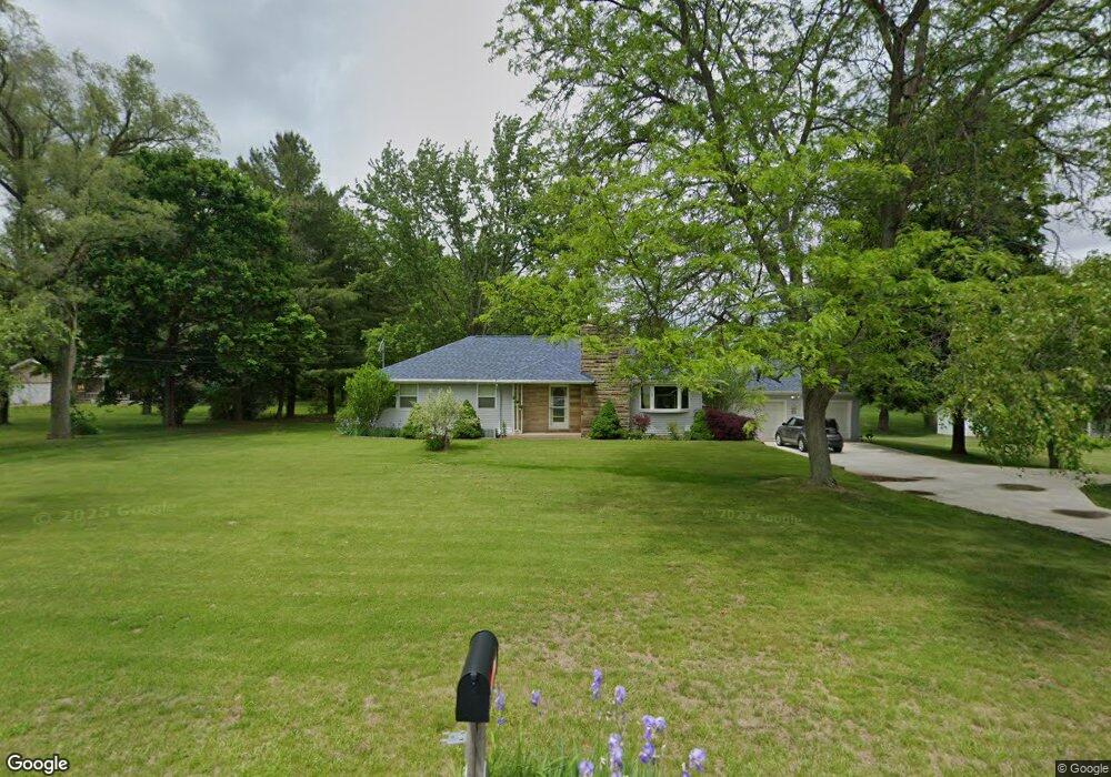
161 Jono Rd Battle Creek, MI 49014
Estimated Value: $207,000 - $223,000
3
Beds
1
Bath
1,326
Sq Ft
$164/Sq Ft
Est. Value
About This Home
This home is located at 161 Jono Rd, Battle Creek, MI 49014 and is currently estimated at $217,289, approximately $163 per square foot. 161 Jono Rd is a home located in Calhoun County with nearby schools including Harper Creek Middle School and Harper Creek High School.
Ownership History
Date
Name
Owned For
Owner Type
Purchase Details
Closed on
Mar 28, 2008
Sold by
Wells Fargo Bank Na
Bought by
Hudson Donald
Current Estimated Value
Home Financials for this Owner
Home Financials are based on the most recent Mortgage that was taken out on this home.
Original Mortgage
$73,625
Outstanding Balance
$46,419
Interest Rate
5.88%
Mortgage Type
Purchase Money Mortgage
Estimated Equity
$170,870
Purchase Details
Closed on
Aug 17, 2007
Sold by
Option One Mortgage Corp
Bought by
Wells Fargo Bank Na and Option One Mortgage Loan Trust 2004-3 As
Purchase Details
Closed on
Aug 10, 2007
Sold by
Gardner Bill and Gardner Karen
Bought by
Option One Mortgage Corp
Purchase Details
Closed on
Jun 25, 2004
Sold by
Habenicht David L and Habenicht Living Trust
Bought by
Gardner Bill and Gardner Karen
Home Financials for this Owner
Home Financials are based on the most recent Mortgage that was taken out on this home.
Original Mortgage
$148,000
Interest Rate
9.3%
Mortgage Type
Purchase Money Mortgage
Create a Home Valuation Report for This Property
The Home Valuation Report is an in-depth analysis detailing your home's value as well as a comparison with similar homes in the area
Home Values in the Area
Average Home Value in this Area
Purchase History
| Date | Buyer | Sale Price | Title Company |
|---|---|---|---|
| Hudson Donald | $77,500 | Attorneys Title Agency Llc | |
| Wells Fargo Bank Na | -- | None Available | |
| Option One Mortgage Corp | $117,300 | None Available | |
| Gardner Bill | $120,000 | -- |
Source: Public Records
Mortgage History
| Date | Status | Borrower | Loan Amount |
|---|---|---|---|
| Open | Hudson Donald | $73,625 | |
| Previous Owner | Gardner Bill | $148,000 |
Source: Public Records
Tax History Compared to Growth
Tax History
| Year | Tax Paid | Tax Assessment Tax Assessment Total Assessment is a certain percentage of the fair market value that is determined by local assessors to be the total taxable value of land and additions on the property. | Land | Improvement |
|---|---|---|---|---|
| 2025 | $2,701 | $117,480 | $0 | $0 |
| 2024 | $1,573 | $108,340 | $0 | $0 |
| 2023 | $2,417 | $94,670 | $0 | $0 |
| 2022 | $1,427 | $88,340 | $0 | $0 |
| 2021 | $2,310 | $69,700 | $0 | $0 |
| 2020 | $2,353 | $67,900 | $0 | $0 |
| 2019 | $2,681 | $66,900 | $0 | $0 |
| 2018 | $2,023 | $59,700 | $11,850 | $47,850 |
| 2017 | $2,023 | $60,000 | $0 | $0 |
| 2016 | $2,023 | $59,950 | $0 | $0 |
| 2015 | $1,288 | $54,800 | $16,657 | $38,143 |
| 2014 | $1,288 | $54,300 | $16,657 | $37,643 |
Source: Public Records
Map
Nearby Homes
- 323 Wattles Rd S
- 226 Nixon
- 154 Hidden Forest Rd
- 153 Hidden Forest Rd
- 173 Strongwood Ave
- 8362 River Rd E
- 140 Princeton St S
- 0 E River Rd
- 141 Moonwood Trail
- 184 Shadowood Ln
- 840 Wattles Rd N
- 97 Shadow Bend Ln
- 605 Westbrook Ave
- 13815 9 Mile Rd
- 11815 H Dr N
- 0 Gavin Ln Unit 17
- 0 Rook St Unit 25019652
- 153 Martin St
- 23 Bradford St
- 1230 Golden Ave