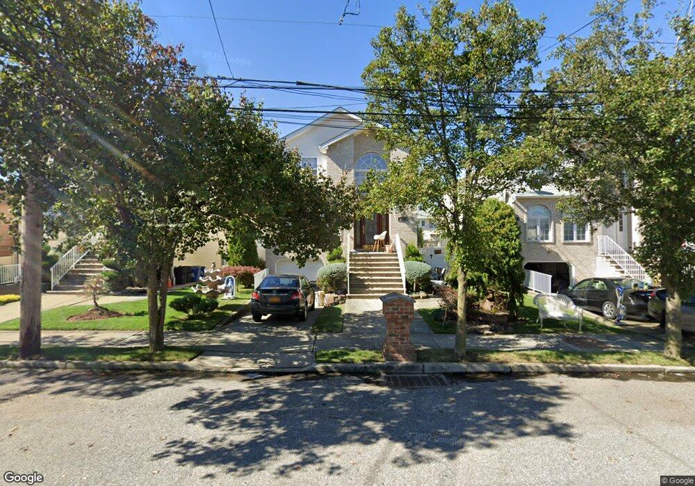
161 Stafford Ave Staten Island, NY 10312
Arden Heights NeighborhoodEstimated Value: $1,039,322 - $1,281,000
3
Beds
4
Baths
2,556
Sq Ft
$456/Sq Ft
Est. Value
About This Home
This home is located at 161 Stafford Ave, Staten Island, NY 10312 and is currently estimated at $1,164,331, approximately $455 per square foot. 161 Stafford Ave is a home located in Richmond County with nearby schools including P.S. 36 - J.C. Drumgoole, I.S. 075 Frank D. Paulo, and Tottenville High School.
Ownership History
Date
Name
Owned For
Owner Type
Purchase Details
Closed on
Nov 21, 2001
Sold by
Victoria Building Corp
Bought by
Carollo Saverio
Current Estimated Value
Home Financials for this Owner
Home Financials are based on the most recent Mortgage that was taken out on this home.
Original Mortgage
$351,000
Interest Rate
7.14%
Create a Home Valuation Report for This Property
The Home Valuation Report is an in-depth analysis detailing your home's value as well as a comparison with similar homes in the area
Home Values in the Area
Average Home Value in this Area
Purchase History
| Date | Buyer | Sale Price | Title Company |
|---|---|---|---|
| Carollo Saverio | $489,000 | Stewart Title |
Source: Public Records
Mortgage History
| Date | Status | Borrower | Loan Amount |
|---|---|---|---|
| Previous Owner | Carollo Saverio | $351,000 | |
| Closed | Carollo Saverio | $31,000 |
Source: Public Records
Tax History Compared to Growth
Tax History
| Year | Tax Paid | Tax Assessment Tax Assessment Total Assessment is a certain percentage of the fair market value that is determined by local assessors to be the total taxable value of land and additions on the property. | Land | Improvement |
|---|---|---|---|---|
| 2025 | $11,134 | $57,780 | $13,482 | $44,298 |
| 2024 | $11,146 | $57,480 | $13,288 | $44,192 |
| 2023 | $10,604 | $53,615 | $12,107 | $41,508 |
| 2022 | $9,810 | $50,580 | $13,440 | $37,140 |
| 2021 | $10,165 | $49,740 | $13,440 | $36,300 |
| 2020 | $9,928 | $48,300 | $13,440 | $34,860 |
| 2019 | $10,082 | $51,300 | $13,440 | $37,860 |
| 2018 | $9,240 | $46,786 | $13,116 | $33,670 |
| 2017 | $8,698 | $44,138 | $13,235 | $30,903 |
| 2016 | $8,014 | $41,640 | $13,440 | $28,200 |
| 2015 | $8,263 | $45,900 | $11,820 | $34,080 |
| 2014 | $8,263 | $44,647 | $11,497 | $33,150 |
Source: Public Records
Map
Nearby Homes
- 610 Woodrow Rd
- 34 Crown Ct
- 387 Woodrow Rd
- 535 Carlton Blvd
- 149 Rensselaer Ave
- 191 Rensselaer Ave Unit 198
- 0 Sheldon Ave
- 9 Sinclair Ave
- 75/79/83 Halpin Ave
- 83 Halpin Ave
- 79 Halpin Ave
- 75 Halpin Ave
- 262 Stafford Ave
- 40 Susanna Ln
- 138 Rathbun Ave
- 17 Holcomb Ave
- 946 Drumgoole Rd W
- 160 Rathbun Ave
- 62 Ruxton Ave
- 48 Linda Ln
- 153 Stafford Ave
- 163 Stafford Ave
- 165 Stafford Ave
- 190 Vineland Ave
- 188 Vineland Ave
- 192 Vineland Ave
- 169 Stafford Ave
- 500 Arden Ave
- 496 Arden Ave
- 194 Vineland Ave
- 490 Arden Ave
- 198 Vineland Ave
- 158 Stafford Ave
- 173 Stafford Ave
- 162 Stafford Ave
- 154 Stafford Ave
- 486 Arden Ave
- 166 Stafford Ave
- 516 Arden Ave
- 170 Stafford Ave