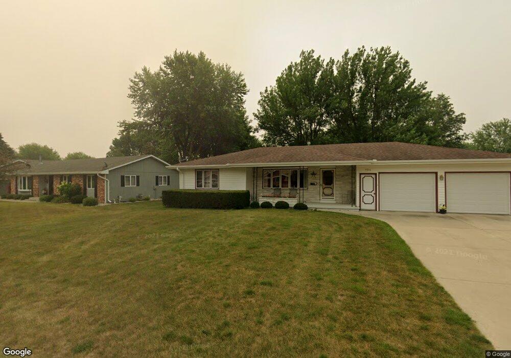
161 W Randall Rd Carroll, IA 51401
Estimated Value: $248,000 - $293,000
2
Beds
2
Baths
1,498
Sq Ft
$183/Sq Ft
Est. Value
About This Home
This home is located at 161 W Randall Rd, Carroll, IA 51401 and is currently estimated at $274,376, approximately $183 per square foot. 161 W Randall Rd is a home with nearby schools including Fairview Elementary School, Adams Elementary School, and Carroll Middle School.
Ownership History
Date
Name
Owned For
Owner Type
Purchase Details
Closed on
Dec 4, 2023
Sold by
Grote Joseph H and Grote Donna M
Bought by
Joseph And Donna Grote Revocable Trust and Grote
Current Estimated Value
Purchase Details
Closed on
Feb 5, 2010
Sold by
Wendl Marie E
Bought by
Grote Joseph H and Grote Donna M
Home Financials for this Owner
Home Financials are based on the most recent Mortgage that was taken out on this home.
Original Mortgage
$134,400
Interest Rate
5.09%
Mortgage Type
New Conventional
Create a Home Valuation Report for This Property
The Home Valuation Report is an in-depth analysis detailing your home's value as well as a comparison with similar homes in the area
Home Values in the Area
Average Home Value in this Area
Purchase History
| Date | Buyer | Sale Price | Title Company |
|---|---|---|---|
| Joseph And Donna Grote Revocable Trust | -- | None Listed On Document | |
| Grote Joseph H | $168,000 | Security Title & Investment |
Source: Public Records
Mortgage History
| Date | Status | Borrower | Loan Amount |
|---|---|---|---|
| Previous Owner | Grote Joseph H | $134,400 |
Source: Public Records
Tax History Compared to Growth
Tax History
| Year | Tax Paid | Tax Assessment Tax Assessment Total Assessment is a certain percentage of the fair market value that is determined by local assessors to be the total taxable value of land and additions on the property. | Land | Improvement |
|---|---|---|---|---|
| 2025 | $2,902 | $265,010 | $33,720 | $231,290 |
| 2024 | $2,902 | $236,160 | $33,720 | $202,440 |
| 2023 | $2,723 | $236,160 | $33,720 | $202,440 |
| 2022 | $2,582 | $187,040 | $31,470 | $155,570 |
| 2021 | $2,582 | $187,040 | $31,470 | $155,570 |
| 2020 | $2,646 | $187,040 | $31,470 | $155,570 |
| 2019 | $2,642 | $187,040 | $31,470 | $155,570 |
| 2018 | $2,454 | $187,040 | $31,470 | $155,570 |
| 2017 | $2,448 | $180,071 | $27,906 | $152,165 |
| 2016 | $2,284 | $168,290 | $0 | $0 |
| 2015 | $2,284 | $166,870 | $0 | $0 |
| 2014 | $2,238 | $166,870 | $0 | $0 |
Source: Public Records
Map
Nearby Homes
- 328 W 21st St
- 2017 N West St
- 611 W 21st St
- 265 Perch St
- 1844 Benjamin St
- 1852 Quint Ave
- 711 W 21st St
- 2340 Skyline Dr
- 1601 Pike Ave
- 222 Bass St
- 1408 N Adams St
- 260 Bass St
- 746 Granada Rd
- 1810 Crestview Dr
- 226 W 13th St
- 1608 Salinger Ave
- 1217 N Main St
- 638 Capistrano Ave
- 1036 N Crawford St
- 204 W 11th St
- 2124 W Todd Terrace
- 151 W Randall Rd
- 2114 W Todd Terrace
- 170 W Randall Rd
- 160 W Randall Rd
- 141 W Randall Rd
- 120 W 21st St
- 178 W Randall Rd
- 152 W Randall Rd
- 2106 W Todd Terrace
- 2123 W Todd Terrace
- 2117 W Todd Terrace
- 133 W Randall Rd
- 142 W Randall Rd
- 204 W Randall Rd
- 133 W 21st St
- 2107 W Todd Terrace
- 123 W 21st St
- 123 W Randall Rd
- 112 W 21st St