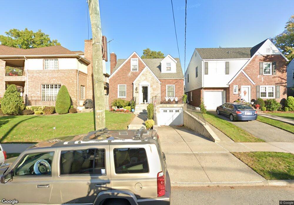
161 Westcott Blvd Staten Island, NY 10314
Westerleigh NeighborhoodEstimated Value: $775,000 - $899,000
--
Bed
4
Baths
1,650
Sq Ft
$503/Sq Ft
Est. Value
About This Home
This home is located at 161 Westcott Blvd, Staten Island, NY 10314 and is currently estimated at $830,676, approximately $503 per square foot. 161 Westcott Blvd is a home located in Richmond County with nearby schools including P.S. 30 Westerleigh, I.S. 51 Edwin Markham, and Susan E Wagner High School.
Ownership History
Date
Name
Owned For
Owner Type
Purchase Details
Closed on
Oct 23, 1996
Sold by
Jorgensen Olga O
Bought by
Osgood Daniel and Osgood Sandra
Current Estimated Value
Home Financials for this Owner
Home Financials are based on the most recent Mortgage that was taken out on this home.
Original Mortgage
$144,000
Outstanding Balance
$13,104
Interest Rate
7.99%
Estimated Equity
$817,572
Create a Home Valuation Report for This Property
The Home Valuation Report is an in-depth analysis detailing your home's value as well as a comparison with similar homes in the area
Home Values in the Area
Average Home Value in this Area
Purchase History
| Date | Buyer | Sale Price | Title Company |
|---|---|---|---|
| Osgood Daniel | $186,000 | Safe Harbor Title Agency Ltd |
Source: Public Records
Mortgage History
| Date | Status | Borrower | Loan Amount |
|---|---|---|---|
| Open | Osgood Daniel | $144,000 |
Source: Public Records
Tax History Compared to Growth
Tax History
| Year | Tax Paid | Tax Assessment Tax Assessment Total Assessment is a certain percentage of the fair market value that is determined by local assessors to be the total taxable value of land and additions on the property. | Land | Improvement |
|---|---|---|---|---|
| 2025 | $7,829 | $51,600 | $13,687 | $37,913 |
| 2024 | $7,841 | $47,940 | $13,898 | $34,042 |
| 2023 | $7,452 | $38,095 | $11,169 | $26,926 |
| 2022 | $7,024 | $49,560 | $16,500 | $33,060 |
| 2021 | $7,404 | $46,980 | $16,500 | $30,480 |
| 2020 | $7,254 | $41,940 | $16,500 | $25,440 |
| 2019 | $6,741 | $44,160 | $16,500 | $27,660 |
| 2018 | $6,174 | $31,746 | $11,625 | $20,121 |
| 2017 | $5,921 | $30,518 | $14,224 | $16,294 |
| 2016 | $5,791 | $30,518 | $14,297 | $16,221 |
| 2015 | $5,076 | $29,723 | $16,126 | $13,597 |
| 2014 | $5,076 | $28,041 | $17,619 | $10,422 |
Source: Public Records
Map
Nearby Homes
- 160 Westcott Blvd
- 36 Sawyer Ave
- 125 Westcott Blvd
- 80 Kemball Ave
- 25 Coale Ave
- 142 Margaretta Ct
- 148 Sturges St
- 136 Sturges St
- 14 Leonard Ave
- 751 Jewett Ave Unit 17
- 751 Jewett Ave
- 48 Markham Place
- 254 Rice Ave
- 204 Utter Ave
- 328 Manor Rd
- 17 Carolina Place
- 21 Winthrop Place
- 307 Fiske Ave
- 25 Winthrop Place
- 307 Clinton B Fiske Ave
- 165 Westcott Blvd
- 157 Westcott Blvd
- 90 Goodwin Ave
- 171 Westcott Blvd
- 97 Crowell Ave
- 95 Crowell Ave
- 84 Goodwin Ave
- 0 Crowell Ave
- 91 Crowell Ave
- 149 Westcott Blvd
- 164 Westcott Blvd
- 116 Goodwin Ave
- 170 Westcott Blvd
- 93 Goodwin Ave
- 87 Crowell Ave
- 108 Crowell Ave
- 78 Goodwin Ave
- 89 Goodwin Ave
- 83 Goodwin Ave
- 100 Crowell Ave