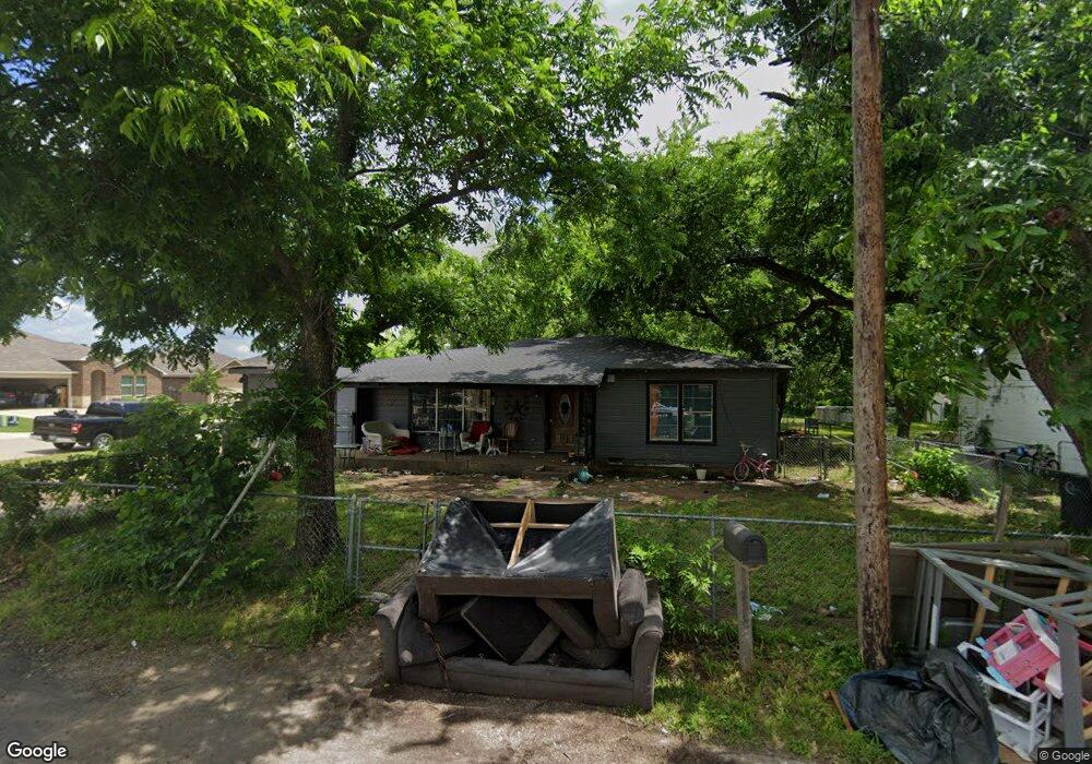
1610 N Buffalo Ave Cleburne, TX 76033
Estimated Value: $184,000 - $216,000
3
Beds
1
Bath
1,446
Sq Ft
$138/Sq Ft
Est. Value
About This Home
This home is located at 1610 N Buffalo Ave, Cleburne, TX 76033 and is currently estimated at $199,610, approximately $138 per square foot. 1610 N Buffalo Ave is a home located in Johnson County with nearby schools including Irving Elementary School, A.D. Wheat Middle School, and Cleburne High School.
Ownership History
Date
Name
Owned For
Owner Type
Purchase Details
Closed on
Aug 9, 2017
Sold by
Barton Michael and Barton Andrea
Bought by
Almethan Properties Llc
Current Estimated Value
Purchase Details
Closed on
Apr 20, 2007
Sold by
R A Development Ltd
Bought by
Garrett Development Group Lp
Home Financials for this Owner
Home Financials are based on the most recent Mortgage that was taken out on this home.
Original Mortgage
$100,000
Interest Rate
6.13%
Mortgage Type
Construction
Create a Home Valuation Report for This Property
The Home Valuation Report is an in-depth analysis detailing your home's value as well as a comparison with similar homes in the area
Home Values in the Area
Average Home Value in this Area
Purchase History
| Date | Buyer | Sale Price | Title Company |
|---|---|---|---|
| Almethan Properties Llc | -- | Providence Title Co | |
| Garrett Development Group Lp | -- | Natc |
Source: Public Records
Mortgage History
| Date | Status | Borrower | Loan Amount |
|---|---|---|---|
| Previous Owner | Garrett Development Group Lp | $100,000 |
Source: Public Records
Tax History Compared to Growth
Tax History
| Year | Tax Paid | Tax Assessment Tax Assessment Total Assessment is a certain percentage of the fair market value that is determined by local assessors to be the total taxable value of land and additions on the property. | Land | Improvement |
|---|---|---|---|---|
| 2025 | $2,270 | $101,805 | $39,000 | $62,805 |
| 2024 | $2,270 | $101,805 | $39,000 | $62,805 |
| 2023 | $2,021 | $90,805 | $28,000 | $62,805 |
| 2022 | $2,273 | $90,805 | $28,000 | $62,805 |
| 2021 | $2,369 | $90,805 | $28,000 | $62,805 |
| 2020 | $1,700 | $61,354 | $20,000 | $41,354 |
| 2019 | $1,813 | $61,354 | $20,000 | $41,354 |
| 2018 | $1,832 | $61,960 | $13,000 | $48,960 |
| 2017 | $1,824 | $61,960 | $13,000 | $48,960 |
| 2016 | $1,674 | $56,860 | $11,500 | $45,360 |
| 2015 | $1,516 | $56,860 | $11,500 | $45,360 |
| 2014 | $1,516 | $56,860 | $11,500 | $45,360 |
Source: Public Records
Map
Nearby Homes
- 411 Euclid St
- 418 Marengo St
- 315 Rose Ave
- 404 Rose Ave
- 308 Poindexter Ave
- 413 Rose Ave
- 414 Rose Ave
- 422 Rose Ave
- 5348 State Highway 171 Unit 4
- 426 Rose Ave
- 502 Bales St
- Sherwood Plan at Craftsman's Corner
- Essex Plan at Craftsman's Corner
- Hanover Plan at Craftsman's Corner
- 433 Rose Ave
- 603 Lilly St
- 508 Bales St
- Robin Plan at Craftsman's Corner
- Cardinal Plan at Craftsman's Corner
- 109 Claude Ave
- 1608 N Buffalo Ave
- 1606 N Buffalo Ave
- 226 Phillips St
- 228 Phillips St
- 224 Phillips St
- 509 Franklin St
- 300 Phillips St
- 1604 N Buffalo Ave
- 507 Franklin St
- 222 Phillips St
- 1615 N Buffalo Ave
- 1611 N Buffalo Ave
- 302 Phillips St
- 505 Franklin St
- 1607 N Buffalo Ave
- 220 Phillips St
- 225 Seclusion Dr
- 301 Seclusion Dr
- 503 Franklin St
- 223 Seclusion Dr