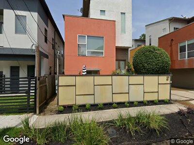
1611 Knox St Unit B Houston, TX 77007
Washington Avenue Coalition NeighborhoodEstimated Value: $459,630 - $465,000
2
Beds
3
Baths
2,204
Sq Ft
$209/Sq Ft
Est. Value
About This Home
This home is located at 1611 Knox St Unit B, Houston, TX 77007 and is currently estimated at $461,658, approximately $209 per square foot. 1611 Knox St Unit B is a home located in Harris County with nearby schools including Memorial Elementary School, Hogg Middle, and Lamar High School.
Ownership History
Date
Name
Owned For
Owner Type
Purchase Details
Closed on
Jun 28, 2012
Sold by
Vlasis Robert T
Bought by
Hotho Michael
Current Estimated Value
Home Financials for this Owner
Home Financials are based on the most recent Mortgage that was taken out on this home.
Original Mortgage
$235,551
Outstanding Balance
$166,089
Interest Rate
3.75%
Mortgage Type
FHA
Estimated Equity
$295,569
Create a Home Valuation Report for This Property
The Home Valuation Report is an in-depth analysis detailing your home's value as well as a comparison with similar homes in the area
Home Values in the Area
Average Home Value in this Area
Purchase History
| Date | Buyer | Sale Price | Title Company |
|---|---|---|---|
| Hotho Michael | -- | None Available |
Source: Public Records
Mortgage History
| Date | Status | Borrower | Loan Amount |
|---|---|---|---|
| Open | Hotho Michael | $235,551 |
Source: Public Records
Tax History Compared to Growth
Tax History
| Year | Tax Paid | Tax Assessment Tax Assessment Total Assessment is a certain percentage of the fair market value that is determined by local assessors to be the total taxable value of land and additions on the property. | Land | Improvement |
|---|---|---|---|---|
| 2023 | $6,469 | $405,381 | $161,500 | $243,881 |
| 2022 | $8,081 | $367,025 | $161,500 | $205,525 |
| 2021 | $8,015 | $343,895 | $161,500 | $182,395 |
| 2020 | $8,523 | $351,953 | $161,500 | $190,453 |
| 2019 | $8,778 | $346,900 | $161,500 | $185,400 |
| 2018 | $6,583 | $338,426 | $114,000 | $224,426 |
| 2017 | $9,502 | $375,800 | $114,000 | $261,800 |
| 2016 | $9,502 | $375,800 | $114,000 | $261,800 |
| 2015 | $7,031 | $375,800 | $114,000 | $261,800 |
| 2014 | $7,031 | $389,753 | $114,000 | $275,753 |
Source: Public Records
Map
Nearby Homes
- 5933 Allen St
- 1603 Knox St Unit B
- 1516 Cohn St
- 1524 Birdsall St
- 6015 Tyne St
- 1510 Birdsall St
- 1801 Radcliffe St
- 6014 Hamman St
- 5432 Nolda St
- 6104 Tyne St Unit B
- 6104 Tyne St Unit A
- 1512 Malone St
- 1432 Utah St
- 6115 Hamman St
- 6110 Tyne St
- 6001 Truro St Unit F
- 6118 Hamman St Unit C
- 5607 Maxie St
- 1330 Malone St
- 6114 Truro St
- 1611 Knox St Unit B
- 1611 Knox St Unit A
- 1611 Knox St
- 1615 Knox St Unit B
- 1615 Knox St Unit C
- 1615 Knox St Unit A
- 1615 Knox St
- 1609 Knox St
- 1612 Cohn St
- 1610 Cohn St
- 1614 Cohn St
- 1619 Knox St
- 1608 Cohn St
- 1605 Knox St
- 1605 Knox St Unit A
- 1605 Knox St Unit B
- 1616 Cohn St
- 1606 Cohn St
- 1621 Knox St
- 1604 Cohn St