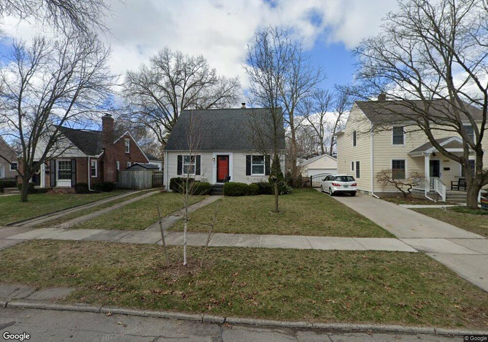
1611 N Blair Ave Royal Oak, MI 48067
Estimated Value: $311,590 - $371,000
4
Beds
1
Bath
998
Sq Ft
$335/Sq Ft
Est. Value
About This Home
This home is located at 1611 N Blair Ave, Royal Oak, MI 48067 and is currently estimated at $334,648, approximately $335 per square foot. 1611 N Blair Ave is a home located in Oakland County with nearby schools including Keller Elementary, Royal Oak Middle School, and Royal Oak High School.
Ownership History
Date
Name
Owned For
Owner Type
Purchase Details
Closed on
Apr 27, 2022
Sold by
Mcgillis Michael P
Bought by
Mcgillis Michael P
Current Estimated Value
Purchase Details
Closed on
Jul 10, 2014
Sold by
Rice William and Rice Niku
Bought by
Mcgillis Michael P and Mcgillis Carolyn R
Home Financials for this Owner
Home Financials are based on the most recent Mortgage that was taken out on this home.
Original Mortgage
$84,000
Interest Rate
4.12%
Mortgage Type
New Conventional
Purchase Details
Closed on
Oct 22, 2007
Sold by
Estate Of Marion Waters and Farrar Maryann H
Bought by
Rice William and Rice Niku
Create a Home Valuation Report for This Property
The Home Valuation Report is an in-depth analysis detailing your home's value as well as a comparison with similar homes in the area
Home Values in the Area
Average Home Value in this Area
Purchase History
| Date | Buyer | Sale Price | Title Company |
|---|---|---|---|
| Mcgillis Michael P | -- | Land Title | |
| Mcgillis Michael P | $160,000 | Interstate Title Inc | |
| Rice William | $166,000 | Devon Title Agency |
Source: Public Records
Mortgage History
| Date | Status | Borrower | Loan Amount |
|---|---|---|---|
| Previous Owner | Mcgillis Michael P | $84,000 |
Source: Public Records
Tax History Compared to Growth
Tax History
| Year | Tax Paid | Tax Assessment Tax Assessment Total Assessment is a certain percentage of the fair market value that is determined by local assessors to be the total taxable value of land and additions on the property. | Land | Improvement |
|---|---|---|---|---|
| 2024 | $2,820 | $125,210 | $0 | $0 |
| 2022 | $3,332 | $111,230 | $0 | $0 |
| 2020 | $2,741 | $96,350 | $0 | $0 |
| 2018 | $3,332 | $83,870 | $0 | $0 |
| 2017 | $3,203 | $83,870 | $0 | $0 |
| 2015 | -- | $77,110 | $0 | $0 |
| 2014 | -- | $71,520 | $0 | $0 |
| 2011 | -- | $64,860 | $0 | $0 |
Source: Public Records
Map
Nearby Homes
- 1208 E 12 Mile (Corner Lot) Rd
- 1208 E 12 Mile (Eastern Lot) Rd
- 1208 E 12 Mile (Center Lot) Rd
- 1018 E 12 Mile Rd
- 1923 N Vermont Ave
- 1939 N Connecticut Ave
- 714 E 12 Mile Rd
- 1117 N Vermont Ave
- 1922 N Wilson Ave
- 1944 Brookwood Ave
- 528 Marlin Ave
- 1935 Brookwood Ave
- 512 Marlin Ave
- 2225 N Connecticut Ave
- 423 Dewey St
- 334 Marlin Ave
- 814 N Gainsborough Ave
- 715 Gardenia Ave
- 801 Hawthorn Ave
- 806 N Altadena Ave
- 1617 N Blair Ave
- 1607 N Blair Ave
- 1601 N Blair Ave
- 1616 Ferris Ave
- 1610 Ferris Ave
- 1606 Ferris Ave
- 1527 N Blair Ave
- 1707 N Blair Ave
- 1700 Ferris Ave
- 1602 Ferris Ave
- 1612 N Blair Ave
- 1616 N Blair Ave
- 1521 N Blair Ave
- 1526 Ferris Ave
- 1606 N Blair Ave
- 1706 Ferris Ave
- 1700 N Blair Ave Unit Bldg-Unit
- 1700 N Blair Ave
- 1715 N Blair Ave
- 1600 N Blair Ave