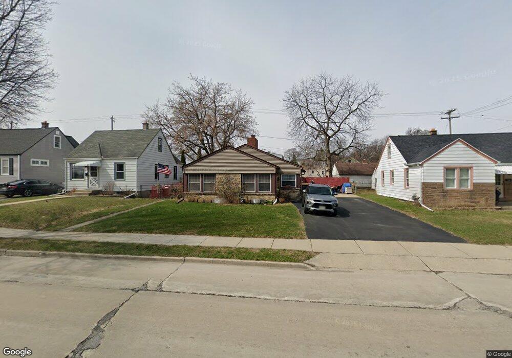
1611 S 92nd St Milwaukee, WI 53214
Conrad Gardens NeighborhoodEstimated Value: $247,244 - $294,000
3
Beds
1
Bath
1,196
Sq Ft
$227/Sq Ft
Est. Value
About This Home
This home is located at 1611 S 92nd St, Milwaukee, WI 53214 and is currently estimated at $271,561, approximately $227 per square foot. 1611 S 92nd St is a home located in Milwaukee County with nearby schools including Wilson Elementary School, Lane Intermediate School, and Nathan Hale High School.
Ownership History
Date
Name
Owned For
Owner Type
Purchase Details
Closed on
Oct 28, 2004
Sold by
Foster Herrick Robert I and Herrick Kathy L
Bought by
Herrick Robert I and Herrick Kathy L
Current Estimated Value
Home Financials for this Owner
Home Financials are based on the most recent Mortgage that was taken out on this home.
Original Mortgage
$136,800
Interest Rate
5.8%
Purchase Details
Closed on
Jan 11, 1999
Sold by
Foster Robert I
Bought by
Foster Robert I and Herrick Kathy L
Home Financials for this Owner
Home Financials are based on the most recent Mortgage that was taken out on this home.
Original Mortgage
$96,250
Interest Rate
6.76%
Purchase Details
Closed on
Mar 14, 1997
Sold by
Hall Eric S and Brezgel Margaret A
Bought by
Foster Robert I
Home Financials for this Owner
Home Financials are based on the most recent Mortgage that was taken out on this home.
Original Mortgage
$91,155
Interest Rate
7.82%
Create a Home Valuation Report for This Property
The Home Valuation Report is an in-depth analysis detailing your home's value as well as a comparison with similar homes in the area
Home Values in the Area
Average Home Value in this Area
Purchase History
| Date | Buyer | Sale Price | Title Company |
|---|---|---|---|
| Herrick Robert I | -- | -- | |
| Foster Robert I | -- | -- | |
| Foster Robert I | $88,500 | -- |
Source: Public Records
Mortgage History
| Date | Status | Borrower | Loan Amount |
|---|---|---|---|
| Closed | Herrick Robert I | $136,800 | |
| Previous Owner | Foster Robert I | $96,250 | |
| Previous Owner | Foster Robert I | $91,155 |
Source: Public Records
Tax History Compared to Growth
Tax History
| Year | Tax Paid | Tax Assessment Tax Assessment Total Assessment is a certain percentage of the fair market value that is determined by local assessors to be the total taxable value of land and additions on the property. | Land | Improvement |
|---|---|---|---|---|
| 2024 | $3,724 | $195,200 | $35,700 | $159,500 |
| 2023 | $3,297 | $126,400 | $20,300 | $106,100 |
| 2022 | $3,329 | $126,400 | $20,300 | $106,100 |
| 2021 | $3,247 | $126,400 | $20,300 | $106,100 |
| 2020 | $3,313 | $126,400 | $20,300 | $106,100 |
| 2019 | $3,185 | $126,400 | $20,300 | $106,100 |
| 2018 | $3,717 | $126,400 | $20,300 | $106,100 |
| 2017 | $3,369 | $126,400 | $20,300 | $106,100 |
| 2016 | $3,265 | $126,400 | $20,300 | $106,100 |
| 2015 | $3,269 | $126,400 | $20,300 | $106,100 |
| 2014 | $3,262 | $126,400 | $20,300 | $106,100 |
Source: Public Records
Map
Nearby Homes
- 9418 W Lapham St
- 1711 S 92nd St
- 1531 S 90th St
- 1747 S 92nd St
- 9104 W Greenfield Ave
- 9000 W Greenfield Ave
- 1362 S 91st St
- 1900 S 95th St
- 8751 W Maple St
- 9420 W Rogers St
- 9730 W Greenfield Ave
- 1432 S 85th St
- 8508 W Greenfield Ave
- 1489 S 84th St
- 2017 S 97th St
- 8915 W Becher St
- 2131 S 90th St
- 2149 S 93rd St
- 9201 W National Ave
- 8610 W Becher St
- 1617 S 92nd St
- 1603 S 92nd St
- 1621 S 92nd St
- 1610 S 93rd St
- 1616 S 93rd St
- 1600 S 93rd St
- 1618 S 93rd St
- 1629 S 92nd St
- 1545 S 92nd St
- 1608 S 92nd St
- 1626 S 93rd St
- 1602 S 92nd St
- 1616 S 92nd St
- 1539 S 92nd St
- 1630 S 93rd St
- 1552 S 92nd St
- 9216 W Lapham St
- 1533 S 92nd St
- 1548 S 92nd St
- 9226 W Lapham St