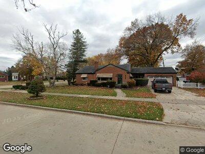
16111 Wick Rd Allen Park, MI 48101
Estimated Value: $253,000 - $347,000
--
Bed
--
Bath
1,365
Sq Ft
$218/Sq Ft
Est. Value
About This Home
This home is located at 16111 Wick Rd, Allen Park, MI 48101 and is currently estimated at $297,008, approximately $217 per square foot. 16111 Wick Rd is a home located in Wayne County with nearby schools including Lindemann Elementary School, Allen Park Middle School, and Allen Park High School.
Ownership History
Date
Name
Owned For
Owner Type
Purchase Details
Closed on
Oct 27, 2005
Sold by
Collins Daniel P and Collins Daniel
Bought by
Colegrove Daniel
Current Estimated Value
Home Financials for this Owner
Home Financials are based on the most recent Mortgage that was taken out on this home.
Original Mortgage
$201,000
Outstanding Balance
$130,668
Interest Rate
8.75%
Mortgage Type
Fannie Mae Freddie Mac
Estimated Equity
$150,184
Purchase Details
Closed on
Sep 25, 1997
Sold by
Tsa Maria L and Tsa Nicholas
Bought by
Collins Daniel P
Create a Home Valuation Report for This Property
The Home Valuation Report is an in-depth analysis detailing your home's value as well as a comparison with similar homes in the area
Home Values in the Area
Average Home Value in this Area
Purchase History
| Date | Buyer | Sale Price | Title Company |
|---|---|---|---|
| Colegrove Daniel | $201,000 | Greco | |
| Collins Daniel P | $136,500 | -- |
Source: Public Records
Mortgage History
| Date | Status | Borrower | Loan Amount |
|---|---|---|---|
| Open | Colegrove Daniel | $201,000 | |
| Previous Owner | Collins Daniel P | $135,000 |
Source: Public Records
Tax History Compared to Growth
Tax History
| Year | Tax Paid | Tax Assessment Tax Assessment Total Assessment is a certain percentage of the fair market value that is determined by local assessors to be the total taxable value of land and additions on the property. | Land | Improvement |
|---|---|---|---|---|
| 2024 | $4,602 | $147,300 | $0 | $0 |
| 2023 | $4,764 | $135,000 | $0 | $0 |
| 2022 | $5,407 | $121,200 | $0 | $0 |
| 2021 | $4,615 | $113,200 | $0 | $0 |
| 2020 | $6,883 | $103,600 | $0 | $0 |
| 2019 | $5,717 | $97,800 | $0 | $0 |
| 2018 | $4,510 | $74,600 | $0 | $0 |
| 2017 | $1,512 | $73,800 | $0 | $0 |
| 2016 | $5,001 | $70,900 | $0 | $0 |
| 2015 | $6,059 | $65,000 | $0 | $0 |
| 2013 | $5,870 | $62,000 | $0 | $0 |
| 2012 | $3,150 | $59,800 | $16,300 | $43,500 |
Source: Public Records
Map
Nearby Homes
- 9064 Becker Ave
- 8998 Quandt Ave
- 9644 Manor Ave
- 8911 Manor Ave
- 17405 Brody Ave
- 9260 Ruth Ave
- 9280 Ruth Ave
- 17494 Herrick St
- 8607 Quandt Ave
- 17489 Brody Ave
- 8464 Becker Ave
- 18755 Dale Ave
- 15769 Aster Ave
- 17440 Midway Ave
- 9648 Sterling Ave
- 9211 Laurence Ave
- 9222 Fox Ave
- 18859 Moore Ave
- 8050 Park Ave
- 15720 Jonas Ave