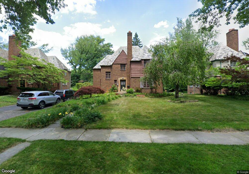
16117 Brewster Rd Cleveland, OH 44112
Estimated Value: $231,702 - $279,000
4
Beds
3
Baths
2,278
Sq Ft
$112/Sq Ft
Est. Value
About This Home
This home is located at 16117 Brewster Rd, Cleveland, OH 44112 and is currently estimated at $255,676, approximately $112 per square foot. 16117 Brewster Rd is a home located in Cuyahoga County with nearby schools including Shaw High School, Apex Academy, and Yeshiva Derech Hatorah.
Ownership History
Date
Name
Owned For
Owner Type
Purchase Details
Closed on
Jul 25, 2005
Sold by
Mitchell Sharon D
Bought by
Mitchell George I and Mitchell Sharon D
Current Estimated Value
Purchase Details
Closed on
Oct 23, 1992
Sold by
May Anthony Christopher
Bought by
May Anthony C
Purchase Details
Closed on
May 31, 1985
Sold by
Young Mary J
Bought by
May Anthony Christopher
Purchase Details
Closed on
Dec 16, 1983
Bought by
Young Mary J
Purchase Details
Closed on
Sep 7, 1978
Sold by
Reardon Ella W
Bought by
Reardon Ella W Tr
Purchase Details
Closed on
Jan 1, 1975
Bought by
Reardon Ella W
Create a Home Valuation Report for This Property
The Home Valuation Report is an in-depth analysis detailing your home's value as well as a comparison with similar homes in the area
Home Values in the Area
Average Home Value in this Area
Purchase History
| Date | Buyer | Sale Price | Title Company |
|---|---|---|---|
| Mitchell George I | -- | -- | |
| May Anthony C | -- | -- | |
| May Anthony Christopher | $78,000 | -- | |
| Young Mary J | $80,000 | -- | |
| Reardon Ella W Tr | -- | -- | |
| Reardon Ella W | -- | -- |
Source: Public Records
Tax History Compared to Growth
Tax History
| Year | Tax Paid | Tax Assessment Tax Assessment Total Assessment is a certain percentage of the fair market value that is determined by local assessors to be the total taxable value of land and additions on the property. | Land | Improvement |
|---|---|---|---|---|
| 2024 | $3,787 | $70,035 | $10,570 | $59,465 |
| 2023 | $3,599 | $49,220 | $8,370 | $40,850 |
| 2022 | $3,623 | $49,210 | $8,370 | $40,850 |
| 2021 | $3,592 | $49,210 | $8,370 | $40,850 |
| 2020 | $3,516 | $45,150 | $7,670 | $37,490 |
| 2019 | $3,678 | $129,000 | $21,900 | $107,100 |
| 2018 | $4,590 | $55,200 | $7,670 | $47,530 |
| 2017 | $3,477 | $45,610 | $4,450 | $41,160 |
| 2016 | $3,450 | $45,610 | $4,450 | $41,160 |
| 2015 | $3,832 | $45,610 | $4,450 | $41,160 |
| 2014 | $3,832 | $53,660 | $5,220 | $48,440 |
Source: Public Records
Map
Nearby Homes
- 15959 Glynn Rd
- 2067 Mount Vernon Blvd
- 16252 Oakhill Rd
- 0 Wyatt Rd
- 15908 Hazel Rd
- 16263 Oakhill Rd
- 2186 Mount Vernon Blvd
- 15724 Wyatt Rd
- 2188 N Taylor Rd
- 15703 Hazel Rd
- 2145 N Taylor Rd
- 2195 N Taylor Rd
- 2090 Newbury Dr
- 2137 N Taylor Rd
- 2256 N Taylor Rd
- 2257 N Taylor Rd
- 1073 Hereford Rd
- 1148 Rutherford Rd
- 936 Dresden Rd
- 1159 Brandon Rd
- 16141 Brewster Rd
- 16089 Brewster Rd
- 16165 Brewster Rd
- 16057 Brewster Rd
- 16124 Glynn Rd
- 16140 Glynn Rd
- 16080 Glynn Rd
- 16164 Glynn Rd
- 16201 Brewster Rd
- 16033 Brewster Rd
- 16064 Glynn Rd
- 16088 Brewster Rd
- 16180 Glynn Rd
- 16064 Brewster Rd
- 16040 Glynn Rd
- 16070 Henley Rd
- 16225 Brewster Rd
- 16009 Brewster Rd
- 16208 Glynn Rd
- 16024 Brewster Rd