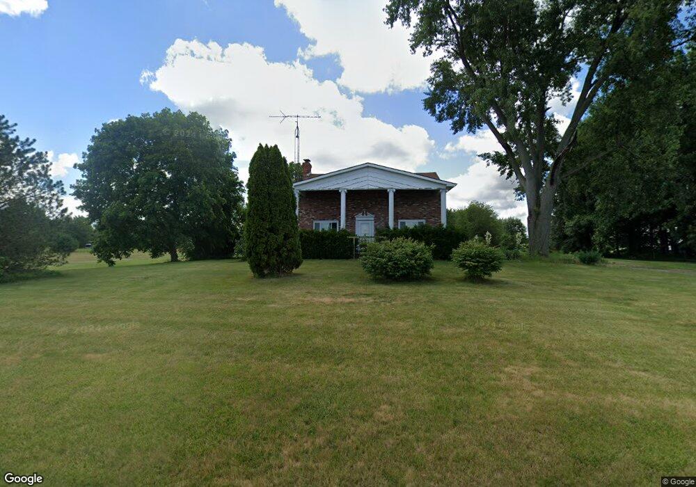
16119 U S 20 Wauseon, OH 43567
Estimated Value: $158,151
5
Beds
3
Baths
1,856
Sq Ft
$85/Sq Ft
Est. Value
About This Home
This home is located at 16119 U S 20, Wauseon, OH 43567 and is currently priced at $158,151, approximately $85 per square foot. 16119 U S 20 is a home located in Fulton County with nearby schools including Evergreen Elementary School, Evergreen Middle School, and Evergreen High School.
Ownership History
Date
Name
Owned For
Owner Type
Purchase Details
Closed on
Dec 15, 2023
Sold by
Gurzynski Joseph D
Bought by
Murphy Karl
Current Estimated Value
Home Financials for this Owner
Home Financials are based on the most recent Mortgage that was taken out on this home.
Original Mortgage
$100,000
Outstanding Balance
$97,990
Interest Rate
6.75%
Mortgage Type
Construction
Purchase Details
Closed on
Mar 5, 2009
Sold by
Deutsche Bank National Trust Company
Bought by
Gurzynski Joseph D and Gurzynski Marsha J
Home Financials for this Owner
Home Financials are based on the most recent Mortgage that was taken out on this home.
Original Mortgage
$45,000
Interest Rate
5.11%
Mortgage Type
Purchase Money Mortgage
Purchase Details
Closed on
Jul 7, 2008
Sold by
Gurzynski Jeffrey D and Gurzynski Jennifer S
Bought by
Deutsche Bank National Trust Company
Purchase Details
Closed on
Nov 24, 2004
Sold by
North Toledo Properties Llc
Bought by
Gurzynski Jeffrey D and Gurzynski Jennifer S
Home Financials for this Owner
Home Financials are based on the most recent Mortgage that was taken out on this home.
Original Mortgage
$128,000
Interest Rate
5.77%
Mortgage Type
Purchase Money Mortgage
Purchase Details
Closed on
Oct 27, 2003
Sold by
North Toledo Properties Llc
Bought by
North Toledo Properties Llc
Purchase Details
Closed on
Dec 2, 2002
Sold by
Dewitt Ronald
Bought by
North Toledo Properties Llc
Home Financials for this Owner
Home Financials are based on the most recent Mortgage that was taken out on this home.
Original Mortgage
$142,500
Interest Rate
6.22%
Mortgage Type
New Conventional
Purchase Details
Closed on
Aug 2, 1996
Sold by
Mossing Mark S
Bought by
Dewitt Earl L and Dewitt Anna M
Home Financials for this Owner
Home Financials are based on the most recent Mortgage that was taken out on this home.
Original Mortgage
$165,600
Interest Rate
8.63%
Mortgage Type
New Conventional
Purchase Details
Closed on
Jan 1, 1990
Bought by
Mossing Mark S and Mossing Pamela D
Create a Home Valuation Report for This Property
The Home Valuation Report is an in-depth analysis detailing your home's value as well as a comparison with similar homes in the area
Home Values in the Area
Average Home Value in this Area
Purchase History
| Date | Buyer | Sale Price | Title Company |
|---|---|---|---|
| Murphy Karl | $125,000 | None Listed On Document | |
| Gurzynski Joseph D | $77,000 | The Resource Title Agency In | |
| Deutsche Bank National Trust Company | $80,000 | None Available | |
| Gurzynski Jeffrey D | $128,000 | Chelsea Title Agency | |
| North Toledo Properties Llc | -- | -- | |
| North Toledo Properties Llc | -- | -- | |
| North Toledo Properties Llc | $145,000 | -- | |
| Dewitt Earl L | $107,000 | -- | |
| Mossing Mark S | -- | -- |
Source: Public Records
Mortgage History
| Date | Status | Borrower | Loan Amount |
|---|---|---|---|
| Open | Murphy Karl | $100,000 | |
| Previous Owner | Gurzynski Joseph D | $45,000 | |
| Previous Owner | Gurzynski Jeffrey D | $128,000 | |
| Previous Owner | North Toledo Properties Llc | $142,500 | |
| Previous Owner | Dewitt Earl L | $165,600 |
Source: Public Records
Tax History Compared to Growth
Tax History
| Year | Tax Paid | Tax Assessment Tax Assessment Total Assessment is a certain percentage of the fair market value that is determined by local assessors to be the total taxable value of land and additions on the property. | Land | Improvement |
|---|---|---|---|---|
| 2024 | $1,586 | $43,680 | $14,980 | $28,700 |
| 2023 | $1,594 | $43,680 | $14,980 | $28,700 |
| 2022 | $1,274 | $37,460 | $12,500 | $24,960 |
| 2021 | $1,263 | $37,460 | $12,500 | $24,960 |
| 2020 | $1,261 | $37,460 | $12,500 | $24,960 |
| 2019 | $1,420 | $41,580 | $11,130 | $30,450 |
| 2018 | $1,267 | $41,580 | $11,130 | $30,450 |
| 2017 | $1,263 | $41,580 | $11,130 | $30,450 |
| 2016 | $1,197 | $36,720 | $11,130 | $25,590 |
| 2015 | $1,083 | $36,720 | $11,130 | $25,590 |
| 2014 | $1,090 | $36,720 | $11,130 | $25,590 |
| 2013 | $1,401 | $42,010 | $8,580 | $33,430 |
Source: Public Records
Map
Nearby Homes
- 16099 Us Highway 20
- 0 County Rd N
- 14640 County Road K
- 0 County Road L
- 13890 Rice Hwy
- 15383 County Road 19
- 402 Pearl St
- 10216 County Road 14
- 328 E Main St
- 511 E Main St
- 128 E Lagrange St
- 221 N Summit St
- 141 E Main St
- 507 Page St
- 210 W Locust St
- 12500 County Road L
- 403 N Summit St
- 205 E Chestnut St
- 136 E Chestnut St
- 114 W Walnut St
- 16119 Us Highway 20
- 16177 Us Highway 20
- 16177 U S 20
- 16099 U S 20
- 16199 U S 20
- 13979 County Road 16
- 13931 County Road 16
- 15976 U S 20
- 15976 Us Highway 20
- 15976 Us 20
- 15961 Us 20
- 15940 Us Highway 20
- 16321 Us Highway 20
- 16368 Us Highway 20
- 13345 County Road W Unit 16-3
- 16630 Us Highway 20
- 16630 Us Highway 20
- 16642 Us Highway 20
- 15850 County Road 16-3
- 15510 Us Highway 20