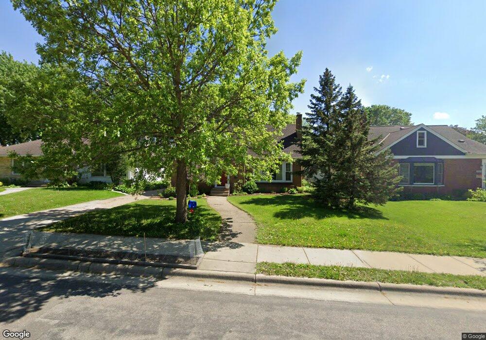
1612 Saunders Ave Saint Paul, MN 55116
Highland Park NeighborhoodEstimated Value: $579,000 - $601,000
4
Beds
2
Baths
2,456
Sq Ft
$240/Sq Ft
Est. Value
About This Home
This home is located at 1612 Saunders Ave, Saint Paul, MN 55116 and is currently estimated at $589,569, approximately $240 per square foot. 1612 Saunders Ave is a home located in Ramsey County with nearby schools including Expo for Excellence Elementary School, Highland Park Middle School, and Highland Park Senior High.
Ownership History
Date
Name
Owned For
Owner Type
Purchase Details
Closed on
Oct 18, 2022
Sold by
Wesenberg Hillary and Wesenberg Dane
Bought by
Sulaiman Erin and Sulaiman Ali
Current Estimated Value
Home Financials for this Owner
Home Financials are based on the most recent Mortgage that was taken out on this home.
Original Mortgage
$306,000
Outstanding Balance
$294,152
Interest Rate
5.89%
Mortgage Type
New Conventional
Estimated Equity
$295,417
Purchase Details
Closed on
Apr 22, 2002
Sold by
Leder William B and Leder Geraldine
Bought by
Soltero Miguel E and Soltero Ana
Create a Home Valuation Report for This Property
The Home Valuation Report is an in-depth analysis detailing your home's value as well as a comparison with similar homes in the area
Home Values in the Area
Average Home Value in this Area
Purchase History
We collect this data history from publicly available records. To have your information removed, we recommend requesting removal directly through your county’s website.
| Date | Buyer | Sale Price | Title Company |
|---|---|---|---|
| Sulaiman Erin | $510,000 | -- | |
| Soltero Miguel E | $215,000 | -- |
Source: Public Records
Mortgage History
We collect this data history from publicly available records. To have your information removed, we recommend requesting removal directly through your county’s website.
| Date | Status | Borrower | Loan Amount |
|---|---|---|---|
| Open | Sulaiman Erin | $306,000 |
Source: Public Records
Tax History
| Year | Tax Paid | Tax Assessment Tax Assessment Total Assessment is a certain percentage of the fair market value that is determined by local assessors to be the total taxable value of land and additions on the property. | Land | Improvement |
|---|---|---|---|---|
| 2025 | $7,792 | $543,300 | $164,400 | $378,900 |
| 2024 | $7,792 | $522,900 | $164,400 | $358,500 |
| 2023 | $7,792 | $505,300 | $164,400 | $340,900 |
| 2022 | $7,202 | $472,000 | $164,400 | $307,600 |
| 2021 | $6,744 | $435,100 | $164,400 | $270,700 |
| 2020 | $6,912 | $432,400 | $164,400 | $268,000 |
| 2019 | $6,680 | $411,600 | $164,400 | $247,200 |
| 2018 | $6,284 | $394,100 | $164,400 | $229,700 |
| 2017 | $5,820 | $382,300 | $164,400 | $217,900 |
| 2016 | $5,486 | $0 | $0 | $0 |
| 2015 | $4,978 | $336,500 | $141,700 | $194,800 |
| 2014 | $4,548 | $0 | $0 | $0 |
Source: Public Records
Map
Nearby Homes
- 1633 Rome Ave
- 1756 Saunders Ave
- 1589 Hillcrest Ave
- 1774 Rome Ave
- 1581 Pinehurst Ave
- 1780 Ford Pkwy
- 1846 Saunders Ave
- 2079 Upper Saint Dennis Rd
- 1861 Rome Ave
- TBD Scheffer Ave
- 1745 Eleanor Ave
- 1857 Ford Pkwy
- 1890 Yorkshire Ave
- 1736 Bayard Ave
- 1748 Bayard Ave
- 1941 W Rome Ave
- 629 Saratoga St S
- 1902 Pinehurst Ave
- 1947 Yorkshire Ct
- 1963 Yorkshire Ct
- 1627 Rome Ave
- 1623 Rome Ave
- 1636 Saunders Ave
- 1630 Saunders Ave
- 1624 Saunders Ave
- 1617 Rome Ave
- 1634 Rome Ave
- 1628 Rome Ave
- 1640 Rome Ave
- 1618 Saunders Ave
- 1624 Rome Ave
- 1646 Rome Ave
- 1611 Rome Ave
- 1618 Rome Ave
- 1652 Rome Ave
- 1606 Saunders Ave
- 1603 Rome Ave
- 1610 Rome Ave
- 1635 Saunders Ave
- 1631 Saunders Ave
Your Personal Tour Guide
Ask me questions while you tour the home.