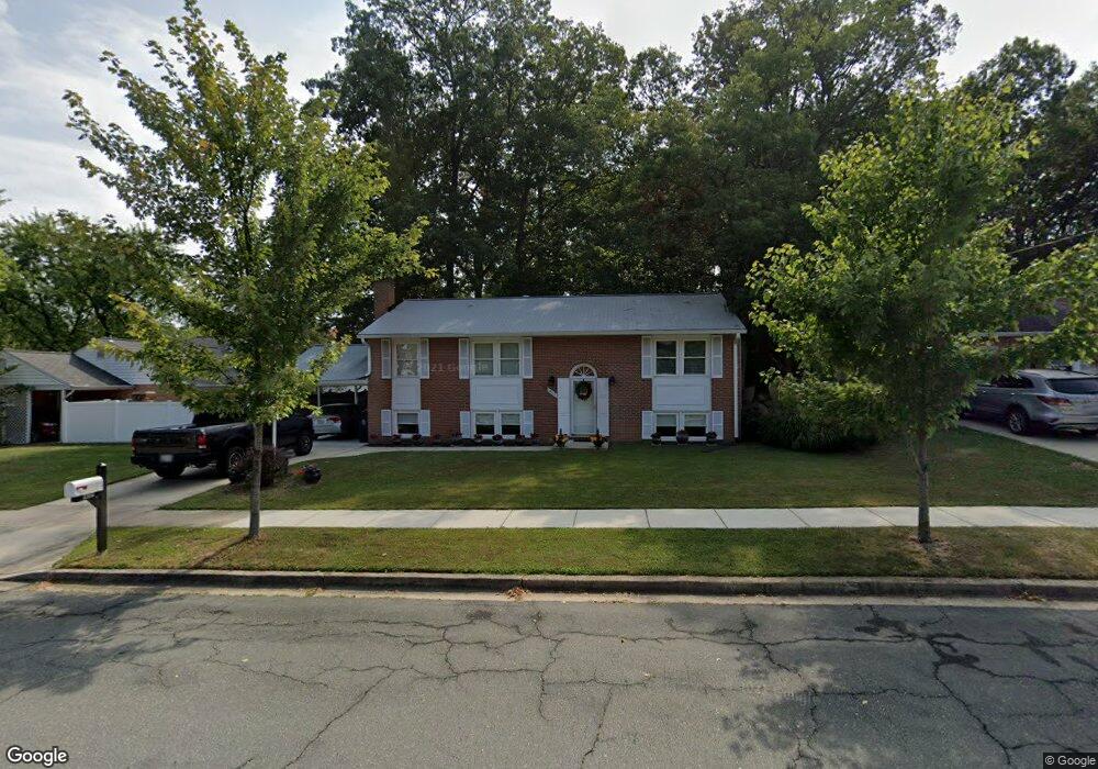
16121 Kent Rd Laurel, MD 20707
West Laurel NeighborhoodEstimated Value: $443,358 - $540,000
About This Home
This home is located at 16121 Kent Rd, Laurel, MD 20707 and is currently estimated at $494,840, approximately $397 per square foot. 16121 Kent Rd is a home located in Prince George's County with nearby schools including Bond Mill Elementary, Martin Luther King Jr. Middle School, and Laurel High School.
Ownership History
We collect this data history from publicly available records. To have your information removed, we recommend requesting removal directly through your county’s website.
Purchase Details
Purchase Details
Home Values in the Area
Average Home Value in this Area
Purchase History
We collect this data history from publicly available records. To have your information removed, we recommend requesting removal directly through your county’s website.
| Date | Buyer | Sale Price | Title Company |
|---|---|---|---|
| -- | None Listed On Document | ||
| -- | None Listed On Document | ||
| -- | None Listed On Document |
Tax History
We collect this data history from publicly available records. To have your information removed, we recommend requesting removal directly through your county’s website.
| Year | Tax Paid | Tax Assessment Tax Assessment Total Assessment is a certain percentage of the fair market value that is determined by local assessors to be the total taxable value of land and additions on the property. | Land | Improvement |
|---|---|---|---|---|
| 2025 | $4,982 | $389,200 | $126,300 | $262,900 |
| 2024 | $4,982 | $364,500 | ||
| 2023 | $3,779 | $339,800 | $0 | $0 |
| 2022 | $4,529 | $315,100 | $101,300 | $213,800 |
| 2021 | $4,405 | $315,100 | $101,300 | $213,800 |
| 2020 | $4,380 | $315,100 | $101,300 | $213,800 |
| 2019 | $4,520 | $353,800 | $100,600 | $253,200 |
| 2018 | $4,375 | $338,333 | $0 | $0 |
| 2017 | $4,254 | $322,867 | $0 | $0 |
| 2016 | -- | $307,400 | $0 | $0 |
| 2015 | $3,586 | $294,733 | $0 | $0 |
| 2014 | $3,586 | $282,067 | $0 | $0 |
Map
- 16098 Gales St
- 16308 Gales St
- 15605 Bond Mill Rd
- 16704 Goldsborough Ave
- 6306 Sandy St
- 6806 Diploma Dr
- 6504 Walker Branch Dr
- 15800 Kerr Rd
- 7001 Marmick Place
- 15405 Bounds Ave
- 7012 Redmiles Rd
- 6707 Sandy View Ct
- 6942 Scotch Dr
- 6920 Scotch Dr
- 6918 Scotch Dr
- 7106 Donston Dr
- 6925 Scotch Dr
- 7209 Brooklyn Bridge Rd
- 15830 Deer Creek Ct
- 7205 Split Rail Ln
- 6108 Goodman Rd
- 6106 Goodman Rd
- 6110 Goodman Rd
- 6112 Goodman Rd
- 6104 Goodman Rd
- 16117 Kent Rd
- 6203 Kaybro St
- 16119 Kent Rd
- 6205 Kaybro St
- 16115 Kent Rd
- 6107 Goodman Rd
- 6109 Goodman Rd
- 6114 Goodman Rd
- 6100 Goodman Rd
- 6200 Roblynn Rd
- 6111 Goodman Rd
- 6207 Kaybro St
- 6201 Kaybro St
- 6113 Goodman Rd
- 6103 Goodman Rd
Ask me questions while you tour the home.