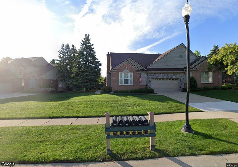
1613 Boulder Ct Rochester, MI 48306
Estimated Value: $513,936 - $539,000
4
Beds
4
Baths
2,250
Sq Ft
$233/Sq Ft
Est. Value
About This Home
This home is located at 1613 Boulder Ct, Rochester, MI 48306 and is currently estimated at $524,484, approximately $233 per square foot. 1613 Boulder Ct is a home located in Oakland County with nearby schools including Hart Middle School, Hugger Elementary School, and Stoney Creek High School.
Ownership History
Date
Name
Owned For
Owner Type
Purchase Details
Closed on
Jul 29, 2022
Sold by
Julie Vitale
Bought by
Powell Cherie and Powell Mark D
Current Estimated Value
Home Financials for this Owner
Home Financials are based on the most recent Mortgage that was taken out on this home.
Original Mortgage
$305,000
Outstanding Balance
$290,875
Interest Rate
5.7%
Mortgage Type
New Conventional
Estimated Equity
$233,609
Purchase Details
Closed on
Oct 24, 2005
Sold by
Osti Frank and Osti Janine
Bought by
Vitale Angelo and Vitale Dorothy
Purchase Details
Closed on
Mar 27, 2001
Sold by
Osti Trust
Bought by
Osti Frank
Purchase Details
Closed on
Jul 15, 1999
Sold by
Pulte Land Dev Corp
Bought by
Osti Trust
Create a Home Valuation Report for This Property
The Home Valuation Report is an in-depth analysis detailing your home's value as well as a comparison with similar homes in the area
Home Values in the Area
Average Home Value in this Area
Purchase History
| Date | Buyer | Sale Price | Title Company |
|---|---|---|---|
| Powell Cherie | $465,000 | -- | |
| Vitale Angelo | $275,000 | Multiple | |
| Osti Frank | -- | -- | |
| Osti Trust | -- | -- |
Source: Public Records
Mortgage History
| Date | Status | Borrower | Loan Amount |
|---|---|---|---|
| Open | Powell Cherie | $305,000 |
Source: Public Records
Tax History
| Year | Tax Paid | Tax Assessment Tax Assessment Total Assessment is a certain percentage of the fair market value that is determined by local assessors to be the total taxable value of land and additions on the property. | Land | Improvement |
|---|---|---|---|---|
| 2025 | $7,269 | $242,910 | $0 | $0 |
| 2024 | $6,469 | $231,140 | $0 | $0 |
| 2023 | $6,195 | $210,870 | $0 | $0 |
| 2022 | $4,304 | $187,860 | $0 | $0 |
| 2021 | $4,044 | $184,220 | $0 | $0 |
| 2020 | $3,797 | $178,020 | $0 | $0 |
| 2019 | $4,174 | $173,540 | $0 | $0 |
| 2018 | $4,168 | $170,860 | $0 | $0 |
| 2017 | $4,087 | $169,580 | $0 | $0 |
| 2016 | $3,958 | $164,430 | $0 | $0 |
| 2015 | -- | $146,250 | $0 | $0 |
| 2014 | -- | $127,950 | $0 | $0 |
| 2011 | -- | $107,050 | $0 | $0 |
Source: Public Records
Map
Nearby Homes
- 1685 Maple Creek Ct
- 1271 Tulberry Cir
- 1600 Mill Race
- 1408 Tulberry Cir
- 1053 Autumnview Ct
- 787 Quarry
- 56434 Ken Charles Dr
- 1021 Clear Creek Dr
- 2423 Buckthorn Dr
- 2455 Buckthorn Dr
- 2515 Barberry Dr Unit 21
- 2204 Monarch Dr Unit 61
- 56853 Mount Vernon Rd
- 1985 Monarch Dr
- 54568 Marissa Ct
- 686 W Bluff Ct Unit 23
- 638 W Bluff Ct Unit 31
- 2800 Marissa Way
- 436 Wedington Ct
- 2392 Kingscross Dr
- 1613 Boulder Ct Unit 43
- 1617 Boulder Ct Unit 23, 45
- 1617 Boulder Ct Unit 45
- 1609 Boulder Ct
- 1610 Boulder Ct Unit 74
- 1616 Boulder Ct
- 1621 Boulder Ct
- 1605 Boulder Ct Unit 39
- 1606 Boulder Ct Unit 76
- 1622 Boulder Ct
- 1825 Dunham Dr
- 1625 Boulder Ct Unit 25 49
- 1625 Boulder Ct Unit 49
- 1655 Maple Creek Ct Unit 105
- 1630 Boulder Ct
- 1401 Washington Rd
- 1629 Boulder Ct Unit 51
- 1385 Washington Rd
- 1859 Dunham Dr Unit 79
- 1859 Dunham Dr
Your Personal Tour Guide
Ask me questions while you tour the home.