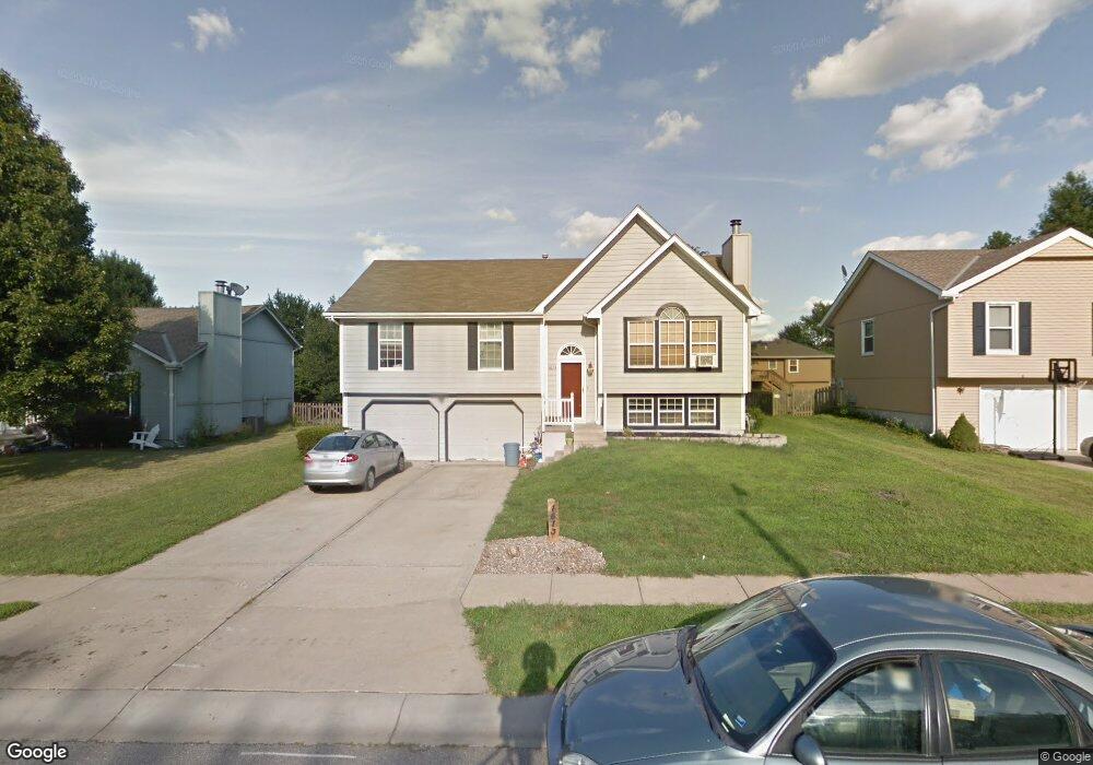
1613 NE Whitestone Dr Lees Summit, MO 64086
Estimated Value: $297,636 - $338,000
3
Beds
3
Baths
1,292
Sq Ft
$243/Sq Ft
Est. Value
About This Home
This home is located at 1613 NE Whitestone Dr, Lees Summit, MO 64086 and is currently estimated at $313,909, approximately $242 per square foot. 1613 NE Whitestone Dr is a home located in Jackson County with nearby schools including Underwood Elementary School, Bernard C. Campbell Middle School, and Lee's Summit North High School.
Ownership History
Date
Name
Owned For
Owner Type
Purchase Details
Closed on
Nov 24, 2010
Sold by
Engler Lee Anne
Bought by
Engler Terrance Dean
Current Estimated Value
Purchase Details
Closed on
Aug 25, 1999
Bought by
Engler Terrance D
Home Financials for this Owner
Home Financials are based on the most recent Mortgage that was taken out on this home.
Original Mortgage
$115,400
Outstanding Balance
$33,162
Interest Rate
7.65%
Mortgage Type
FHA
Estimated Equity
$280,747
Purchase Details
Closed on
Oct 13, 1997
Sold by
Gordy Clifford R and Gordy Ann
Bought by
Engler Terrance D
Home Financials for this Owner
Home Financials are based on the most recent Mortgage that was taken out on this home.
Original Mortgage
$102,403
Interest Rate
7.54%
Mortgage Type
FHA
Create a Home Valuation Report for This Property
The Home Valuation Report is an in-depth analysis detailing your home's value as well as a comparison with similar homes in the area
Home Values in the Area
Average Home Value in this Area
Purchase History
| Date | Buyer | Sale Price | Title Company |
|---|---|---|---|
| Engler Terrance Dean | -- | None Available | |
| Engler Terrance D | -- | -- | |
| Engler Terrance D | -- | Stewart Title |
Source: Public Records
Mortgage History
| Date | Status | Borrower | Loan Amount |
|---|---|---|---|
| Open | Engler Terrance D | $115,400 | |
| Previous Owner | Engler Terrance D | $102,403 |
Source: Public Records
Tax History Compared to Growth
Tax History
| Year | Tax Paid | Tax Assessment Tax Assessment Total Assessment is a certain percentage of the fair market value that is determined by local assessors to be the total taxable value of land and additions on the property. | Land | Improvement |
|---|---|---|---|---|
| 2025 | $2,884 | $42,967 | $7,370 | $35,597 |
| 2024 | $2,863 | $39,944 | $5,122 | $34,822 |
| 2023 | $2,863 | $39,943 | $5,162 | $34,781 |
| 2022 | $2,623 | $32,490 | $4,696 | $27,794 |
| 2021 | $2,677 | $32,490 | $4,696 | $27,794 |
| 2020 | $2,450 | $29,450 | $4,696 | $24,754 |
| 2019 | $2,384 | $31,906 | $4,696 | $27,210 |
| 2018 | $2,422 | $27,769 | $4,087 | $23,682 |
| 2016 | $2,401 | $27,246 | $4,332 | $22,914 |
Source: Public Records
Map
Nearby Homes
- 1629 NE Whitestone Dr
- 1404 NE Whitestone Dr
- 1717 NE Luther Rd
- 1412 NE Ernest Way
- 27104 E Cedar Grove Dr
- 1138 NE Mulberry St
- 1118 NE Deerbrook Terrace
- 1676 NE Ozark Dr
- 1000 NE Brookfield Dr
- 810 NE Chestnut St
- 816 NE Pollard St
- 809 NE Cedar St
- 811 NE Mulberry St
- 1108 NE Ridgeview Dr
- 905 NE Country Ln
- 1708 NE Balboa St
- 821 NE Colleen Dr
- 1345 NE Foxwood Dr
- 13511 Woodland Ranch Dr
- 13311 Woodland Ranch Dr
- 1617 NE Whitestone Dr
- 1609 NE Whitestone Dr
- 1612 NE Whitestone Dr
- 1608 NE Whitestone Dr
- 1616 NE Whitestone Dr
- 1605 NE Whitestone Dr
- 1621 NE Whitestone Dr
- 1612 NE Stonewood Dr
- 1604 NE Whitestone Dr
- 1608 NE Stonewood Dr
- 1616 NE Stonewood Dr
- 1620 NE Whitestone Dr
- 1625 NE Whitestone Dr
- 1601 NE Whitestone Dr
- 1620 NE Stonewood Dr
- 1604 NE Stonewood Dr
- 1600 NE Whitestone Dr
- 1624 NE Whitestone Dr
- 1613 NE Tawny Dr
- 1613 NE Stonewood Dr