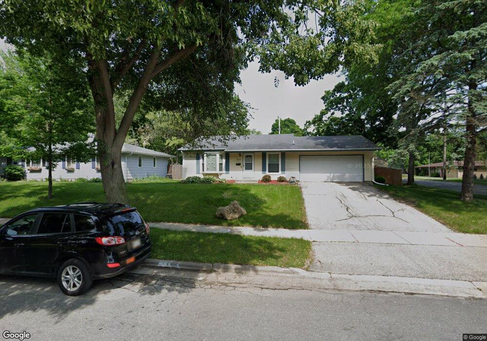
1613 Rae Ln Madison, WI 53711
Orchard Ridge NeighborhoodEstimated Value: $399,351 - $419,000
3
Beds
2
Baths
1,088
Sq Ft
$373/Sq Ft
Est. Value
About This Home
This home is located at 1613 Rae Ln, Madison, WI 53711 and is currently estimated at $406,088, approximately $373 per square foot. 1613 Rae Ln is a home located in Dane County with nearby schools including Orchard Ridge Elementary School, Toki Middle School, and Vel Phillips Memorial High School.
Ownership History
Date
Name
Owned For
Owner Type
Purchase Details
Closed on
May 31, 2005
Sold by
Lehmann David R and Lehmann Gabriella F
Bought by
Obrien Kevin J and Obrien Katie C
Current Estimated Value
Home Financials for this Owner
Home Financials are based on the most recent Mortgage that was taken out on this home.
Original Mortgage
$188,000
Interest Rate
5.82%
Mortgage Type
New Conventional
Create a Home Valuation Report for This Property
The Home Valuation Report is an in-depth analysis detailing your home's value as well as a comparison with similar homes in the area
Home Values in the Area
Average Home Value in this Area
Purchase History
| Date | Buyer | Sale Price | Title Company |
|---|---|---|---|
| Obrien Kevin J | $188,000 | None Available |
Source: Public Records
Mortgage History
| Date | Status | Borrower | Loan Amount |
|---|---|---|---|
| Closed | Obrien Kevin J | $188,000 |
Source: Public Records
Tax History Compared to Growth
Tax History
| Year | Tax Paid | Tax Assessment Tax Assessment Total Assessment is a certain percentage of the fair market value that is determined by local assessors to be the total taxable value of land and additions on the property. | Land | Improvement |
|---|---|---|---|---|
| 2024 | $10,887 | $327,400 | $98,100 | $229,300 |
| 2023 | $5,023 | $297,600 | $89,200 | $208,400 |
| 2021 | $4,764 | $239,700 | $71,900 | $167,800 |
| 2020 | $4,738 | $223,000 | $66,900 | $156,100 |
| 2019 | $4,403 | $208,400 | $62,500 | $145,900 |
| 2018 | $4,002 | $189,500 | $62,500 | $127,000 |
| 2017 | $3,954 | $178,800 | $62,500 | $116,300 |
| 2016 | $3,740 | $165,600 | $62,500 | $103,100 |
| 2015 | $3,727 | $159,200 | $62,500 | $96,700 |
| 2014 | $3,648 | $159,200 | $62,500 | $96,700 |
| 2013 | $3,811 | $154,600 | $60,700 | $93,900 |
Source: Public Records
Map
Nearby Homes
- 1506 Lynndale Rd
- 5826 Balsam Rd
- 5701 Bartlett Ln
- 6305-6307 Hammersley Rd
- 5726 Hempstead Rd
- 5837 Suffolk Rd
- 6217 Pioneer Rd
- 6017 Mayhill Dr
- 13 Jacobs Ct
- 6210 Davenport Dr
- 2118 Gilbert Rd
- 5314 Tolman Terrace
- 2310 Ravenswood Rd
- 2309 Mckenna Blvd
- 2218 Teal Dr
- 6749 Raymond Rd
- 2301 Teal Dr
- 18 S Wickham Ct
- 2201 Tawhee Dr
- 5201 Hammersley Rd