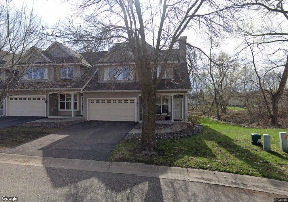
1614 121st Cir NW Coon Rapids, MN 55448
Estimated Value: $279,000 - $297,008
3
Beds
3
Baths
1,589
Sq Ft
$182/Sq Ft
Est. Value
About This Home
This home is located at 1614 121st Cir NW, Coon Rapids, MN 55448 and is currently estimated at $288,752, approximately $181 per square foot. 1614 121st Cir NW is a home located in Anoka County with nearby schools including Lucile Bruner Elementary School, Eisenhower Elementary School, and Laughlin Junior/Senior High School.
Ownership History
Date
Name
Owned For
Owner Type
Purchase Details
Closed on
Jul 20, 2020
Sold by
Anderson Kelly L and Anderson Robert
Bought by
White Katelyn M and White Charlotte A
Current Estimated Value
Home Financials for this Owner
Home Financials are based on the most recent Mortgage that was taken out on this home.
Original Mortgage
$222,110
Outstanding Balance
$196,952
Interest Rate
3.1%
Mortgage Type
New Conventional
Estimated Equity
$91,800
Purchase Details
Closed on
May 21, 2015
Sold by
Dargis Megan Megan
Bought by
Andersen Kelly Kelly
Home Financials for this Owner
Home Financials are based on the most recent Mortgage that was taken out on this home.
Original Mortgage
$166,500
Interest Rate
3.84%
Purchase Details
Closed on
Jan 13, 2003
Sold by
Svk Development Inc
Bought by
Panter Dawn
Create a Home Valuation Report for This Property
The Home Valuation Report is an in-depth analysis detailing your home's value as well as a comparison with similar homes in the area
Home Values in the Area
Average Home Value in this Area
Purchase History
| Date | Buyer | Sale Price | Title Company |
|---|---|---|---|
| White Katelyn M | $233,800 | Burnet Title | |
| Andersen Kelly Kelly | $166,500 | -- | |
| Panter Dawn | $187,843 | -- |
Source: Public Records
Mortgage History
| Date | Status | Borrower | Loan Amount |
|---|---|---|---|
| Open | White Katelyn M | $222,110 | |
| Previous Owner | Andersen Kelly Kelly | $166,500 |
Source: Public Records
Tax History Compared to Growth
Tax History
| Year | Tax Paid | Tax Assessment Tax Assessment Total Assessment is a certain percentage of the fair market value that is determined by local assessors to be the total taxable value of land and additions on the property. | Land | Improvement |
|---|---|---|---|---|
| 2025 | $2,673 | $267,100 | $55,000 | $212,100 |
| 2024 | $2,673 | $264,200 | $55,000 | $209,200 |
| 2023 | $2,387 | $250,300 | $55,000 | $195,300 |
| 2022 | $2,212 | $251,000 | $49,500 | $201,500 |
| 2021 | $2,186 | $210,000 | $32,000 | $178,000 |
| 2020 | $2,100 | $203,300 | $35,000 | $168,300 |
| 2019 | $1,963 | $189,000 | $35,000 | $154,000 |
| 2018 | $1,812 | $173,500 | $0 | $0 |
| 2017 | $1,576 | $157,700 | $0 | $0 |
| 2016 | $1,791 | $151,100 | $0 | $0 |
| 2015 | -- | $151,100 | $17,800 | $133,300 |
| 2014 | -- | $126,100 | $11,300 | $114,800 |
Source: Public Records
Map
Nearby Homes
- 12010 Eagle St NW
- 1727 121st Ln NW
- 1449 119th Ln NW
- 1625 124th Ave NW
- 12463 Drake St NW
- 12365 Jay St NW
- 11852 Yellow Pine St NW
- 1660 Northdale Blvd NW
- 11923 Wintergreen St NW
- 12554 Grouse St NW
- 1593 126th Ln NW
- 2068 124th Ln NW
- 1450 126th Ln NW
- 11350 Jay St NW
- 12488 Unity St NW
- 11444 Hanson Blvd NW
- 2147 125th Ln NW
- 11424 Hanson Blvd NW
- 1930 127th Cir NW
- 899 123rd Ln NW
- 1612 121st Cir NW
- 1610 121st Cir NW
- 1618 121st Cir NW
- 1608 121st Cir NW
- 1613 121st Cir NW
- 1611 121st Cir NW
- 1620 121st Cir NW
- 1609 121st Cir NW
- 1624 121st Cir NW
- 1624 1624 121st Cir NW
- 12026 Ibis St NW
- 1635 121st Cir NW
- 1637 121st Cir NW
- 1637 1637 121st Cir NW
- 1639 121st Cir NW
- 1602 121st Cir NW
- 1626 121st Cir NW
- 1641 121st Cir NW
- 1600 121st Cir NW
- 12042 Ibis St NW