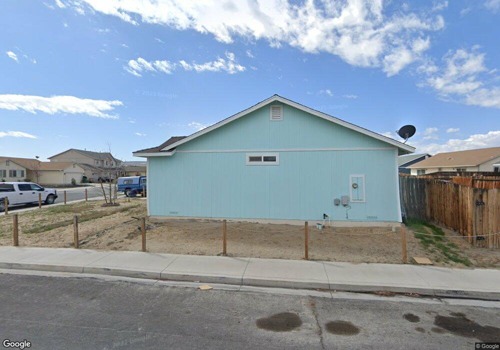
1614 Burger Rd Fernley, NV 89408
Estimated Value: $366,000 - $383,000
4
Beds
2
Baths
1,656
Sq Ft
$228/Sq Ft
Est. Value
About This Home
This home is located at 1614 Burger Rd, Fernley, NV 89408 and is currently estimated at $377,020, approximately $227 per square foot. 1614 Burger Rd is a home located in Lyon County with nearby schools including East Valley Elementary School, Fernley Intermediate School, and Fernley High School.
Ownership History
Date
Name
Owned For
Owner Type
Purchase Details
Closed on
Aug 31, 2006
Sold by
Jkb Paramont Homes Nevada Llc
Bought by
Pomeroy Tad E and Slowman Pomeroy Tina M
Current Estimated Value
Home Financials for this Owner
Home Financials are based on the most recent Mortgage that was taken out on this home.
Original Mortgage
$196,730
Interest Rate
5.88%
Mortgage Type
FHA
Create a Home Valuation Report for This Property
The Home Valuation Report is an in-depth analysis detailing your home's value as well as a comparison with similar homes in the area
Home Values in the Area
Average Home Value in this Area
Purchase History
| Date | Buyer | Sale Price | Title Company |
|---|---|---|---|
| Pomeroy Tad E | $199,818 | Title Service & Escrow Co |
Source: Public Records
Mortgage History
| Date | Status | Borrower | Loan Amount |
|---|---|---|---|
| Previous Owner | Pomeroy Tad E | $196,730 |
Source: Public Records
Tax History Compared to Growth
Tax History
| Year | Tax Paid | Tax Assessment Tax Assessment Total Assessment is a certain percentage of the fair market value that is determined by local assessors to be the total taxable value of land and additions on the property. | Land | Improvement |
|---|---|---|---|---|
| 2025 | $1,415 | $109,341 | $40,250 | $69,091 |
| 2024 | $1,783 | $109,683 | $40,250 | $69,433 |
| 2023 | $1,783 | $105,266 | $40,250 | $65,016 |
| 2022 | $1,679 | $100,312 | $40,250 | $60,062 |
| 2021 | $1,667 | $90,011 | $31,500 | $58,511 |
| 2020 | $1,626 | $87,333 | $31,500 | $55,833 |
| 2019 | $1,606 | $79,999 | $26,250 | $53,749 |
| 2018 | $1,575 | $69,583 | $17,150 | $52,433 |
| 2017 | $1,575 | $63,930 | $11,550 | $52,380 |
| 2016 | $1,390 | $48,471 | $5,780 | $42,691 |
| 2015 | $1,425 | $39,551 | $5,780 | $33,771 |
| 2014 | $1,394 | $27,920 | $5,780 | $22,140 |
Source: Public Records
Map
Nearby Homes
- 1505 Trubode Ln
- 1324 Nevada Pacific Blvd
- 1369 Nevada Pacific Blvd
- 1371 Nevada Pacific Blvd
- 4552 Mifflin St Unit Lot 9
- 4552 Mifflin St
- 4555 Mifflin St Unit Lot 22
- 4547 Mifflin St Unit Lot 24
- 0 Nevada Pacific Blvd
- 164 Westward Ln
- 4536 Mifflin St Unit Lot 5
- 4535 Mifflin St Unit Lot 27
- 4535 Mifflin St
- APN 021-191-08
- 2187 Snow Drift Rd
- 152 Westward Ln
- 021 46103
- 1075 Browne Ln
- 4520 Mifflin St Unit Lot 1
- 4531 Mifflin St Unit Lot 28
- 1612 Burger Rd
- 1616 Burger Rd
- 139 Relief Springs Rd
- 141 Relief Springs Rd
- 1618 Burger Rd
- 1610 Burger Rd
- 137 Relief Springs Rd
- 143 Relief Springs Rd
- 1613 Burger Rd
- 1615 Burger Rd
- 1611 Burger Rd
- 135 Relief Springs Rd
- 1620 Burger Rd
- 1608 Burger Rd
- 1617 Burger Rd
- 145 Relief Springs Rd
- 1609 Burger Rd
- 133 Relief Springs Rd
- 1619 Burger Rd
- 1622 Burger Rd