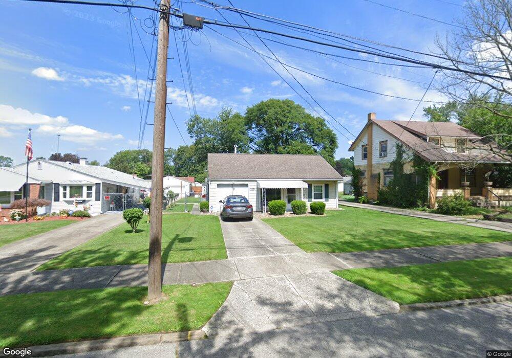
1614 Weston Ave Youngstown, OH 44514
Estimated Value: $82,000 - $112,000
2
Beds
1
Bath
732
Sq Ft
$128/Sq Ft
Est. Value
About This Home
This home is located at 1614 Weston Ave, Youngstown, OH 44514 and is currently estimated at $93,386, approximately $127 per square foot. 1614 Weston Ave is a home located in Mahoning County with nearby schools including Paul C. Bunn Elementary School, Chaney High School, and Summit Academy Secondary School - Youngstown.
Ownership History
Date
Name
Owned For
Owner Type
Purchase Details
Closed on
Jun 18, 2012
Sold by
Bryant Carla K and Bryant Christopher P
Bought by
Karl Rosemary A and Karl Richard H
Current Estimated Value
Purchase Details
Closed on
Dec 14, 1995
Sold by
Daniel Sender A
Bought by
Bryant Carla K Floyd and Bryant Christopher P
Home Financials for this Owner
Home Financials are based on the most recent Mortgage that was taken out on this home.
Original Mortgage
$25,500
Interest Rate
7.45%
Mortgage Type
New Conventional
Purchase Details
Closed on
May 21, 1990
Bought by
Sender A Daniel
Create a Home Valuation Report for This Property
The Home Valuation Report is an in-depth analysis detailing your home's value as well as a comparison with similar homes in the area
Home Values in the Area
Average Home Value in this Area
Purchase History
| Date | Buyer | Sale Price | Title Company |
|---|---|---|---|
| Karl Rosemary A | $18,500 | Attorney | |
| Bryant Carla K Floyd | $30,000 | -- | |
| Sender A Daniel | $26,000 | -- |
Source: Public Records
Mortgage History
| Date | Status | Borrower | Loan Amount |
|---|---|---|---|
| Previous Owner | Bryant Carla K Floyd | $25,500 |
Source: Public Records
Tax History Compared to Growth
Tax History
| Year | Tax Paid | Tax Assessment Tax Assessment Total Assessment is a certain percentage of the fair market value that is determined by local assessors to be the total taxable value of land and additions on the property. | Land | Improvement |
|---|---|---|---|---|
| 2024 | $623 | $12,710 | $2,430 | $10,280 |
| 2023 | $618 | $12,710 | $2,430 | $10,280 |
| 2022 | $614 | $9,710 | $2,500 | $7,210 |
| 2021 | $614 | $9,710 | $2,500 | $7,210 |
| 2020 | $617 | $9,710 | $2,500 | $7,210 |
| 2019 | $616 | $8,670 | $2,230 | $6,440 |
| 2018 | $622 | $8,670 | $2,230 | $6,440 |
| 2017 | $619 | $8,670 | $2,230 | $6,440 |
| 2016 | $731 | $11,020 | $2,230 | $8,790 |
| 2015 | $716 | $11,020 | $2,230 | $8,790 |
| 2014 | $711 | $11,020 | $2,230 | $8,790 |
| 2013 | $701 | $11,020 | $2,230 | $8,790 |
Source: Public Records
Map
Nearby Homes
- 1646 Weston Ave
- 1653 Brownlee Ave
- 1560 Wakefield Ave
- 1654 Wakefield Ave
- 1928 Medford Ave
- 4227 Sheridan Rd
- 1665 Wakefield Ave
- 1513 Wakefield Ave
- 1954 Everett Ave
- 4528 Sheridan Rd
- 2007 E Midlothian Blvd
- 3551 Shirley Rd
- 2020 Medford Ave
- 2001 Brownlee Ave
- 2016 Pointview Ave
- 3509 Lenox Ave
- 0 Crescent Dr Unit 5124984
- 3448 Neilson Ave
- 1885 Country Club Ave
- 1720 Sequoya Dr
- 1618 Weston Ave
- 1610 Weston Ave
- 1622 Weston Ave
- 1606 Weston Ave
- 1630 Weston Ave
- 1602 Weston Ave
- 1613 Everett Ave
- 1617 Everett Ave
- 1609 Everett Ave
- 1621 Everett Ave
- 1605 Everett Ave
- 1613 Weston Ave
- 1617 Weston Ave
- 1609 Weston Ave
- 1625 Everett Ave
- 1601 Everett Ave
- 1634 Weston Ave
- 1601 Weston Ave
- 1629 Everett Ave
- 1578 Weston Ave