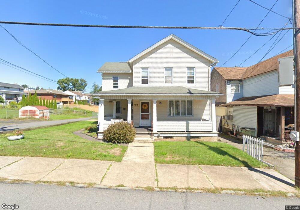
1615 Ash St Scranton, PA 18510
Hill Section NeighborhoodEstimated Value: $159,000 - $198,182
3
Beds
2
Baths
1,675
Sq Ft
$110/Sq Ft
Est. Value
About This Home
This home is located at 1615 Ash St, Scranton, PA 18510 and is currently estimated at $184,296, approximately $110 per square foot. 1615 Ash St is a home located in Lackawanna County with nearby schools including Lakeside Elementary School, Pinchbeck Elementary School, and Columbia Heights Elementary School.
Ownership History
Date
Name
Owned For
Owner Type
Purchase Details
Closed on
Apr 25, 2007
Sold by
Cascio Mary Denicola and Cascio Mary
Bought by
Patterson Sheri and Sakosky William
Current Estimated Value
Home Financials for this Owner
Home Financials are based on the most recent Mortgage that was taken out on this home.
Original Mortgage
$90,000
Outstanding Balance
$54,506
Interest Rate
6.18%
Mortgage Type
FHA
Estimated Equity
$129,790
Create a Home Valuation Report for This Property
The Home Valuation Report is an in-depth analysis detailing your home's value as well as a comparison with similar homes in the area
Home Values in the Area
Average Home Value in this Area
Purchase History
| Date | Buyer | Sale Price | Title Company |
|---|---|---|---|
| Patterson Sheri | $100,000 | None Available |
Source: Public Records
Mortgage History
| Date | Status | Borrower | Loan Amount |
|---|---|---|---|
| Open | Patterson Sheri | $90,000 |
Source: Public Records
Tax History Compared to Growth
Tax History
| Year | Tax Paid | Tax Assessment Tax Assessment Total Assessment is a certain percentage of the fair market value that is determined by local assessors to be the total taxable value of land and additions on the property. | Land | Improvement |
|---|---|---|---|---|
| 2025 | $2,554 | $7,000 | $2,650 | $4,350 |
| 2024 | $2,354 | $7,000 | $2,650 | $4,350 |
| 2023 | $2,354 | $7,000 | $2,650 | $4,350 |
| 2022 | $2,303 | $7,000 | $2,650 | $4,350 |
| 2021 | $2,303 | $7,000 | $2,650 | $4,350 |
| 2020 | $2,265 | $7,000 | $2,650 | $4,350 |
| 2019 | $2,137 | $7,000 | $2,650 | $4,350 |
| 2018 | $2,137 | $7,000 | $2,650 | $4,350 |
| 2017 | $2,104 | $7,000 | $2,650 | $4,350 |
| 2016 | $836 | $7,000 | $2,650 | $4,350 |
| 2015 | $1,306 | $7,000 | $2,650 | $4,350 |
| 2014 | -- | $7,000 | $2,650 | $4,350 |
Source: Public Records
Map
Nearby Homes
- 1017 Prescott Ave
- 1112 Ridge Ave
- 1406 Ash St
- 900 Taylor Ave
- 826 N Irving Ave
- 139 William St
- 805-807 N Irving Ave
- 0 Colfax and Gibson Ave Unit GSBSC255175
- 715 Prescott Ave Unit L17
- 2122 Ash St
- 627 S Blakely St
- 1207 N Webster Ave
- 1005 Luke Ave
- 7 Oakwood Place
- 1105 Quincy Ave
- 825 827 Quincy Ave Unit 825-827
- 616-618 Harrison Ave
- 615-617 Quincy Ave
- 1210 Monroe Ave
- 1325 Olive St
- 1621 Ash St
- 1623 Ash St
- 0 Ash Unit 7679468-11450434
- 1015 Engle Ct
- 1611 Ash St
- 1625 Ash St
- 1013 Wheeler Ave
- 1006 Ridge Ave
- 1620 Ash St
- 1007 Wheeler Ave
- 1014 Ridge Ave
- 1627 Ash St
- 1012 Ridge Ave
- 1610 Ash St
- 1616 Ash St
- 1020 Ridge Ave
- 1628 Ash St
- 1001 Wheeler Ave Unit 1
- 1001 Wheeler Ave
- 1001 Wheeler Ave Unit 2