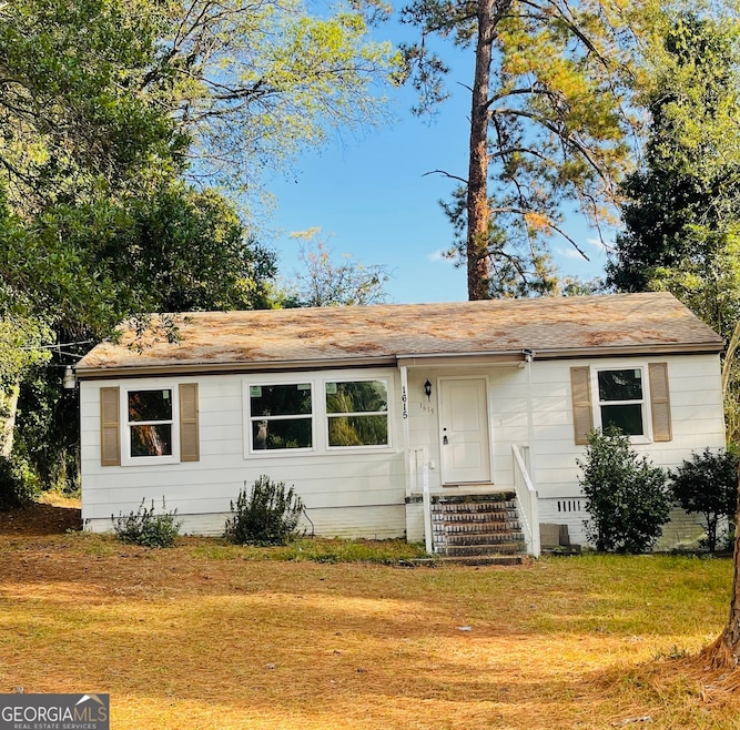

1615 Engle Dr Macon, GA 31211
Estimated payment $755/month
Highlights
- Ranch Style House
- Central Heating and Cooling System
- Family Room
- No HOA
About This Home
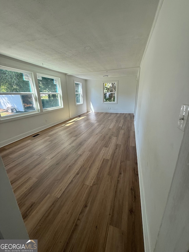
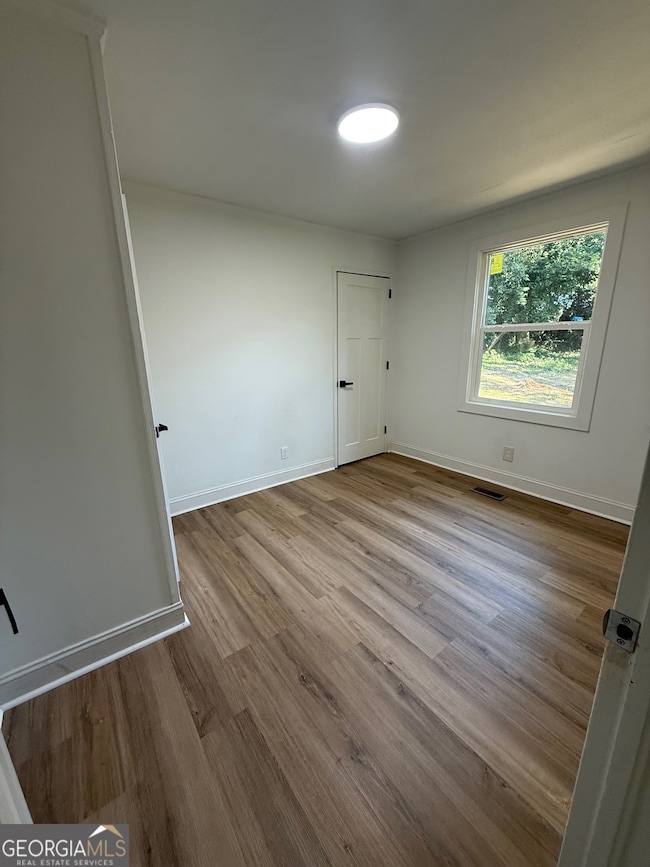
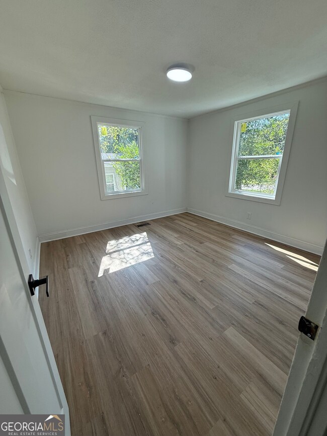
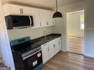
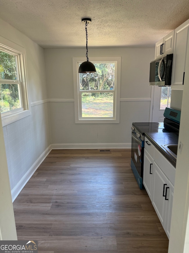
Public Remarks: Welcome to 1615 Engle Drive, a beautifully remodeled 3-bedroom, 1-bath home located in the heart of Macon, just minutes from Northeast High School and Appling Middle School. This charming property features a cozy kitchen equipped with a brand-new stove and microwave, complemented by stylish LVP flooring throughout. Enjoy the comfort of nicely sized bedrooms and the benefit of energy-efficient updates designed to help you save on utilities. The home sits on a spacious lot with both a large front and backyard - perfect for outdoor activities or future expansion. Priced at just $135,000, this move-in-ready home is an excellent choice for first-time buyers or anyone seeking quality and value in a great location.
Home Details
Home Type
- Single Family
Est. Annual Taxes
- $533
Year Built
- Built in 1949 | Remodeled
Lot Details
- 0.27 Acre Lot
Parking
- Off-Street Parking
Home Design
- Ranch Style House
- Vinyl Siding
Interior Spaces
- 960 Sq Ft Home
- Family Room
- Laundry in Hall
Kitchen
- Oven or Range
- Microwave
Bedrooms and Bathrooms
- 3 Main Level Bedrooms
- 1 Full Bathroom
Schools
- Martin Luther King Jr Elementary School
- Appling Middle School
- Northeast High School
Utilities
- Central Heating and Cooling System
- Cable TV Available
Community Details
- No Home Owners Association
- Fleetwood Downs Subdivision
Map
Home Values in the Area
Average Home Value in this Area
Tax History
| Year | Tax Paid | Tax Assessment Tax Assessment Total Assessment is a certain percentage of the fair market value that is determined by local assessors to be the total taxable value of land and additions on the property. | Land | Improvement |
|---|---|---|---|---|
| 2025 | $533 | $21,681 | $3,510 | $18,171 |
| 2024 | $551 | $21,681 | $3,510 | $18,171 |
| 2023 | $490 | $19,311 | $3,510 | $15,801 |
| 2022 | $621 | $17,936 | $3,286 | $14,650 |
| 2021 | $465 | $12,227 | $2,934 | $9,293 |
| 2020 | $475 | $12,227 | $2,934 | $9,293 |
| 2019 | $479 | $12,227 | $2,934 | $9,293 |
| 2018 | $913 | $12,227 | $2,934 | $9,293 |
| 2017 | $458 | $12,227 | $2,934 | $9,293 |
| 2016 | $423 | $12,227 | $2,934 | $9,293 |
| 2015 | $599 | $12,227 | $2,934 | $9,293 |
| 2014 | $230 | $12,227 | $2,934 | $9,293 |
Property History
| Date | Event | Price | List to Sale | Price per Sq Ft |
|---|---|---|---|---|
| 11/08/2025 11/08/25 | For Sale | $135,000 | -- | $141 / Sq Ft |
Purchase History
| Date | Type | Sale Price | Title Company |
|---|---|---|---|
| Special Warranty Deed | $45,000 | None Listed On Document | |
| Special Warranty Deed | $45,000 | None Listed On Document | |
| Executors Deed | $30,000 | -- | |
| Warranty Deed | $30,000 | None Available |
Mortgage History
| Date | Status | Loan Amount | Loan Type |
|---|---|---|---|
| Previous Owner | $27,000 | New Conventional |
Source: Georgia MLS
MLS Number: 10640790
APN: R061-0024
Disclaimer: Certain information contained herein is derived from information provided by parties other than Homes.com. All information provided is deemed reliable, but is not guaranteed to be accurate and should be independently verified.
![]() The data relating to real estate for sale on this web site comes in part from the Broker Reciprocity Program of Georgia MLS. Real estate listings held by brokerage firms other than Redfin are marked with the Broker Reciprocity logo and detailed information about them includes the name of the listing brokers. Information deemed reliable but not guaranteed. Copyright 2025 Georgia MLS. All rights reserved.
The data relating to real estate for sale on this web site comes in part from the Broker Reciprocity Program of Georgia MLS. Real estate listings held by brokerage firms other than Redfin are marked with the Broker Reciprocity logo and detailed information about them includes the name of the listing brokers. Information deemed reliable but not guaranteed. Copyright 2025 Georgia MLS. All rights reserved.
- 1752 Upper River Rd
- 1895 Clinton Rd
- 1968 Clinton Rd
- 1400 Gray Hwy
- 1420 Gray Hwy
- 2050 Old Clinton Rd
- 1105 Boulevard
- 870 Laurel Ave
- 865 Nottingham Dr
- 850 Parkview Ct
- 972 Center St
- 920 Williams St E
- 847 Northern St Unit C
- 2050 Merriwood Dr
- 2107 Meriwood Dr Unit B
- 382 Cowan St
- 720 Tidewater Cir
- 776 Baconsfield Dr
- 1737 Graham Rd
- 2275 Gray Hwy
