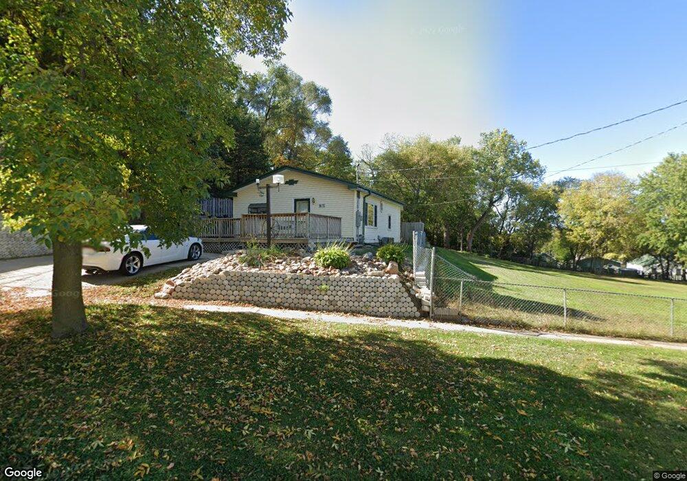
1615 Glendale Blvd Sioux City, IA 51105
East Side Sioux City NeighborhoodEstimated Value: $148,000 - $174,000
3
Beds
1
Bath
950
Sq Ft
$170/Sq Ft
Est. Value
About This Home
This home is located at 1615 Glendale Blvd, Sioux City, IA 51105 and is currently estimated at $161,946, approximately $170 per square foot. 1615 Glendale Blvd is a home with nearby schools including Unity Elementary School, East Middle School, and East High School.
Ownership History
Date
Name
Owned For
Owner Type
Purchase Details
Closed on
Dec 31, 2018
Sold by
Flom David L and Flom Kimberly K
Bought by
Hasler Robert B
Current Estimated Value
Home Financials for this Owner
Home Financials are based on the most recent Mortgage that was taken out on this home.
Original Mortgage
$79,325
Outstanding Balance
$69,460
Interest Rate
4.5%
Mortgage Type
New Conventional
Estimated Equity
$92,486
Create a Home Valuation Report for This Property
The Home Valuation Report is an in-depth analysis detailing your home's value as well as a comparison with similar homes in the area
Home Values in the Area
Average Home Value in this Area
Purchase History
| Date | Buyer | Sale Price | Title Company |
|---|---|---|---|
| Hasler Robert B | $83,500 | -- |
Source: Public Records
Mortgage History
| Date | Status | Borrower | Loan Amount |
|---|---|---|---|
| Open | Hasler Robert B | $79,325 |
Source: Public Records
Tax History Compared to Growth
Tax History
| Year | Tax Paid | Tax Assessment Tax Assessment Total Assessment is a certain percentage of the fair market value that is determined by local assessors to be the total taxable value of land and additions on the property. | Land | Improvement |
|---|---|---|---|---|
| 2025 | $2,580 | $174,300 | $24,900 | $149,400 |
| 2024 | $2,580 | $148,600 | $24,900 | $123,700 |
| 2023 | $2,250 | $148,600 | $24,900 | $123,700 |
| 2022 | $2,082 | $112,200 | $22,800 | $89,400 |
| 2021 | $2,082 | $105,600 | $22,800 | $82,800 |
| 2020 | $1,846 | $90,600 | $16,000 | $74,600 |
| 2019 | $1,708 | $75,600 | $0 | $0 |
| 2018 | $1,686 | $75,600 | $0 | $0 |
| 2017 | $1,464 | $64,500 | $0 | $0 |
| 2016 | $1,446 | $64,500 | $0 | $0 |
| 2015 | $1,597 | $64,500 | $10,200 | $54,300 |
| 2014 | $1,598 | $70,200 | $10,400 | $59,800 |
Source: Public Records
Map
Nearby Homes
- 1409 Rustin St
- 1700 Irene St
- 2615 11th St
- 1010 Pacific St
- 3221 11th St
- 909 Alice St
- 2909 9th St
- 904-822-821 Lewis Blvd Dubuque St
- 1220 Saint Marys St
- 3011 7th St
- 301 Logan St
- 2323 Floyd Blvd
- 3700 28th St Unit 133A
- 3700 28th St Unit 337
- 2806 2nd St
- 101 Logan St
- 2900 Anna Cr
- 115 S Paxton St
- 2941 Addison Cr
- 1330 22nd St
- 1613 & 1617 Glendale Blvd
- 1613 Glendale Blvd
- 1601 Glendale Blvd
- 1522 Hildahl Ave
- 1505 Glendale Blvd
- 1602 Rustin St
- 1610 Rustin St
- 1515 Lansdown Ave
- 1618 Rustin St
- 1612 Rustin St
- 1523 Hildahl Ave
- 1506 Glendale Blvd
- 3005 Melrose Ave
- 1500 Lansdown Ave
- 3004 Melrose Ave
- 1501 Glendale Blvd
- 1507 Hildahl Ave
- 1624 Rustin St
- 1501 Lansdown Ave
- 3008 Melrose Ave