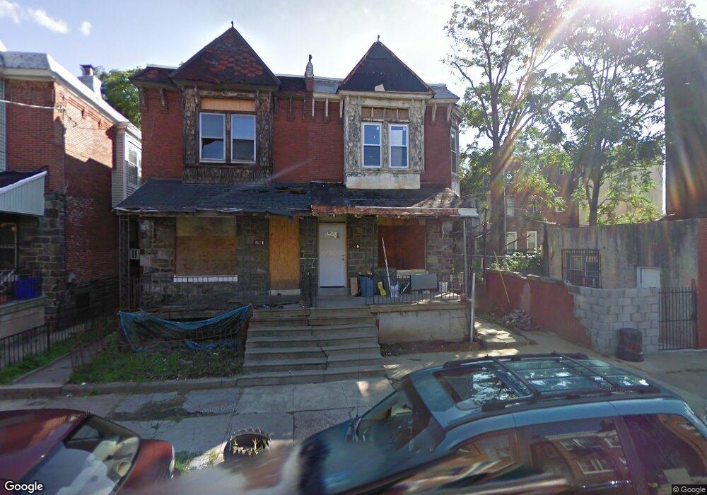
1615 N 55th St Philadelphia, PA 19131
Overbrook NeighborhoodEstimated Value: $145,000 - $220,000
4
Beds
1
Bath
1,536
Sq Ft
$119/Sq Ft
Est. Value
About This Home
This home is located at 1615 N 55th St, Philadelphia, PA 19131 and is currently estimated at $182,706, approximately $118 per square foot. 1615 N 55th St is a home located in Philadelphia County with nearby schools including Edward Heston School, Overbrook High School, and Universal Bluford Charter School.
Ownership History
Date
Name
Owned For
Owner Type
Purchase Details
Closed on
Dec 15, 2010
Sold by
Finney James and Finney Carida
Bought by
Parker Robert L and Parker Tanesha N
Current Estimated Value
Home Financials for this Owner
Home Financials are based on the most recent Mortgage that was taken out on this home.
Original Mortgage
$98,671
Outstanding Balance
$66,925
Interest Rate
4.75%
Mortgage Type
FHA
Estimated Equity
$115,781
Purchase Details
Closed on
Jul 16, 2004
Sold by
Mapp Frances M Witcher
Bought by
Mapp Wade Glenis
Create a Home Valuation Report for This Property
The Home Valuation Report is an in-depth analysis detailing your home's value as well as a comparison with similar homes in the area
Home Values in the Area
Average Home Value in this Area
Purchase History
| Date | Buyer | Sale Price | Title Company |
|---|---|---|---|
| Parker Robert L | $100,000 | None Available | |
| Mapp Wade Glenis | -- | -- |
Source: Public Records
Mortgage History
| Date | Status | Borrower | Loan Amount |
|---|---|---|---|
| Open | Parker Robert L | $98,671 |
Source: Public Records
Tax History Compared to Growth
Tax History
| Year | Tax Paid | Tax Assessment Tax Assessment Total Assessment is a certain percentage of the fair market value that is determined by local assessors to be the total taxable value of land and additions on the property. | Land | Improvement |
|---|---|---|---|---|
| 2025 | $1,228 | $172,000 | $34,400 | $137,600 |
| 2024 | $1,228 | $172,000 | $34,400 | $137,600 |
| 2023 | $1,228 | $87,700 | $17,540 | $70,160 |
| 2022 | $598 | $42,700 | $17,540 | $25,160 |
| 2021 | $1,228 | $0 | $0 | $0 |
| 2020 | $1,228 | $0 | $0 | $0 |
| 2019 | $1,184 | $0 | $0 | $0 |
| 2018 | $915 | $0 | $0 | $0 |
| 2017 | $1,335 | $0 | $0 | $0 |
| 2016 | $915 | $0 | $0 | $0 |
| 2015 | $876 | $0 | $0 | $0 |
| 2014 | -- | $95,400 | $13,200 | $82,200 |
| 2012 | -- | $8,224 | $2,931 | $5,293 |
Source: Public Records
Map
Nearby Homes
- 5514 Lansdowne Ave
- 5506 Lansdowne Ave
- 1535 N Allison St
- 5546 Lansdowne Ave
- 1524 N 55th St
- 1512 N 55th St
- 1530 N Conestoga St
- 5521 Media St
- 1510 N Conestoga St
- 1537 N Frazier St
- 1535 N Frazier St
- 5502 Media St
- 5542 Media St
- 1500 N 56th St
- 5448 Media St
- 5454 Stewart St
- 1669 N 56th St
- 1522 N Frazier St
- 5640 Lansdowne Ave
- 1447 N 55th St
- 1617 N 55th St
- 1621 N 55th St
- 5447 Lansdowne Ave
- 1623 N 55th St
- 5445 Lansdowne Ave
- 1625 N 55th St
- 1614 N 55th St
- 1616 N 55th St
- 1618 N 55th St
- 1620 N 55th St
- 1622 N 55th St
- 5505 Lansdowne Ave
- 1624 N 55th St
- 1626 N 55th St
- 1628 N 55th St
- 5509 Lansdowne Ave
- 5454 Lansdowne Ave
- 5456 Lansdowne Ave
- 5512 Hunter St
- 5427 Lansdowne Ave