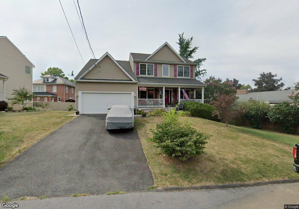
1615 Roberts St Winchester, VA 22601
Estimated Value: $495,000 - $597,000
4
Beds
3
Baths
2,573
Sq Ft
$213/Sq Ft
Est. Value
About This Home
This home is located at 1615 Roberts St, Winchester, VA 22601 and is currently estimated at $547,424, approximately $212 per square foot. 1615 Roberts St is a home located in Winchester City with nearby schools including Garland R. Quarles Elementary School, Daniel Morgan Middle School, and John Handley High School.
Ownership History
Date
Name
Owned For
Owner Type
Purchase Details
Closed on
Jan 4, 2019
Sold by
Carter Tony C and Carter Kathleen D
Bought by
City Of Winchester
Current Estimated Value
Purchase Details
Closed on
Mar 1, 2006
Sold by
Eagle Crest Homes Llc
Bought by
Eyles Karen B and Deazagra Eirka D
Home Financials for this Owner
Home Financials are based on the most recent Mortgage that was taken out on this home.
Original Mortgage
$35,000
Interest Rate
6.16%
Mortgage Type
Future Advance Clause Open End Mortgage
Create a Home Valuation Report for This Property
The Home Valuation Report is an in-depth analysis detailing your home's value as well as a comparison with similar homes in the area
Home Values in the Area
Average Home Value in this Area
Purchase History
| Date | Buyer | Sale Price | Title Company |
|---|---|---|---|
| City Of Winchester | -- | None Available | |
| Eyles Karen B | $34,379 | None Available |
Source: Public Records
Mortgage History
| Date | Status | Borrower | Loan Amount |
|---|---|---|---|
| Previous Owner | Eyles Karen B | $35,000 |
Source: Public Records
Tax History
| Year | Tax Paid | Tax Assessment Tax Assessment Total Assessment is a certain percentage of the fair market value that is determined by local assessors to be the total taxable value of land and additions on the property. | Land | Improvement |
|---|---|---|---|---|
| 2025 | $4,320 | $543,400 | $65,000 | $478,400 |
| 2024 | $3,961 | $477,200 | $65,000 | $412,200 |
| 2023 | $3,961 | $477,200 | $65,000 | $412,200 |
| 2022 | $3,261 | $350,600 | $65,000 | $285,600 |
| 2021 | $3,261 | $350,600 | $65,000 | $285,600 |
| 2020 | $2,730 | $293,600 | $65,000 | $228,600 |
| 2019 | $2,730 | $293,600 | $65,000 | $228,600 |
| 2018 | $1,232 | $270,800 | $65,000 | $205,800 |
| 2017 | $2,464 | $270,800 | $65,000 | $205,800 |
| 2016 | $2,257 | $248,000 | $65,000 | $183,000 |
| 2015 | $2,257 | $248,000 | $65,000 | $183,000 |
| 2014 | $2,125 | $223,700 | $65,000 | $158,700 |
Source: Public Records
Map
Nearby Homes
- 1400 Valley Ave
- 31 W Whitlock Ave
- 227 Miller St
- 236 Miller St
- 25 W Southwerk St
- 1610 S Loudoun St
- 13 E Hart St
- 1025 S Loudoun St
- 407 Jefferson St
- 20 E Hart St
- 501 Jefferson St
- 1004 S Cameron St
- 21 W Pall Mall St
- 1805 Harvest Dr
- 1817 Harvest Dr
- Adams Plan at Abrams Crossing at Meadow Branch
- Adams II Plan at Abrams Crossing at Meadow Branch
- 703 S Loudoun St
- 21 E Germain St
- 17 E Leicester St
- 1619 Roberts St
- 1612 Valley Ave
- 157 Lambden Ave
- 1616 Valley Ave
- 1625 Roberts St
- 1700-1704 Roberts St
- 149 Lambden Ave
- 1614 Roberts St
- 1610 Roberts St
- 1618 Roberts St
- 1620 Valley Ave
- 1508 Valley Ave
- 1622 Roberts St
- 147 Lambden Ave
- 1624 Valley Ave
- 1626 Roberts St
- 1605 Valley Ave
- 156 Lambden Ave
- 1603 Valley Ave
- 1611 Valley Ave