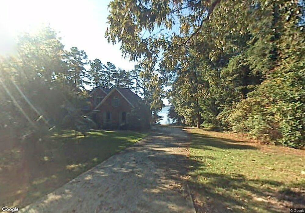
1616 Lindler Dr Gilbert, SC 29054
Estimated Value: $497,000 - $949,000
4
Beds
4
Baths
2,439
Sq Ft
$325/Sq Ft
Est. Value
About This Home
This home is located at 1616 Lindler Dr, Gilbert, SC 29054 and is currently estimated at $792,468, approximately $324 per square foot. 1616 Lindler Dr is a home with nearby schools including Centerville Elementary School, Gilbert Middle School, and Gilbert High School.
Ownership History
Date
Name
Owned For
Owner Type
Purchase Details
Closed on
Feb 27, 2018
Sold by
Bell Place Llc
Bought by
Caldwell William B and Caldwell Melanie A
Current Estimated Value
Home Financials for this Owner
Home Financials are based on the most recent Mortgage that was taken out on this home.
Original Mortgage
$450,000
Interest Rate
4.04%
Mortgage Type
Purchase Money Mortgage
Purchase Details
Closed on
Dec 22, 2008
Sold by
Bell Place Llc
Bought by
Sanders Mark
Home Financials for this Owner
Home Financials are based on the most recent Mortgage that was taken out on this home.
Original Mortgage
$10,000
Interest Rate
6.1%
Mortgage Type
Seller Take Back
Create a Home Valuation Report for This Property
The Home Valuation Report is an in-depth analysis detailing your home's value as well as a comparison with similar homes in the area
Home Values in the Area
Average Home Value in this Area
Purchase History
| Date | Buyer | Sale Price | Title Company |
|---|---|---|---|
| Caldwell William B | $450,000 | None Available | |
| Sanders Mark | $10,000 | -- |
Source: Public Records
Mortgage History
| Date | Status | Borrower | Loan Amount |
|---|---|---|---|
| Closed | Caldwell William B | $450,000 | |
| Previous Owner | Sanders Mark | $10,000 |
Source: Public Records
Tax History
| Year | Tax Paid | Tax Assessment Tax Assessment Total Assessment is a certain percentage of the fair market value that is determined by local assessors to be the total taxable value of land and additions on the property. | Land | Improvement |
|---|---|---|---|---|
| 2024 | $3,111 | $19,076 | $10,800 | $8,276 |
| 2023 | $2,849 | $19,076 | $10,800 | $8,276 |
| 2022 | $2,841 | $19,076 | $10,800 | $8,276 |
| 2020 | $3,205 | $19,076 | $10,800 | $8,276 |
| 2019 | $2,882 | $18,000 | $11,200 | $6,800 |
| 2018 | $2,910 | $19,065 | $11,200 | $7,865 |
| 2017 | $13,846 | $28,598 | $16,800 | $11,798 |
| 2016 | $13,416 | $28,598 | $16,800 | $11,798 |
| 2014 | $2,519 | $17,957 | $9,704 | $8,253 |
| 2013 | -- | $17,960 | $9,700 | $8,260 |
Source: Public Records
Map
Nearby Homes
- 1633 Barracks Dr
- 1459 Bombing Range Rd
- 180 Lillian St
- 1233 Shull Island Rd
- 1148 Shull Island Rd
- 1305 Rock Island Rd
- 417 Dot Ct
- 870 Shore Rd
- 0 Counts Ferry Rd Unit LOT 5
- 0 Counts Ferry Rd Unit LOT 6
- 0 Counts Ferry Rd Unit LOT 4
- 0 Counts Ferry Rd Unit LOT 2
- 0 Counts Ferry Rd Unit LOT 7
- 0 Counts Ferry Rd Unit LOT 1
- 0 Counts Ferry Rd Unit LOT 8
- 0 Misty Cir Unit 566318
- 1541 Counts Ferry Rd
- 131 W Circle Dr
- 148 Pintail Lake Dr
- 157 Collins Cove Dr
- 1628 Lindler Dr
- 1608 Lindler Dr
- 1605 Lindler Dr
- 1520 Shull Ave
- 1516 Shull Ave
- 1601 Lindler Dr
- 0 Taylor Dr Unit 449950
- 1604 Shull Ave
- 1620 Shull Ave
- 1500 Shull Ave
- 1306 Shull Ave
- 1523 Shull Ave
- 1153 Shull Ave
- 1626 Shull Ave
- 1605 Taylor Dr
- 1032 Shull Ave
- 1535 Shull Ave
- 1611 Furman Dr
- 1632 Shull Ave
- 1650 Shull Ave
Your Personal Tour Guide
Ask me questions while you tour the home.