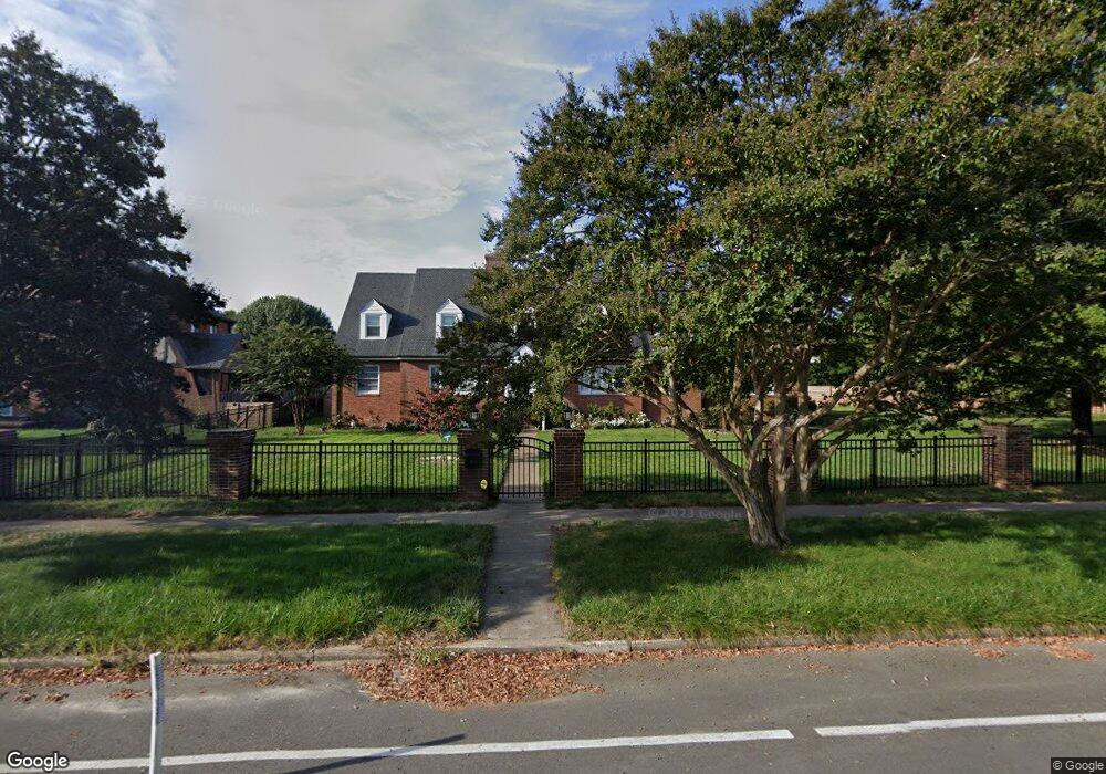
1617 Brookland Pkwy Richmond, VA 23227
Sherwood Park NeighborhoodEstimated Value: $630,000 - $823,000
3
Beds
2
Baths
3,688
Sq Ft
$196/Sq Ft
Est. Value
About This Home
This home is located at 1617 Brookland Pkwy, Richmond, VA 23227 and is currently estimated at $722,535, approximately $195 per square foot. 1617 Brookland Pkwy is a home located in Richmond City with nearby schools including Linwood Holton Elementary School, Henderson Middle School, and John Marshall High School.
Ownership History
Date
Name
Owned For
Owner Type
Purchase Details
Closed on
May 3, 1996
Sold by
Cleveland Beverly W Braxton and Cleveland Kenneth W
Bought by
Highe Anthony L
Current Estimated Value
Home Financials for this Owner
Home Financials are based on the most recent Mortgage that was taken out on this home.
Original Mortgage
$146,300
Outstanding Balance
$8,199
Interest Rate
7.82%
Mortgage Type
New Conventional
Estimated Equity
$714,336
Create a Home Valuation Report for This Property
The Home Valuation Report is an in-depth analysis detailing your home's value as well as a comparison with similar homes in the area
Home Values in the Area
Average Home Value in this Area
Purchase History
| Date | Buyer | Sale Price | Title Company |
|---|---|---|---|
| Highe Anthony L | $154,000 | -- |
Source: Public Records
Mortgage History
| Date | Status | Borrower | Loan Amount |
|---|---|---|---|
| Open | Highe Anthony L | $146,300 |
Source: Public Records
Tax History Compared to Growth
Tax History
| Year | Tax Paid | Tax Assessment Tax Assessment Total Assessment is a certain percentage of the fair market value that is determined by local assessors to be the total taxable value of land and additions on the property. | Land | Improvement |
|---|---|---|---|---|
| 2025 | $6,504 | $542,000 | $160,000 | $382,000 |
| 2024 | $6,360 | $530,000 | $150,000 | $380,000 |
| 2023 | $6,036 | $503,000 | $140,000 | $363,000 |
| 2022 | $5,220 | $435,000 | $95,000 | $340,000 |
| 2021 | $5,040 | $424,000 | $85,000 | $339,000 |
| 2020 | $5,040 | $420,000 | $85,000 | $335,000 |
| 2019 | $4,716 | $393,000 | $85,000 | $308,000 |
| 2018 | $4,488 | $374,000 | $85,000 | $289,000 |
| 2017 | $4,356 | $363,000 | $80,000 | $283,000 |
| 2016 | $3,660 | $335,000 | $75,000 | $260,000 |
| 2015 | $2,904 | $322,000 | $65,000 | $257,000 |
| 2014 | $2,904 | $302,000 | $65,000 | $237,000 |
Source: Public Records
Map
Nearby Homes
- 1604 Brookland Pkwy
- 1708 Westwood Ave
- 3304 Loxley Rd
- 1815 Seddon Rd
- 1350 Westwood Ave Unit U307
- 1350 Westwood Ave Unit U703
- 1350 Westwood Ave Unit 501
- 1716 Maple Shade Ln
- 1912 Elmsmere Ave
- 1320 Brookland Pkwy
- 1615 W Laburnum Ave
- 1603 W Laburnum Ave
- 1915 Maple Shade Ln
- 2104 Libbie Lake St W Unit B
- 3446 Carlton St Unit 6-3A
- 3446 Carlton St Unit 6-13B
- 3446 Carlton St
- Providence Plan at Mason Yards
- 1900 Roseneath Rd Unit 4B
- 1900 Roseneath Rd Unit 8B
- 1615 Brookland Pkwy
- 1613 Brookland Pkwy
- 1611 Brookland Pkwy
- 3207 Hermitage Rd
- 3315 N Arthur Ashe Blvd
- 1610 Brookland Pkwy
- 1609 Brookland Pkwy
- 1612 Brookland Pkwy
- 1608 Brookland Pkwy
- 1606 Brookland Pkwy
- 1607 Brookland Pkwy
- 3207 N Arthur Ashe Blvd
- 1609 Westwood Ave
- 1608 Wentbridge Rd
- 1610 Wentbridge Rd
- 1602 Brookland Pkwy
- 1606 Wentbridge Rd
- 1605 Brookland Pkwy
- 1605 N East Brookland Pkwy
- 1607 Westwood Ave