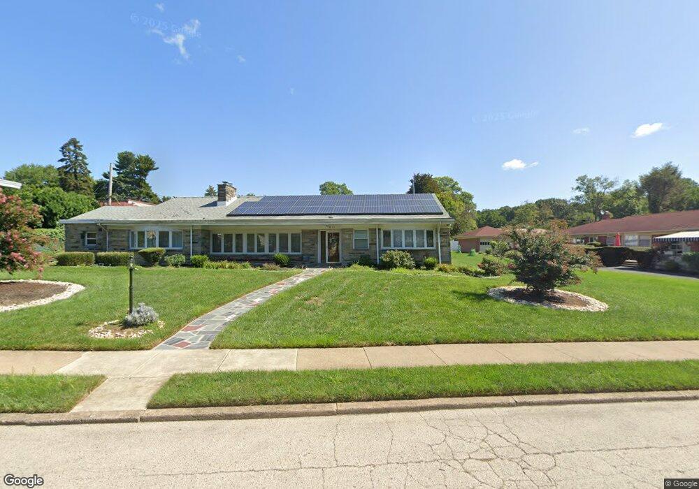
1617 N 72nd St Philadelphia, PA 19151
Overbrook NeighborhoodEstimated Value: $483,000 - $608,000
--
Bed
--
Bath
2,502
Sq Ft
$216/Sq Ft
Est. Value
About This Home
This home is located at 1617 N 72nd St, Philadelphia, PA 19151 and is currently estimated at $539,768, approximately $215 per square foot. 1617 N 72nd St is a home located in Philadelphia County with nearby schools including Lamberton Robert E School, Overbrook High School, and Ad Prima Charter School.
Ownership History
Date
Name
Owned For
Owner Type
Purchase Details
Closed on
Jul 10, 2000
Sold by
Milani Joseph W and Milani Albert M
Bought by
Tilghman George S and Tilghman Rita L
Current Estimated Value
Home Financials for this Owner
Home Financials are based on the most recent Mortgage that was taken out on this home.
Original Mortgage
$150,000
Outstanding Balance
$53,865
Interest Rate
8.28%
Estimated Equity
$485,903
Purchase Details
Closed on
Jul 30, 1996
Sold by
Jurkofsky Joseph J and Jurkofsky Joane
Bought by
Boston Barbara A
Create a Home Valuation Report for This Property
The Home Valuation Report is an in-depth analysis detailing your home's value as well as a comparison with similar homes in the area
Home Values in the Area
Average Home Value in this Area
Purchase History
| Date | Buyer | Sale Price | Title Company |
|---|---|---|---|
| Tilghman George S | $195,000 | -- | |
| Boston Barbara A | $149,000 | -- |
Source: Public Records
Mortgage History
| Date | Status | Borrower | Loan Amount |
|---|---|---|---|
| Open | Tilghman George S | $150,000 |
Source: Public Records
Tax History Compared to Growth
Tax History
| Year | Tax Paid | Tax Assessment Tax Assessment Total Assessment is a certain percentage of the fair market value that is determined by local assessors to be the total taxable value of land and additions on the property. | Land | Improvement |
|---|---|---|---|---|
| 2025 | $6,121 | $522,100 | $104,420 | $417,680 |
| 2024 | $6,121 | $522,100 | $104,420 | $417,680 |
| 2023 | $6,121 | $437,300 | $87,460 | $349,840 |
| 2022 | $5,491 | $392,300 | $87,460 | $304,840 |
| 2021 | $6,121 | $0 | $0 | $0 |
| 2020 | $6,121 | $0 | $0 | $0 |
| 2019 | $6,711 | $0 | $0 | $0 |
| 2018 | $5,133 | $0 | $0 | $0 |
| 2017 | $5,133 | $0 | $0 | $0 |
| 2016 | $4,713 | $0 | $0 | $0 |
| 2015 | $4,512 | $0 | $0 | $0 |
| 2014 | -- | $366,700 | $280,808 | $85,892 |
| 2012 | -- | $54,976 | $18,184 | $36,792 |
Source: Public Records
Map
Nearby Homes
- 1721 N 72nd St
- 7326 Brookhaven Rd
- 7102 City Ave
- 1843-45 N 72nd St
- 7343 Ruskin Rd
- 7251 Haverford Ave
- 7507 Sherwood Rd
- 7517 Brookhaven Rd
- 7519 Brookhaven Rd
- 7520 Overbrook Ave
- 7448 Rhoads St
- 1001 EC808 City Ave
- 1001 City Ave Unit E-706
- 1001 City Ave Unit EC206
- 1001 City Ave Unit E-1129
- 1001 City Ave Unit W-418
- 1001 City Ave Unit W-801
- 1001 City Ave Unit W-811
- 1001 City Ave Unit EC707
- 1001 City Ave Unit E-726
- 1605 N 72nd St
- 7032 Brentwood Rd
- 1623 N 72nd St
- 7028 Brentwood Rd
- 7021 Woodbine Ave
- 1601 N 72nd St
- 1601 N 72nd St
- 1610 N 72nd St
- 1614 N 72nd St
- 1622 N 72nd St
- 7017 Woodbine Ave
- 1626 N 72nd St
- 7018 Brentwood Rd
- 1606 N 72nd St
- 7013 Woodbine Ave
- 1730 N 71st St
- 7200 Brentwood Rd Unit 2
- 7111 Brentwood Rd
- 7012 Brentwood Rd
- 7033 Brentwood Rd