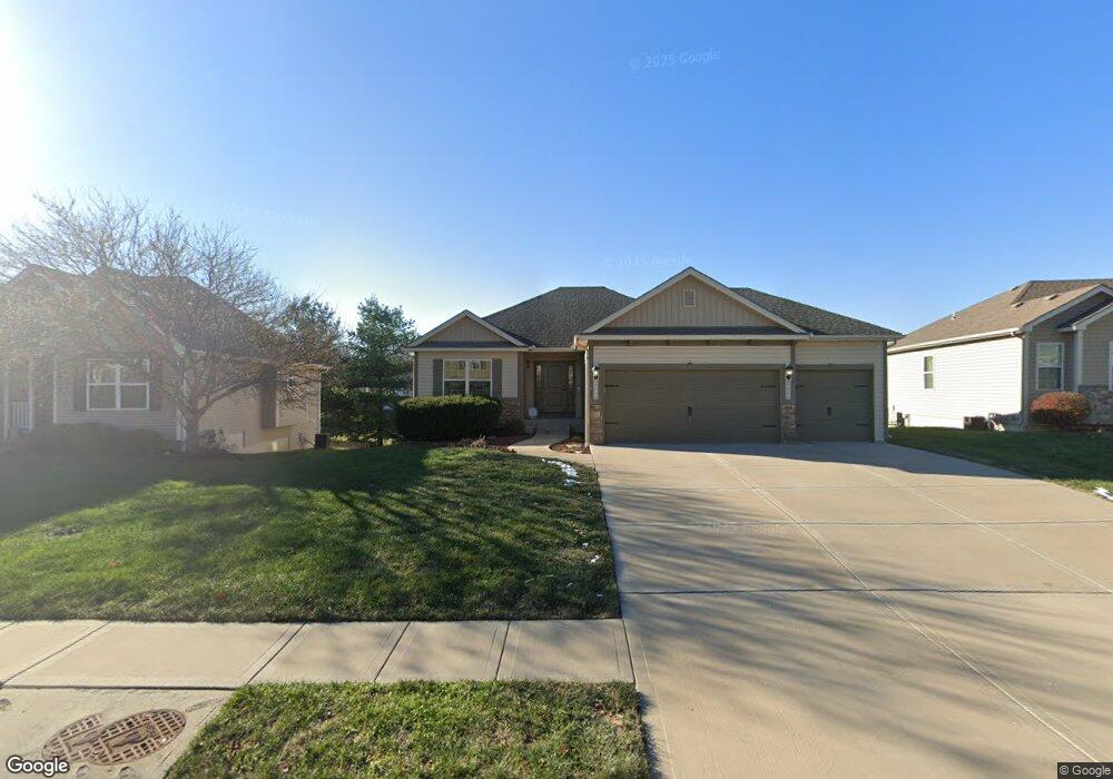
1617 NE 124th St Kansas City, MO 64165
Estimated Value: $392,000 - $423,000
4
Beds
3
Baths
1,358
Sq Ft
$302/Sq Ft
Est. Value
About This Home
This home is located at 1617 NE 124th St, Kansas City, MO 64165 and is currently estimated at $410,001, approximately $301 per square foot. 1617 NE 124th St is a home located in Clay County with nearby schools including Horizon Elementary School, Smithville Middle School, and Smithville High School.
Ownership History
Date
Name
Owned For
Owner Type
Purchase Details
Closed on
Nov 29, 2011
Sold by
Newcastle Homes L L C
Bought by
Moore William Greenville and Moore Heather
Current Estimated Value
Home Financials for this Owner
Home Financials are based on the most recent Mortgage that was taken out on this home.
Original Mortgage
$239,900
Outstanding Balance
$165,050
Interest Rate
4.13%
Mortgage Type
VA
Estimated Equity
$244,951
Purchase Details
Closed on
Mar 31, 2011
Sold by
Spyglass Development Company Llc
Bought by
Newcastle Homes Llc
Home Financials for this Owner
Home Financials are based on the most recent Mortgage that was taken out on this home.
Original Mortgage
$206,550
Interest Rate
4.98%
Mortgage Type
Purchase Money Mortgage
Create a Home Valuation Report for This Property
The Home Valuation Report is an in-depth analysis detailing your home's value as well as a comparison with similar homes in the area
Home Values in the Area
Average Home Value in this Area
Purchase History
| Date | Buyer | Sale Price | Title Company |
|---|---|---|---|
| Moore William Greenville | -- | Platte County Title & Abstra | |
| Newcastle Homes Llc | -- | Platte County Title & Abstra |
Source: Public Records
Mortgage History
| Date | Status | Borrower | Loan Amount |
|---|---|---|---|
| Open | Moore William Greenville | $239,900 | |
| Previous Owner | Newcastle Homes Llc | $206,550 |
Source: Public Records
Tax History Compared to Growth
Tax History
| Year | Tax Paid | Tax Assessment Tax Assessment Total Assessment is a certain percentage of the fair market value that is determined by local assessors to be the total taxable value of land and additions on the property. | Land | Improvement |
|---|---|---|---|---|
| 2025 | $3,834 | $62,850 | -- | -- |
| 2024 | $3,834 | $54,700 | -- | -- |
| 2023 | $3,805 | $54,700 | $0 | $0 |
| 2022 | $3,585 | $49,130 | $0 | $0 |
| 2021 | $3,604 | $49,134 | $7,600 | $41,534 |
| 2020 | $3,459 | $44,760 | $0 | $0 |
| 2019 | $3,387 | $44,764 | $7,600 | $37,164 |
| 2018 | $3,165 | $40,510 | $0 | $0 |
| 2017 | $2,714 | $40,510 | $6,650 | $33,860 |
| 2016 | $2,714 | $39,430 | $6,650 | $32,780 |
| 2015 | $2,700 | $39,430 | $6,650 | $32,780 |
| 2014 | $2,640 | $38,270 | $7,220 | $31,050 |
Source: Public Records
Map
Nearby Homes
- 1301 NE 123rd St
- 1216 NE 123rd St
- 1222 NE 122nd St
- 1218 NE 122nd St
- 12154 N Forrest Ct
- 12160 N Tracy Ave
- 12146 N Tracy Ave
- 1207 NE 122nd St
- 12151 N Forest Ct
- 12150 N Forrest Ct
- 1325 NE 122nd St
- 1203 Aspen Dr
- 11433 N Highland Ave
- 13223 N Virginia Ave
- 707 NE Cookingham Dr
- 2010 NE 114th Terrace
- 902 Aspen Dr
- 1201 NE 114th St
- 1311 NE 113th Terrace
- 813 NE 113th Terrace
- 1621 NE 124th St
- 1609 NE 124th St
- 1605 NE 124th St
- 1625 NE 124th St
- 1612 NE 124th St
- 1620 NE 124th St
- 1601 NE 124th St
- 12333 N Wayne Ave
- 1624 NE 124th St
- 12415 N Wayne Ave
- 1629 NE 124th St
- 12329 N Wayne Ave
- 1614 NE 123rd St
- 12419 N Wayne Ave
- 1618 NE 123rd St
- 1610 NE 123rd St
- 12325 N Wayne Ave
- 1628 NE 124th St
- 1622 NE 123rd St
- 1641 NE 124th St