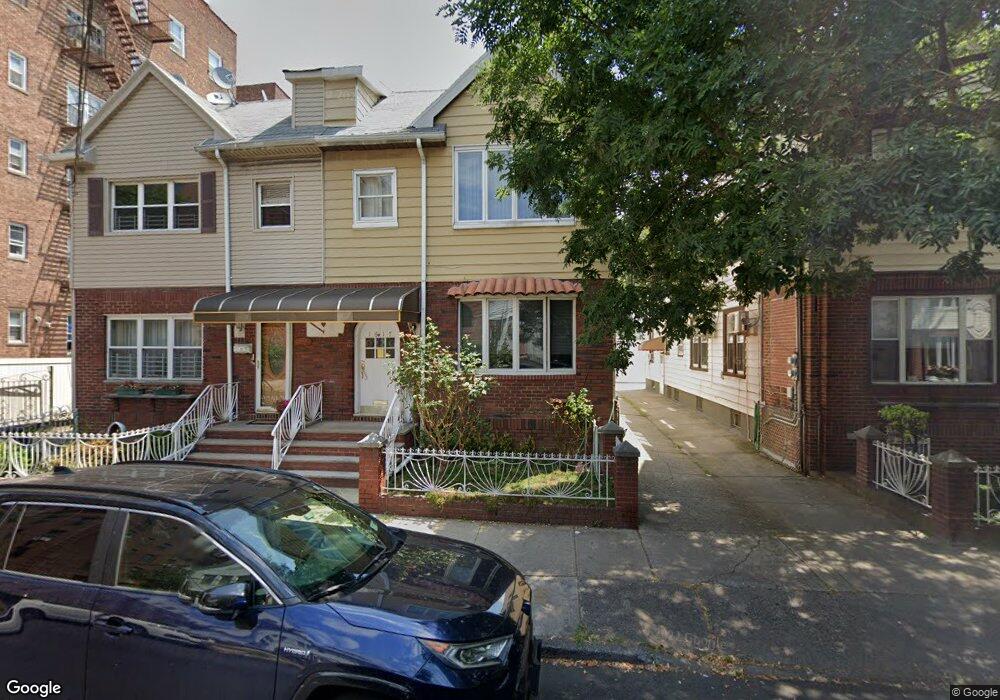
1617 W 12th St Brooklyn, NY 11223
Gravesend NeighborhoodEstimated Value: $1,183,363 - $1,571,000
--
Bed
--
Bath
2,400
Sq Ft
$576/Sq Ft
Est. Value
About This Home
This home is located at 1617 W 12th St, Brooklyn, NY 11223 and is currently estimated at $1,382,841, approximately $576 per square foot. 1617 W 12th St is a home located in Kings County with nearby schools including P.S. 128K BENSONHURST, Seth Low Intermediate School 96, and James Madison High School.
Ownership History
Date
Name
Owned For
Owner Type
Purchase Details
Closed on
Jan 19, 2024
Sold by
Concetta Yannotti Trustee and Rovito Family Irrevocable Trust
Bought by
Laurent Teresa and Vincent Rovito Living Trust
Current Estimated Value
Purchase Details
Closed on
Jan 23, 2009
Sold by
Rovito Isabella and Rovito Joseph
Bought by
Laurent Trustee Teresa and Rovito Family Irrevocable Trust
Create a Home Valuation Report for This Property
The Home Valuation Report is an in-depth analysis detailing your home's value as well as a comparison with similar homes in the area
Home Values in the Area
Average Home Value in this Area
Purchase History
| Date | Buyer | Sale Price | Title Company |
|---|---|---|---|
| Laurent Teresa | -- | -- | |
| Laurent Teresa | -- | -- | |
| Laurent Trustee Teresa | -- | -- | |
| Laurent Trustee Teresa | -- | -- |
Source: Public Records
Tax History Compared to Growth
Tax History
| Year | Tax Paid | Tax Assessment Tax Assessment Total Assessment is a certain percentage of the fair market value that is determined by local assessors to be the total taxable value of land and additions on the property. | Land | Improvement |
|---|---|---|---|---|
| 2025 | $9,536 | $90,180 | $14,940 | $75,240 |
| 2024 | $9,536 | $82,920 | $14,940 | $67,980 |
| 2023 | $9,096 | $100,500 | $14,940 | $85,560 |
| 2022 | $7,385 | $82,320 | $14,940 | $67,380 |
| 2021 | $8,306 | $79,320 | $14,940 | $64,380 |
| 2020 | $4,057 | $82,020 | $14,940 | $67,080 |
| 2019 | $7,617 | $65,220 | $14,940 | $50,280 |
| 2018 | $3,145 | $37,324 | $8,919 | $28,405 |
| 2017 | $2,972 | $35,498 | $9,169 | $26,329 |
| 2016 | $2,927 | $35,498 | $9,353 | $26,145 |
| 2015 | $1,581 | $34,945 | $10,567 | $24,378 |
| 2014 | $1,581 | $32,970 | $10,570 | $22,400 |
Source: Public Records
Map
Nearby Homes
- 100 Avenue P Unit 1H
- 100 Avenue P Unit 4A
- 1626 W 13th St
- 1570 W 10th St Unit 1B
- 25 Quentin Rd
- 103 Quentin Rd Unit B503
- 60 Quentin Rd
- 74 Quentin Rd
- 1639 W 9th St
- 86 Quentin Rd
- 1708 W 12th St
- 157 Avenue P Unit 2A
- 1718 W 11th St
- 1714 W 12th St
- 1720 W 12th St
- 26 Avenue P Unit 7C
- 1664 W 8th St
- 226 Kings Hwy
- 133 Quentin Rd
- 2265 78th St
- 1619 W 12th St
- 1613 W 12th St
- 1623 W 12th St
- 1625 W 12th St
- 1620 W 11th St
- 1618 W 11th St
- 1622 W 11th St
- 1629 W 12th St
- 1614 W 11th St
- 100 Ave P Unit 6D
- 100 Ave P Unit 1F
- 100 Avenue P Unit 65
- 100 Ave P Unit 2 G
- 100 Ave P Unit 6 K
- 100 Ave P Unit 1-B
- 100 Avenue P Unit 5C
- 100 Avenue P Unit 5A
- 100 Avenue P Unit 3D
- 100 Avenue P Unit 1A
- 100 Avenue P Unit 4G