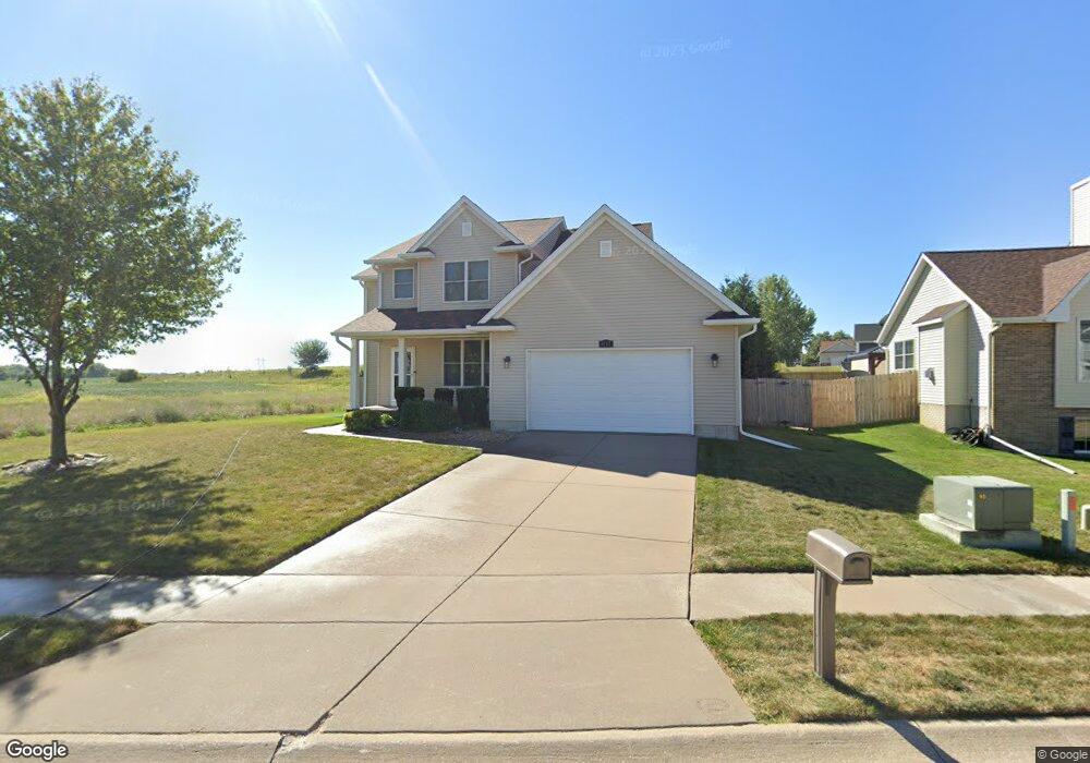
1617 W 71st St Davenport, IA 52806
North Side NeighborhoodEstimated Value: $361,458 - $394,000
3
Beds
3
Baths
2,188
Sq Ft
$175/Sq Ft
Est. Value
About This Home
This home is located at 1617 W 71st St, Davenport, IA 52806 and is currently estimated at $383,365, approximately $175 per square foot. 1617 W 71st St is a home located in Scott County with nearby schools including Cumberland Hall School, Academy Of Continuing Education, and Wood Intermediate School.
Ownership History
Date
Name
Owned For
Owner Type
Purchase Details
Closed on
Aug 6, 2007
Sold by
Mbdp Properties Lc
Bought by
Nicoletto Sara M and Nicoletto Scott A
Current Estimated Value
Home Financials for this Owner
Home Financials are based on the most recent Mortgage that was taken out on this home.
Original Mortgage
$229,500
Outstanding Balance
$144,863
Interest Rate
6.69%
Mortgage Type
New Conventional
Estimated Equity
$238,502
Purchase Details
Closed on
Mar 5, 2007
Sold by
Jersey Roads L C
Bought by
Mbdp Properties L C
Create a Home Valuation Report for This Property
The Home Valuation Report is an in-depth analysis detailing your home's value as well as a comparison with similar homes in the area
Home Values in the Area
Average Home Value in this Area
Purchase History
| Date | Buyer | Sale Price | Title Company |
|---|---|---|---|
| Nicoletto Sara M | $255,000 | None Available | |
| Mbdp Properties L C | $38,000 | None Available |
Source: Public Records
Mortgage History
| Date | Status | Borrower | Loan Amount |
|---|---|---|---|
| Open | Nicoletto Sara M | $229,500 |
Source: Public Records
Tax History Compared to Growth
Tax History
| Year | Tax Paid | Tax Assessment Tax Assessment Total Assessment is a certain percentage of the fair market value that is determined by local assessors to be the total taxable value of land and additions on the property. | Land | Improvement |
|---|---|---|---|---|
| 2025 | $5,382 | $346,910 | $58,830 | $288,080 |
| 2024 | $5,248 | $311,340 | $58,830 | $252,510 |
| 2023 | $5,778 | $311,340 | $58,830 | $252,510 |
| 2022 | $5,939 | $279,390 | $53,320 | $226,070 |
| 2021 | $5,704 | $274,730 | $53,320 | $221,410 |
| 2020 | $5,626 | $267,740 | $53,320 | $214,420 |
| 2019 | $5,450 | $251,430 | $53,320 | $198,110 |
| 2018 | $5,330 | $251,430 | $53,320 | $198,110 |
| 2017 | $5,356 | $251,430 | $53,320 | $198,110 |
| 2016 | $5,154 | $244,070 | $0 | $0 |
| 2015 | $5,154 | $240,960 | $0 | $0 |
| 2014 | $5,158 | $240,960 | $0 | $0 |
| 2013 | $5,064 | $0 | $0 | $0 |
| 2012 | -- | $232,860 | $42,290 | $190,570 |
Source: Public Records
Map
Nearby Homes
- 1724 W 69th St
- SWQ - Division W 76th St
- SEQ - Division W 76th St
- Division St N & W 76th St
- 000 Pacific St
- Lot 65 W 66th St
- 2012 W 68th St
- 7319 Volquardsen Ave
- 2110 W 68th St
- 2113 W 75th Place
- 6504 Cedar St
- 1301 W 62nd Ct
- Lot 26 Benjamin Ct
- 1415 W 59th St
- 2714 W 66th St
- 5803 Fillmore Ln
- LOT 54 Franklin Ave
- Lot 56 Franklin Ave
- 6308 Appomattox Rd
- 6322 Appomattox Rd
- 1621 W 71st St
- 1622 W 71st St
- 1616 W 71st St
- 1628 W 71st St
- 1629 W 71st St
- 1620 W 69th St
- 1628 W 69th St
- 1633 W 71st St
- 7101 Madison St
- 6911 Madison St
- 7105 Madison St
- 1611 W 69th St
- 7119 Madison St
- 1619 W 69th St
- 7113 Madison St
- 7110 Madison St
- 7127 Madison St
- 1635 W 69th St
- 6916 Madison St
- 7102 Madison St