1618 Sherwood Rd Mexico, MO 65265
Estimated Value: $140,218 - $181,000
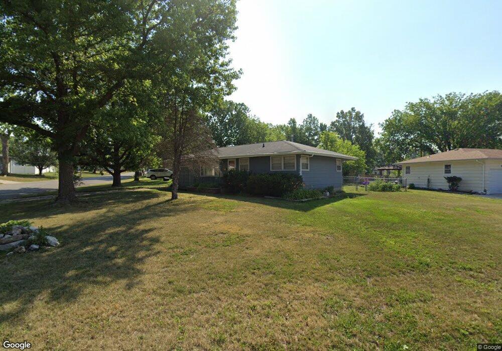
About This Home
This home is located at 1618 Sherwood Rd, Mexico, MO 65265 and is currently estimated at $166,055, approximately $172 per square foot. 1618 Sherwood Rd is a home located in Audrain County with nearby schools including Mexico High School, St. Brendan School, and Missouri Military Academy.
Ownership History
We collect this data history from publicly available records. To have your information removed, we recommend requesting removal directly through your county’s website.
Purchase Details
Home Financials for this Owner
Home Financials are based on the most recent Mortgage that was taken out on this home.Purchase Details
Home Financials for this Owner
Home Financials are based on the most recent Mortgage that was taken out on this home.Home Values in the Area
Average Home Value in this Area
Purchase History
We collect this data history from publicly available records. To have your information removed, we recommend requesting removal directly through your county’s website.
| Date | Buyer | Sale Price | Title Company |
|---|---|---|---|
| -- | None Listed On Document | ||
| -- | None Listed On Document | ||
| -- | -- |
Mortgage History
We collect this data history from publicly available records. To have your information removed, we recommend requesting removal directly through your county’s website.
| Date | Status | Borrower | Loan Amount |
|---|---|---|---|
| Open | $90,000 | ||
| Previous Owner | $76,451 |
Tax History
We collect this data history from publicly available records. To have your information removed, we recommend requesting removal directly through your county’s website.
| Year | Tax Paid | Tax Assessment Tax Assessment Total Assessment is a certain percentage of the fair market value that is determined by local assessors to be the total taxable value of land and additions on the property. | Land | Improvement |
|---|---|---|---|---|
| 2025 | $1,037 | $15,040 | $2,660 | $12,380 |
| 2024 | $1,033 | $15,040 | $2,660 | $12,380 |
| 2023 | $1,032 | $15,040 | $2,660 | $12,380 |
| 2022 | $1,010 | $15,040 | $2,660 | $12,380 |
| 2021 | $997 | $15,040 | $2,660 | $12,380 |
| 2020 | $975 | $15,040 | $2,660 | $12,380 |
| 2019 | $984 | $15,040 | $2,660 | $12,380 |
| 2018 | $977 | $0 | $0 | $0 |
| 2017 | $977 | $0 | $0 | $0 |
| 2012 | $886 | $15,040 | $0 | $0 |
Map
- 1803 Savannah Ct
- 1722 Beacon St
- 1403 Arcadia St
- 915 Concordia St
- 809 Concordia St
- 410 Ringo St
- 1405 Dorcas St
- 1813 Meadowlark Ln
- 221 S Kentucky St
- 11319 Audrain County Road 9908
- 21231 Highway Ff
- 113 N Abat St
- TRACT 3 State Highway Ff
- 11422 Audrain Road 9907
- 524 W Maple St
- 1403 N Western St
- 603 W Maple St
- 429 W Orange St
- 408 W Maple St
- 20749 Audrain Road 918
Ask me questions while you tour the home.