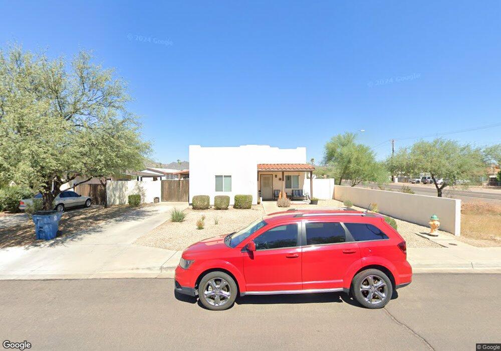
1618 W Mockingbird St Apache Junction, AZ 85120
Estimated Value: $284,312 - $440,000
Studio
--
Bath
1,221
Sq Ft
$295/Sq Ft
Est. Value
About This Home
This home is located at 1618 W Mockingbird St, Apache Junction, AZ 85120 and is currently estimated at $360,078, approximately $294 per square foot. 1618 W Mockingbird St is a home located in Pinal County with nearby schools including Four Peaks Elementary School, Cactus Canyon Junior High School, and Apache Junction High School.
Ownership History
Date
Name
Owned For
Owner Type
Purchase Details
Closed on
Apr 23, 2008
Sold by
Habitat For Humanity Valley Of The Sun
Bought by
Lansing Phillip Joseph and Lansing Alichia Leanne
Current Estimated Value
Home Financials for this Owner
Home Financials are based on the most recent Mortgage that was taken out on this home.
Original Mortgage
$89,609
Outstanding Balance
$56,258
Interest Rate
5.8%
Mortgage Type
Seller Take Back
Estimated Equity
$303,820
Create a Home Valuation Report for This Property
The Home Valuation Report is an in-depth analysis detailing your home's value as well as a comparison with similar homes in the area
Home Values in the Area
Average Home Value in this Area
Purchase History
| Date | Buyer | Sale Price | Title Company |
|---|---|---|---|
| Lansing Phillip Joseph | $195,500 | Grand Canyon Title Agency In |
Source: Public Records
Mortgage History
| Date | Status | Borrower | Loan Amount |
|---|---|---|---|
| Open | Lansing Phillip Joseph | $89,609 |
Source: Public Records
Tax History
| Year | Tax Paid | Tax Assessment Tax Assessment Total Assessment is a certain percentage of the fair market value that is determined by local assessors to be the total taxable value of land and additions on the property. | Land | Improvement |
|---|---|---|---|---|
| 2025 | $1,395 | $23,787 | -- | -- |
| 2024 | $1,317 | $25,463 | -- | -- |
| 2023 | $1,365 | $20,880 | $1,176 | $19,704 |
| 2022 | $1,317 | $15,805 | $1,176 | $14,629 |
| 2021 | $1,381 | $14,152 | $0 | $0 |
| 2020 | $1,302 | $13,570 | $0 | $0 |
| 2019 | $1,303 | $12,853 | $0 | $0 |
| 2018 | $1,242 | $11,855 | $0 | $0 |
| 2017 | $1,254 | $11,109 | $0 | $0 |
| 2016 | $1,231 | $11,048 | $1,208 | $9,841 |
| 2014 | $1,172 | $6,566 | $1,050 | $5,516 |
Source: Public Records
Map
Nearby Homes
- 1557 W Greasewood St
- 980 N Ironwood Dr Unit 15
- 1280 N Ironwood Dr Unit 84
- 1280 N Ironwood Dr Unit 4
- 1280 N Ironwood Dr Unit 40
- 1280 N Ironwood Dr Unit 92
- 1877 W Road Agent St
- 1896 W Road Agent St
- 2497 W Shiprock St
- 2489 W Shiprock St
- 710 N Ironwood Dr
- 651 N Ironwood Dr Unit 60
- 651 N Ironwood Dr Unit 22
- 651 N Ironwood Dr Unit 3
- 651 N Ironwood Dr Unit 67
- 651 N Ironwood Dr Unit 68
- 651 N Ironwood Dr Unit 8
- 651 N Ironwood Dr Unit 61
- 651 N Ironwood Dr Unit 62
- 651 N Ironwood Dr Unit 4
- 1640 W Mockingbird St
- 1662 W Mockingbird St
- 1130 N Ironwood Dr
- 1615 W Mockingbird St
- 1678 W Mockingbird St
- 1639 W Mockingbird St
- 1105 N Ironwood Dr
- 1657 W Mockingbird St
- 1029 N Ironwood Dr
- 1696 W Mockingbird St
- 1673 W Mockingbird St
- 1127 N Ironwood Dr
- 1005 N Ironwood Dr
- 1705 W Mockingbird St
- 1724 W Mockingbird St
- 1641 W Roundup St
- 1727 W Mockingbird St
- 1746 W Mockingbird St
- 1108 N Silver Dr
- 1108 N Silver Dr Unit CLEAN
Your Personal Tour Guide
Ask me questions while you tour the home.