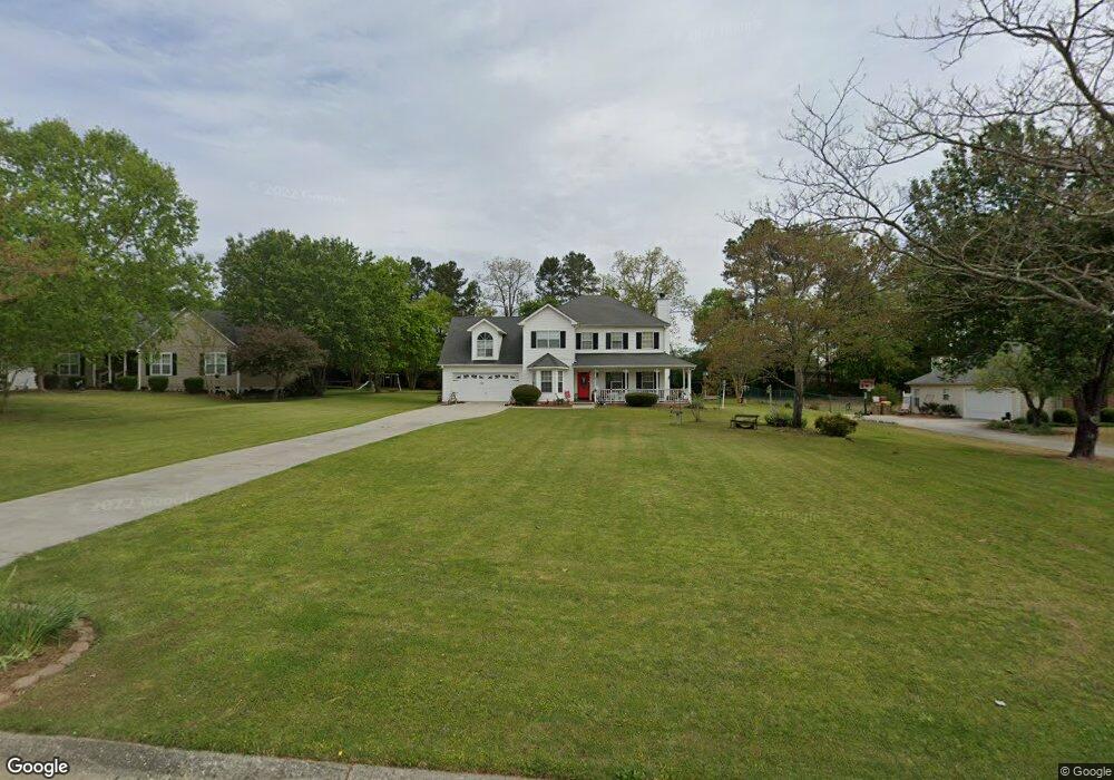
162 Cole Cir Unit 1 Bethlehem, GA 30620
Estimated Value: $325,519 - $385,000
--
Bed
3
Baths
1,798
Sq Ft
$198/Sq Ft
Est. Value
About This Home
This home is located at 162 Cole Cir Unit 1, Bethlehem, GA 30620 and is currently estimated at $356,130, approximately $198 per square foot. 162 Cole Cir Unit 1 is a home located in Barrow County with nearby schools including Yargo Elementary School, Haymon-Morris Middle School, and Apalachee High School.
Ownership History
Date
Name
Owned For
Owner Type
Purchase Details
Closed on
Aug 25, 1997
Sold by
Casper Co
Bought by
Kreller Edward C and Kreller Shirley L
Current Estimated Value
Home Financials for this Owner
Home Financials are based on the most recent Mortgage that was taken out on this home.
Original Mortgage
$91,900
Outstanding Balance
$13,040
Interest Rate
6.5%
Mortgage Type
New Conventional
Estimated Equity
$343,090
Purchase Details
Closed on
Dec 9, 1996
Sold by
C G S Development In
Bought by
The Casper Company I
Purchase Details
Closed on
Jul 9, 1996
Bought by
C G S Development In
Create a Home Valuation Report for This Property
The Home Valuation Report is an in-depth analysis detailing your home's value as well as a comparison with similar homes in the area
Home Values in the Area
Average Home Value in this Area
Purchase History
| Date | Buyer | Sale Price | Title Company |
|---|---|---|---|
| Kreller Edward C | $114,900 | -- | |
| The Casper Company I | $36,000 | -- | |
| C G S Development In | $678,600 | -- |
Source: Public Records
Mortgage History
| Date | Status | Borrower | Loan Amount |
|---|---|---|---|
| Open | Kreller Edward C | $91,900 |
Source: Public Records
Tax History Compared to Growth
Tax History
| Year | Tax Paid | Tax Assessment Tax Assessment Total Assessment is a certain percentage of the fair market value that is determined by local assessors to be the total taxable value of land and additions on the property. | Land | Improvement |
|---|---|---|---|---|
| 2024 | $1,074 | $96,113 | $26,800 | $69,313 |
| 2023 | $705 | $96,513 | $26,800 | $69,713 |
| 2022 | $849 | $82,818 | $22,400 | $60,418 |
| 2021 | $789 | $76,418 | $16,000 | $60,418 |
| 2020 | $618 | $62,056 | $16,000 | $46,056 |
| 2019 | $644 | $62,056 | $16,000 | $46,056 |
| 2018 | $698 | $59,256 | $13,200 | $46,056 |
| 2017 | $1,514 | $52,004 | $13,200 | $38,804 |
| 2016 | $523 | $47,350 | $13,200 | $34,150 |
| 2015 | $1,380 | $47,746 | $13,200 | $34,546 |
| 2014 | $1,199 | $41,410 | $6,468 | $34,942 |
| 2013 | -- | $39,764 | $6,468 | $33,296 |
Source: Public Records
Map
Nearby Homes
- 209 Angie Way
- 303 Ron Dr
- 1111 Otis Dr
- 1129 Loganville Hwy
- 1024 Lyndhurst Ln
- 758 Clarence Edwards Rd
- 1164 Otis Dr
- 720 Westbury Ct
- 738 Worth Ct
- 724 Westbury Dr
- 0 Jb Owens Unit 7552902
- 0 Jb Owens Unit 7552891
- 0 Jb Owens Unit LOT 2 - 2.09 ACRES
- 0 Jb Owens Unit LOT 3 - 2.01 ACRES
- 190 Lokeys Ln
- 704 Newnham Walk
- 713 Carl Bethlehem Rd
- The Barnes Plan at River Meadows
- The Paisley Plan at River Meadows
- The Rose II Plan at River Meadows
- 160 Cole Cir
- 164 Cole Cir
- 1439 Dillard Heights Dr
- 1437 Dillard Heights Dr
- 1437 Dillard Heights Dr Unit 11
- 166 Cole Cir
- 158 Cole Cir Unit 1
- 1435 Dillard Heights Dr
- 1443 Dillard Heights Dr
- 1433 Dillard Heights Dr
- 161 Cole Cir Unit 1
- 163 Cole Cir Unit 1
- 1445 Dillard Heights Dr
- 165 Cole Cir
- 168 Cole Cir
- 156 Cole Cir
- 1431 Dillard Heights Dr
- 1447 Dillard Heights Dr
- 157 Cole Cir Unit 1
- 1440 Dillard Heights Dr