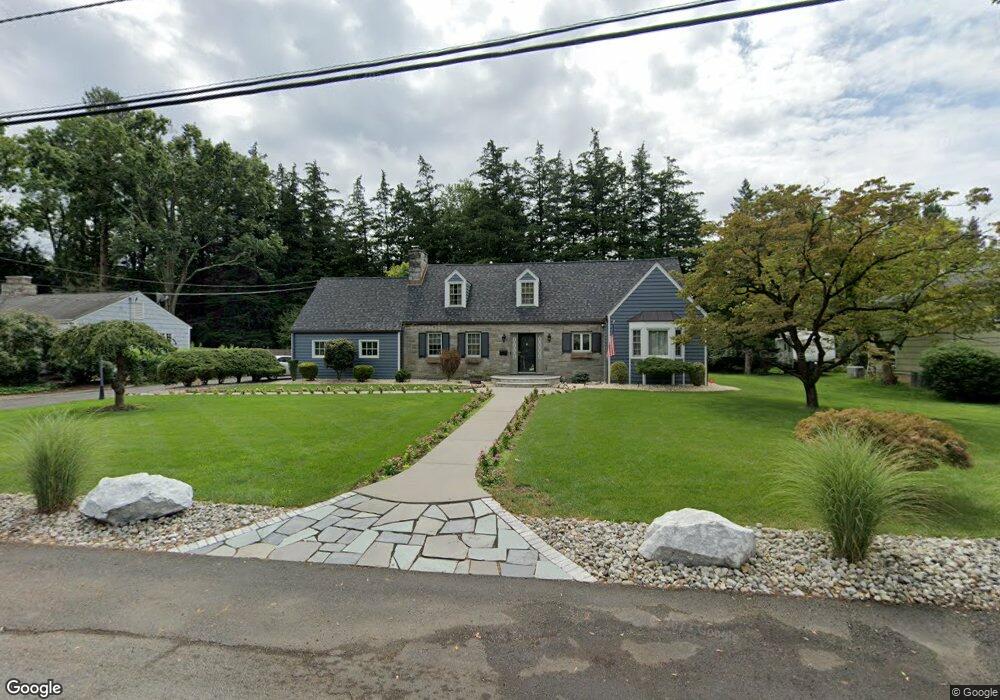
162 Farm Ln Bound Brook, NJ 08805
Estimated Value: $628,000 - $697,000
--
Bed
--
Bath
2,313
Sq Ft
$288/Sq Ft
Est. Value
About This Home
This home is located at 162 Farm Ln, Bound Brook, NJ 08805 and is currently estimated at $665,650, approximately $287 per square foot. 162 Farm Ln is a home located in Somerset County with nearby schools including LaMonte Annex Elementary School, Lafayette Elementary School, and Bound Brook High School.
Ownership History
Date
Name
Owned For
Owner Type
Purchase Details
Closed on
Jan 30, 2002
Sold by
Jannuzzi Julie
Bought by
Pinto Jane
Current Estimated Value
Home Financials for this Owner
Home Financials are based on the most recent Mortgage that was taken out on this home.
Original Mortgage
$200,000
Outstanding Balance
$83,223
Interest Rate
7.15%
Estimated Equity
$582,427
Purchase Details
Closed on
Jun 12, 1995
Sold by
Vartanian Richard
Bought by
Jannuzzi Francis and Jannuzzi Julie
Home Financials for this Owner
Home Financials are based on the most recent Mortgage that was taken out on this home.
Original Mortgage
$175,000
Interest Rate
7.82%
Create a Home Valuation Report for This Property
The Home Valuation Report is an in-depth analysis detailing your home's value as well as a comparison with similar homes in the area
Home Values in the Area
Average Home Value in this Area
Purchase History
| Date | Buyer | Sale Price | Title Company |
|---|---|---|---|
| Pinto Jane | $300,000 | -- | |
| Jannuzzi Francis | $220,000 | -- |
Source: Public Records
Mortgage History
| Date | Status | Borrower | Loan Amount |
|---|---|---|---|
| Open | Pinto Jane | $200,000 | |
| Previous Owner | Jannuzzi Francis | $175,000 |
Source: Public Records
Tax History Compared to Growth
Tax History
| Year | Tax Paid | Tax Assessment Tax Assessment Total Assessment is a certain percentage of the fair market value that is determined by local assessors to be the total taxable value of land and additions on the property. | Land | Improvement |
|---|---|---|---|---|
| 2025 | $12,616 | $585,000 | $258,000 | $327,000 |
| 2024 | $12,616 | $556,000 | $238,000 | $318,000 |
| 2023 | $12,226 | $518,500 | $208,000 | $310,500 |
| 2022 | $12,313 | $494,900 | $183,000 | $311,900 |
| 2021 | $12,721 | $436,000 | $158,000 | $278,000 |
| 2020 | $12,311 | $398,800 | $143,000 | $255,800 |
| 2019 | $12,721 | $393,000 | $133,000 | $260,000 |
| 2018 | $12,906 | $387,100 | $123,000 | $264,100 |
| 2017 | $12,904 | $378,300 | $123,000 | $255,300 |
| 2016 | $12,809 | $378,300 | $113,000 | $265,300 |
| 2015 | $11,827 | $357,200 | $123,000 | $234,200 |
| 2014 | $11,559 | $337,200 | $103,000 | $234,200 |
Source: Public Records
Map
Nearby Homes
- 180 Farm Ln
- 745 Schoolhouse Ln
- 650 Central Ave
- 807 Watchung Rd
- 811 Mountain Ave
- 563 Winsor St
- 1820 Woodland Terrace
- 1740 Middlebrook Rd
- 520 Winsor St
- 1891 Middlebrook Rd
- 14 E Maple Ave
- 112 E Union Ave
- 143 Vosseller Ave
- 112-114 E Union Ave
- 320 Church St
- 606 Vosseller Ave
- 102 W Franklin St
- 617 Vosseller Ave
- 307 W Union Ave
- 126 W High St