Estimated Value: $315,139 - $334,000
3
Beds
3
Baths
1,700
Sq Ft
$191/Sq Ft
Est. Value
About This Home
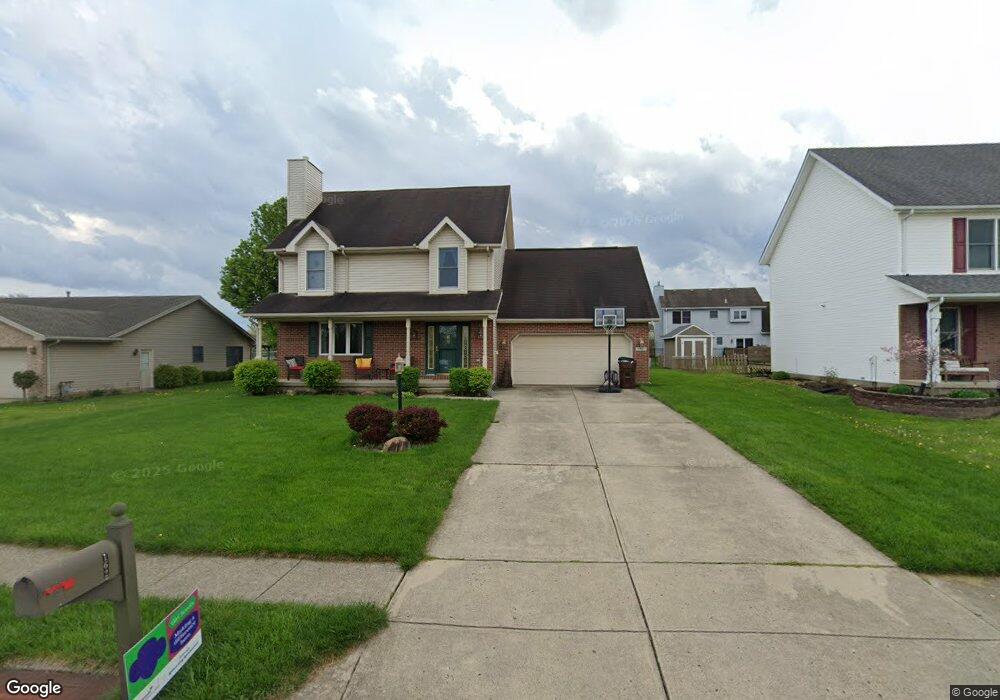
This home is located at 162 Locust View Way, Troy, OH 45373 and is currently estimated at $325,285, approximately $191 per square foot. 162 Locust View Way is a home located in Miami County with nearby schools including Concord Elementary School, Van Cleve Elementary School, and Troy Junior High School.
Ownership History
Date
Name
Owned For
Owner Type
Purchase Details
Closed on
Aug 30, 2000
Sold by
Central City Intermediary Llc
Bought by
Shearer Michael C and Shearer Jennifer A
Current Estimated Value
Home Financials for this Owner
Home Financials are based on the most recent Mortgage that was taken out on this home.
Original Mortgage
$144,850
Outstanding Balance
$53,391
Interest Rate
8.26%
Mortgage Type
FHA
Estimated Equity
$271,894
Purchase Details
Closed on
Jun 30, 2000
Sold by
Hagi Hiroshi and Hagi Atsuko
Bought by
Central City Intermediary Llc
Purchase Details
Closed on
Oct 26, 1995
Sold by
Kegley Glennis
Bought by
Hagi Hiroshi and Hagi Atsuko
Home Financials for this Owner
Home Financials are based on the most recent Mortgage that was taken out on this home.
Original Mortgage
$93,000
Interest Rate
7.65%
Mortgage Type
New Conventional
Purchase Details
Closed on
Feb 7, 1995
Sold by
Monnin Ed J
Bought by
Kegley Glennis and Kegley Ardena
Create a Home Valuation Report for This Property
The Home Valuation Report is an in-depth analysis detailing your home's value as well as a comparison with similar homes in the area
Home Values in the Area
Average Home Value in this Area
Purchase History
| Date | Buyer | Sale Price | Title Company |
|---|---|---|---|
| Shearer Michael C | $145,000 | -- | |
| Central City Intermediary Llc | -- | -- | |
| Hagi Hiroshi | $156,000 | -- | |
| Kegley Glennis | $27,500 | -- |
Source: Public Records
Mortgage History
| Date | Status | Borrower | Loan Amount |
|---|---|---|---|
| Open | Central City Intermediary Llc | $144,850 | |
| Previous Owner | Hagi Hiroshi | $93,000 |
Source: Public Records
Tax History Compared to Growth
Tax History
| Year | Tax Paid | Tax Assessment Tax Assessment Total Assessment is a certain percentage of the fair market value that is determined by local assessors to be the total taxable value of land and additions on the property. | Land | Improvement |
|---|---|---|---|---|
| 2024 | $2,943 | $75,740 | $13,440 | $62,300 |
| 2023 | $2,943 | $75,740 | $13,440 | $62,300 |
| 2022 | $2,465 | $75,740 | $13,440 | $62,300 |
| 2021 | $2,188 | $63,110 | $11,200 | $51,910 |
| 2020 | $2,190 | $63,110 | $11,200 | $51,910 |
| 2019 | $2,210 | $63,110 | $11,200 | $51,910 |
| 2018 | $1,919 | $52,190 | $10,960 | $41,230 |
| 2017 | $1,937 | $52,190 | $10,960 | $41,230 |
| 2016 | $1,910 | $52,190 | $10,960 | $41,230 |
| 2015 | $1,840 | $48,340 | $10,150 | $38,190 |
| 2014 | $1,840 | $48,340 | $10,150 | $38,190 |
| 2013 | $1,851 | $48,340 | $10,150 | $38,190 |
Source: Public Records
Map
Nearby Homes
- 2765 Silver Maple Ct
- 445 Wisteria Dr
- 660 Wisteria Dr
- 203 Boone Dr
- 0 Lincolnshire Unit 939331
- 1701 Chevington Chase
- 2215 Merrimont Dr
- 2065 S Co Road 25a
- 1117 Honeydew Dr
- 1216 Wind Rock Ct
- 768 Stonehenge Dr
- Spruce Plan at Summit Landing
- Norway Plan at Summit Landing
- Chestnut Plan at Summit Landing
- Juniper Plan at Summit Landing
- Palmetto Plan at Summit Landing
- Ashton Plan at Summit Landing
- Empress Plan at Summit Landing
- Ironwood Plan at Summit Landing
- Aspen II Plan at Summit Landing
- 176 Locust View Way
- 150 Locust View Way
- 181 Green Oak Dr
- 190 Locust View Way
- 175 Green Oak Dr
- 2633 Walnut Ridge Dr
- 185 Locust View Way
- 140 Locust View Way
- 148 Trader Ct
- 143 Trader Ct
- 199 Green Oak Dr
- 202 Locust View Way
- 2626 Walnut Ridge Dr
- 2643 Walnut Ridge Dr
- 2901 Red Oak Cir
- 170 Green Oak Dr
- 2636 Walnut Ridge Dr
- 216 Locust View Way
- 215 Green Oak Dr
- 2659 Walnut Ridge Dr