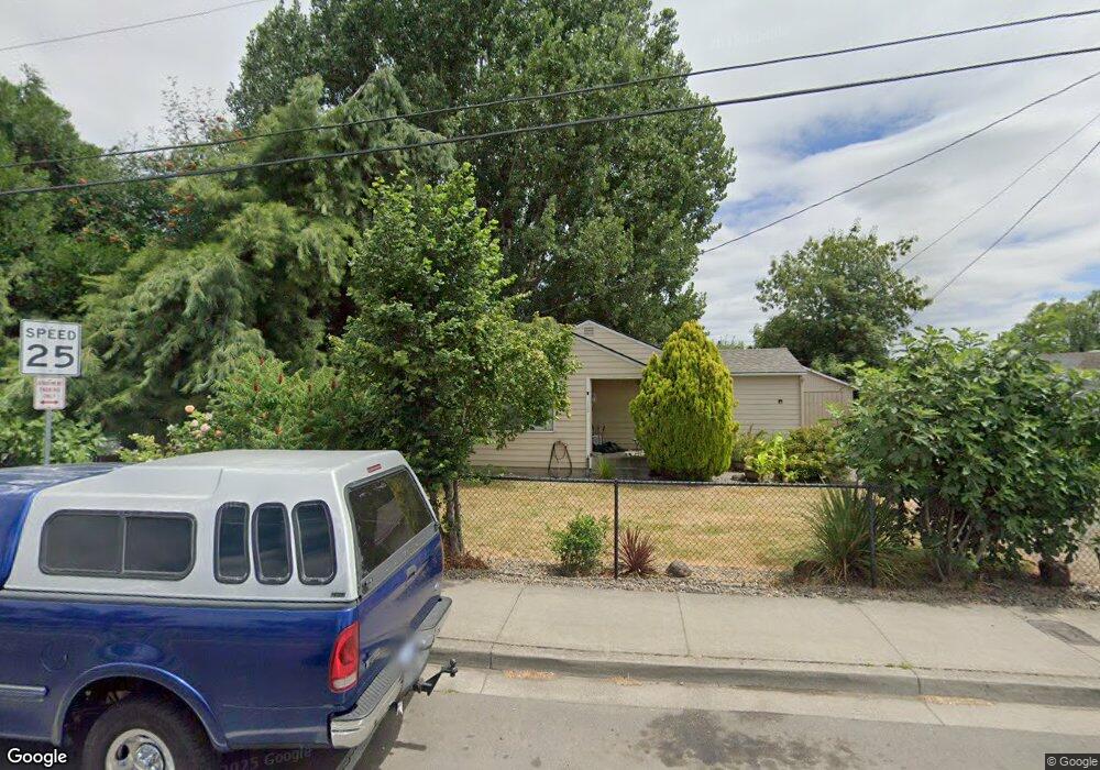
162 N 4th Ave Cornelius, OR 97113
Estimated Value: $402,000 - $469,000
3
Beds
1
Bath
1,308
Sq Ft
$330/Sq Ft
Est. Value
About This Home
This home is located at 162 N 4th Ave, Cornelius, OR 97113 and is currently estimated at $431,448, approximately $329 per square foot. 162 N 4th Ave is a home located in Washington County with nearby schools including Cornelius Elementary School, Neil Armstrong Middle School, and Tom McCall Upper Elementary School.
Ownership History
Date
Name
Owned For
Owner Type
Purchase Details
Closed on
Apr 23, 2004
Sold by
A & W Properties Llc
Bought by
Emmert Terry W
Current Estimated Value
Home Financials for this Owner
Home Financials are based on the most recent Mortgage that was taken out on this home.
Original Mortgage
$115,500
Outstanding Balance
$54,923
Interest Rate
5.92%
Mortgage Type
Unknown
Estimated Equity
$376,525
Purchase Details
Closed on
Mar 28, 2003
Sold by
Pledge Property Ix Llc
Bought by
A & W Properties Llc and Diaz Louis J
Purchase Details
Closed on
Jan 27, 2003
Sold by
Cop William A and Cop Linda M
Bought by
Pledged Property Ix Llc
Purchase Details
Closed on
Apr 8, 1998
Sold by
Cop William A
Bought by
Cop William A and Cop Linda M
Home Financials for this Owner
Home Financials are based on the most recent Mortgage that was taken out on this home.
Original Mortgage
$117,000
Interest Rate
9.37%
Mortgage Type
Purchase Money Mortgage
Create a Home Valuation Report for This Property
The Home Valuation Report is an in-depth analysis detailing your home's value as well as a comparison with similar homes in the area
Purchase History
| Date | Buyer | Sale Price | Title Company |
|---|---|---|---|
| Emmert Terry W | $165,000 | Pacific Nw Title | |
| A & W Properties Llc | $119,900 | First American | |
| Pledged Property Ix Llc | $119,000 | -- | |
| Cop William A | -- | Chicago Title Insurance Co |
Source: Public Records
Mortgage History
| Date | Status | Borrower | Loan Amount |
|---|---|---|---|
| Open | Emmert Terry W | $115,500 | |
| Previous Owner | Cop William A | $117,000 |
Source: Public Records
Tax History
| Year | Tax Paid | Tax Assessment Tax Assessment Total Assessment is a certain percentage of the fair market value that is determined by local assessors to be the total taxable value of land and additions on the property. | Land | Improvement |
|---|---|---|---|---|
| 2026 | $3,313 | $190,680 | -- | -- |
| 2025 | $3,313 | $185,130 | -- | -- |
| 2024 | $3,025 | $179,740 | -- | -- |
| 2023 | $3,025 | $174,510 | $0 | $0 |
| 2022 | $2,681 | $174,510 | $0 | $0 |
| 2021 | $2,649 | $164,500 | $0 | $0 |
| 2020 | $2,639 | $159,710 | $0 | $0 |
| 2019 | $2,581 | $155,060 | $0 | $0 |
| 2018 | $2,502 | $150,550 | $0 | $0 |
| 2017 | $2,424 | $146,170 | $0 | $0 |
| 2016 | $2,356 | $141,920 | $0 | $0 |
| 2015 | $2,217 | $137,790 | $0 | $0 |
| 2014 | $2,141 | $133,780 | $0 | $0 |
Source: Public Records
Map
Nearby Homes
- 332 S Tarrybrook Dr
- 253 S Tarrybrook Cir
- 570 N 10th Ave Unit 75
- 570 N 10th Ave Unit 2
- 570 N 10th Ave Unit 6
- 570 N 10th Ave Unit 80
- 570 N 10th Ave Unit 110
- 570 N 10th St Unit 29
- 420 N 13th Ave
- 1509 Centennial Cir
- 961 S 4th Ave
- 1832 Vine Ct
- 1504 Frontier Cir
- 3831 Pacific Ave Unit D5
- 3831 Pacific Ave Unit D2
- 1506 Pioneer Cir
- 1100 S Ivy St
- 1830 Tamarack Way
- 4403 Wagon Wheel Cir
- 1402 Pioneer Way
- 437 N Barlow St
- 453 N Barlow St
- 182 N 4th Ave
- 471 N Barlow St
- 165 N 5th Ave
- 171 N 5th Place
- 246 N 4th Ave
- 522 N Adair St
- 276 N 4th Ave
- 186 N 5th Ave Unit 17
- 186 N 5th Ave
- 198 N 5th Place
- 261 N 4th Ave
- 249 N 5th Ave
- 275 N 5th Ave
- 442 Baseline St
- 298 N 4th Ave
- 273 N 4th Ave
- 281 N 5th Ave
- 242 N 5th Ave