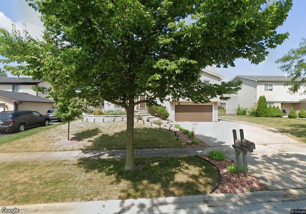
162 Pheasant Rd Matteson, IL 60443
West Matteson NeighborhoodEstimated Value: $271,971 - $320,000
4
Beds
3
Baths
2,312
Sq Ft
$131/Sq Ft
Est. Value
About This Home
This home is located at 162 Pheasant Rd, Matteson, IL 60443 and is currently estimated at $302,993, approximately $131 per square foot. 162 Pheasant Rd is a home located in Cook County with nearby schools including Colin Powell Middle School.
Ownership History
Date
Name
Owned For
Owner Type
Purchase Details
Closed on
Jul 21, 2008
Sold by
Vincent Grace J
Bought by
Vincent Grace Jean and Grace Jean Vincent Revocable Trust
Current Estimated Value
Purchase Details
Closed on
May 8, 2000
Sold by
Vincent Joseph L and Vincent Grace J
Bought by
Vincent Joseph L and Vincent Grace J
Create a Home Valuation Report for This Property
The Home Valuation Report is an in-depth analysis detailing your home's value as well as a comparison with similar homes in the area
Home Values in the Area
Average Home Value in this Area
Purchase History
| Date | Buyer | Sale Price | Title Company |
|---|---|---|---|
| Vincent Grace Jean | -- | None Available | |
| Vincent Joseph L | -- | -- |
Source: Public Records
Tax History
| Year | Tax Paid | Tax Assessment Tax Assessment Total Assessment is a certain percentage of the fair market value that is determined by local assessors to be the total taxable value of land and additions on the property. | Land | Improvement |
|---|---|---|---|---|
| 2025 | $7,889 | $25,000 | $3,390 | $21,610 |
| 2024 | $7,889 | $25,000 | $3,390 | $21,610 |
| 2023 | $2,812 | $25,000 | $3,390 | $21,610 |
| 2022 | $2,812 | $15,002 | $2,966 | $12,036 |
| 2021 | $2,764 | $15,000 | $2,965 | $12,035 |
| 2020 | $2,488 | $15,000 | $2,965 | $12,035 |
| 2019 | $5,159 | $15,615 | $2,754 | $12,861 |
| 2018 | $2,840 | $15,615 | $2,754 | $12,861 |
| 2017 | $4,994 | $15,615 | $2,754 | $12,861 |
| 2016 | $3,943 | $13,325 | $2,542 | $10,783 |
| 2015 | $4,067 | $13,325 | $2,542 | $10,783 |
| 2014 | $3,874 | $13,325 | $2,542 | $10,783 |
| 2013 | $3,691 | $12,530 | $2,542 | $9,988 |
Source: Public Records
Map
Nearby Homes
- 141 Timberlane Rd
- 56 Timberlane Rd
- 124 Oriole Rd
- 123 Oriole Rd
- 152 Oakhurst Rd
- 50 Willow Rd
- 42 Pheasant Rd
- 41 Willow Rd
- 72 White Oaks Rd
- 25 Pheasant Rd
- 34 Wedgewood Rd
- 6128 Wedgewood Ct
- 6005 Woodgate Dr
- 6237 Michael Ln
- 5943 Woodgate Dr
- 133 Deerpath Rd
- 40 Huntingwood Rd
- 10 Wedgewood Rd
- 13 Oakview Rd
- 156 Cloverleaf Rd
- 204 Pheasant Rd
- 154 Pheasant Rd Unit 4
- 201 Timberlane Rd
- 157 Timberlane Rd
- 210 Pheasant Rd
- 148 Pheasant Rd
- 205 Timberlane Rd
- 203 Pheasant Rd
- 203 Pheasant Rd Unit 4
- 153 Pheasant Rd
- 149 Timberlane Rd Unit 4
- 211 Timberlane Rd
- 209 Pheasant Rd
- 161 Pheasant Rd
- 218 Pheasant Rd
- 147 Pheasant Rd
- 140 Pheasant Rd
- 219 Timberlane Rd
- 224 Pheasant Rd
- 132 Pheasant Rd
Your Personal Tour Guide
Ask me questions while you tour the home.