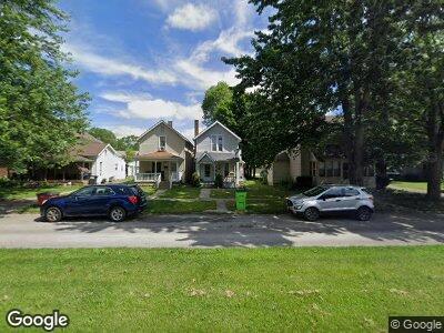
162 Summit St Fostoria, OH 44830
Estimated Value: $76,000 - $91,000
2
Beds
1
Bath
1,100
Sq Ft
$75/Sq Ft
Est. Value
About This Home
This home is located at 162 Summit St, Fostoria, OH 44830 and is currently estimated at $82,328, approximately $74 per square foot. 162 Summit St is a home located in Seneca County with nearby schools including Fostoria Intermediate Elementary School and Fostoria Junior/Senior High School.
Ownership History
Date
Name
Owned For
Owner Type
Purchase Details
Closed on
May 12, 2006
Sold by
The Secretary Of Veterans Affairs
Bought by
Harmon Jason
Current Estimated Value
Purchase Details
Closed on
Jul 8, 2003
Sold by
Pelphrey Jeffrey L
Bought by
Brust Rick L
Purchase Details
Closed on
May 29, 2001
Bought by
Pelphrey Jeffrey L
Purchase Details
Closed on
Mar 15, 2001
Sold by
Frary Robert
Bought by
Manufacturers And Traders Trust
Purchase Details
Closed on
Nov 21, 1997
Sold by
Kitchen Robert D
Bought by
Frary Robert
Purchase Details
Closed on
Jan 1, 1986
Create a Home Valuation Report for This Property
The Home Valuation Report is an in-depth analysis detailing your home's value as well as a comparison with similar homes in the area
Home Values in the Area
Average Home Value in this Area
Purchase History
| Date | Buyer | Sale Price | Title Company |
|---|---|---|---|
| Harmon Jason | $48,500 | None Available | |
| Brust Rick L | $49,000 | -- | |
| Pelphrey Jeffrey L | $20,000 | -- | |
| Manufacturers And Traders Trust | $17,700 | -- | |
| Frary Robert | $10,000 | -- | |
| -- | $16,000 | -- |
Source: Public Records
Tax History Compared to Growth
Tax History
| Year | Tax Paid | Tax Assessment Tax Assessment Total Assessment is a certain percentage of the fair market value that is determined by local assessors to be the total taxable value of land and additions on the property. | Land | Improvement |
|---|---|---|---|---|
| 2024 | $1,072 | $19,330 | $2,310 | $17,020 |
| 2023 | $1,072 | $19,330 | $2,310 | $17,020 |
| 2022 | $939 | $14,870 | $1,920 | $12,950 |
| 2021 | $957 | $14,870 | $1,920 | $12,950 |
| 2020 | $961 | $14,868 | $1,918 | $12,950 |
| 2019 | $937 | $14,351 | $1,852 | $12,499 |
| 2018 | $954 | $14,351 | $1,852 | $12,499 |
| 2017 | $846 | $14,351 | $1,852 | $12,499 |
| 2016 | $656 | $12,282 | $1,971 | $10,311 |
| 2015 | $645 | $12,282 | $1,971 | $10,311 |
| 2014 | $614 | $12,282 | $1,971 | $10,311 |
| 2013 | $720 | $13,353 | $2,142 | $11,211 |
Source: Public Records
Map
Nearby Homes
- 827 N Main St
- 900 Leonard St
- 716 N Union St Unit B
- 825 Cory St
- 712 N County Line St
- 712 N Countyline St
- 525 N Main St
- 940 N Main St
- 892 N Countyline St
- 900 N Countyline St
- 234 W High St
- 1006 Leonard Ct
- 435 Park Ave Unit 202
- 337 N Union St
- 1306 N Union St
- 440 Union Ct
- 217 Potter St
- 212 Potter St
- 610 Westhaven Dr
- 203 N Union St