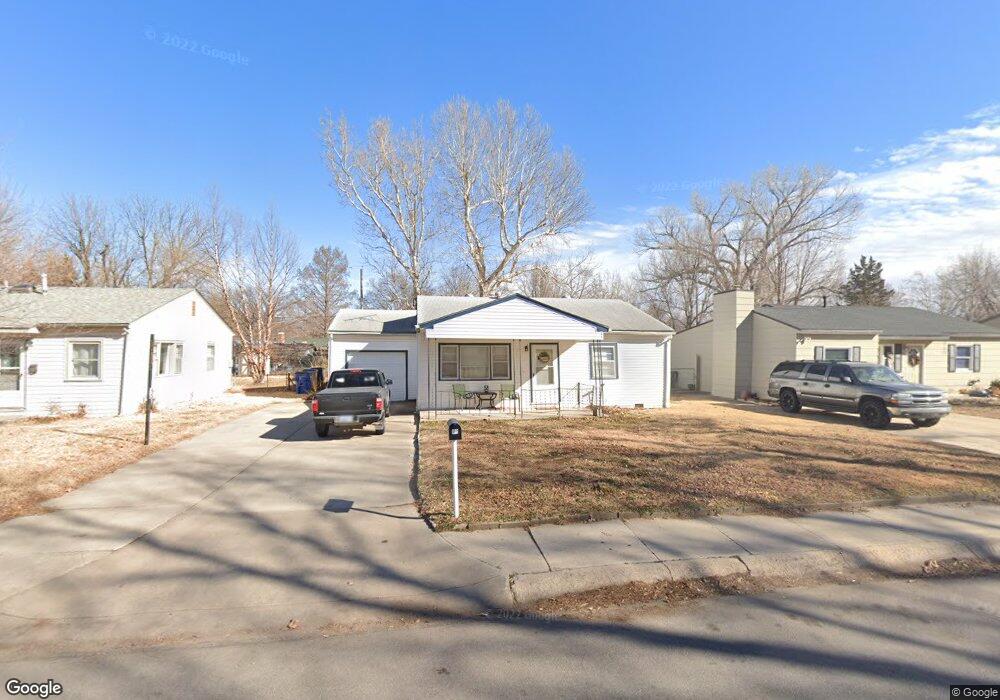
162 Wire Ave Haysville, KS 67060
Estimated Value: $138,760 - $152,000
3
Beds
1
Bath
900
Sq Ft
$162/Sq Ft
Est. Value
About This Home
This home is located at 162 Wire Ave, Haysville, KS 67060 and is currently estimated at $145,380, approximately $161 per square foot. 162 Wire Ave is a home located in Sedgwick County with nearby schools including Rex Elementary School, Haysville Middle School, and Campus High School.
Ownership History
Date
Name
Owned For
Owner Type
Purchase Details
Closed on
Jul 19, 2005
Sold by
Brown David M and Brown Karen L
Bought by
Brown David M and Brown Karen L
Current Estimated Value
Create a Home Valuation Report for This Property
The Home Valuation Report is an in-depth analysis detailing your home's value as well as a comparison with similar homes in the area
Home Values in the Area
Average Home Value in this Area
Purchase History
| Date | Buyer | Sale Price | Title Company |
|---|---|---|---|
| Brown David M | -- | None Available | |
| Brown David M | -- | None Available |
Source: Public Records
Tax History Compared to Growth
Tax History
| Year | Tax Paid | Tax Assessment Tax Assessment Total Assessment is a certain percentage of the fair market value that is determined by local assessors to be the total taxable value of land and additions on the property. | Land | Improvement |
|---|---|---|---|---|
| 2025 | $1,623 | $13,444 | $3,117 | $10,327 |
| 2023 | $1,623 | $11,443 | $1,955 | $9,488 |
| 2022 | $1,395 | $9,776 | $1,852 | $7,924 |
| 2021 | $1,343 | $9,132 | $1,852 | $7,280 |
| 2020 | $1,253 | $8,396 | $1,852 | $6,544 |
| 2019 | $1,186 | $7,924 | $1,852 | $6,072 |
| 2018 | $1,119 | $7,544 | $1,449 | $6,095 |
| 2017 | $1,122 | $0 | $0 | $0 |
| 2016 | $1,089 | $0 | $0 | $0 |
| 2015 | -- | $0 | $0 | $0 |
| 2014 | -- | $0 | $0 | $0 |
Source: Public Records
Map
Nearby Homes
- 242 Wire Ave
- 115 Hungerford Ave
- 214 Stearns Ave
- 150 Sunset Ave
- 200 Sunset Ave
- 181 Sunset Ave
- 238 Western Ave
- 415 Spring Dr
- 449 W 4th St
- 213 Timberlane Ct
- 1204 W Leonard St
- 504 S Shira Cir
- 523 Alexander Dr
- 988 Alexander Dr
- 201 E Karla Ave
- 224 N Maynard Ave
- 156 W Alexander Ct
- 221 River Birch St
- 1307 W Hannah Ln
- 616 E Peach Ave