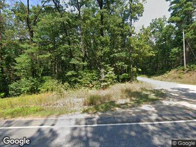
1620 Fruitvale Rd Holton, MI 49425
Estimated Value: $339,000 - $397,000
3
Beds
3
Baths
1,496
Sq Ft
$243/Sq Ft
Est. Value
About This Home
This home is located at 1620 Fruitvale Rd, Holton, MI 49425 and is currently estimated at $363,942, approximately $243 per square foot. 1620 Fruitvale Rd is a home located in Muskegon County with nearby schools including Holton Elementary School, Holton Middle School, and Holton High School.
Ownership History
Date
Name
Owned For
Owner Type
Purchase Details
Closed on
Mar 30, 2017
Sold by
Tucker Regine Cannady and Cannady Timothy
Bought by
Cannady Michael L and Cannady Kristy L
Current Estimated Value
Home Financials for this Owner
Home Financials are based on the most recent Mortgage that was taken out on this home.
Original Mortgage
$144,000
Interest Rate
4.15%
Mortgage Type
New Conventional
Create a Home Valuation Report for This Property
The Home Valuation Report is an in-depth analysis detailing your home's value as well as a comparison with similar homes in the area
Home Values in the Area
Average Home Value in this Area
Purchase History
| Date | Buyer | Sale Price | Title Company |
|---|---|---|---|
| Cannady Michael L | $180,000 | Lighthouse Title Inc |
Source: Public Records
Mortgage History
| Date | Status | Borrower | Loan Amount |
|---|---|---|---|
| Closed | Cannady Michael L | $176,000 | |
| Closed | Cannady Michael L | $144,000 | |
| Closed | Tucker Regine | $56,000 | |
| Closed | Cannady Regine A | $35,000 | |
| Closed | Cannady Regine A | $40,000 | |
| Closed | Cannady Timothy | $208,000 | |
| Closed | Cannady Timothy | $72,800 |
Source: Public Records
Tax History Compared to Growth
Tax History
| Year | Tax Paid | Tax Assessment Tax Assessment Total Assessment is a certain percentage of the fair market value that is determined by local assessors to be the total taxable value of land and additions on the property. | Land | Improvement |
|---|---|---|---|---|
| 2024 | $1,024 | $161,300 | $0 | $0 |
| 2023 | $979 | $137,200 | $0 | $0 |
| 2022 | $2,754 | $112,200 | $0 | $0 |
| 2021 | $2,679 | $110,600 | $0 | $0 |
| 2020 | $2,653 | $109,100 | $0 | $0 |
| 2019 | $2,615 | $105,300 | $0 | $0 |
| 2018 | $2,553 | $87,400 | $0 | $0 |
| 2017 | $2,499 | $89,000 | $0 | $0 |
| 2016 | $834 | $73,400 | $0 | $0 |
| 2015 | -- | $72,900 | $0 | $0 |
| 2014 | -- | $72,600 | $0 | $0 |
| 2013 | -- | $68,600 | $0 | $0 |
Source: Public Records
Map
Nearby Homes
- 1866 Fir Ave
- 2509 Skeels Rd
- 2090 E Roosevelt Rd
- V/L E Winston Rd
- 7060 S 142nd Ave
- 4334 Brunswick Rd
- V L 12a East Wilke Rd
- 2299 Kent Rd
- V/L 12A E Wilke Rd
- 53 W Wilke Rd
- 999 Holton Whitehall Rd
- V/L ''D'' Hyde Park Rd
- V/L ''B'' Hyde Park Rd
- 00 Hyde Park Rd
- V/L S 120th Ave
- 0 Hart Rd
- 699 E White Lake Dr
- 0 Silver Creek Rd Unit 24007124
- 863 E Drexel Rd
- 3625 Sunrise Ridge Dr
- 1620 Fruitvale Rd
- 1630 Fruitvale Rd
- 11380 Oak Ave
- 11347 Hemlock St
- 11357 Oak Ave
- 11350 Oak Ave
- 11335 Hemlock St
- 11334 Hemlock St
- 11349 Oak Ave
- 11327 Hemlock St
- 11343 Oak Ave
- 11325 Hemlock St
- 1552 Lake Ave
- 11326 Hemlock St
- 11340 Pine St
- 11309 Hemlock St
- 11334 Pine St
- 11314 Hemlock St
- 11325 Oak Ave
- 11300 Pine St
