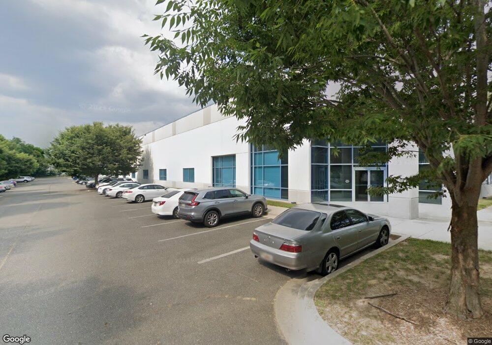
16200 Queens Ct Upper Marlboro, MD 20774
Estimated Value: $19,849,788
--
Bed
--
Bath
96,292
Sq Ft
$206/Sq Ft
Est. Value
About This Home
This home is located at 16200 Queens Ct, Upper Marlboro, MD 20774 and is currently estimated at $19,849,788, approximately $206 per square foot. 16200 Queens Ct is a home located in Prince George's County with nearby schools including Pointer Ridge Elementary School, Benjamin Tasker Middle School, and Bowie High School.
Ownership History
Date
Name
Owned For
Owner Type
Purchase Details
Closed on
Jun 10, 2024
Sold by
Civf V-Md1w05 Llc and Bcore Defender Md1w05 Llc
Bought by
16200 Queens Ct Llc
Current Estimated Value
Home Financials for this Owner
Home Financials are based on the most recent Mortgage that was taken out on this home.
Original Mortgage
$14,325,000
Outstanding Balance
$14,126,419
Interest Rate
6.94%
Mortgage Type
New Conventional
Estimated Equity
$5,723,369
Purchase Details
Closed on
Dec 30, 2020
Sold by
Tomorrows Property Llc
Bought by
Civf V Md1w05 Llc
Purchase Details
Closed on
Sep 10, 2003
Sold by
Prince Georges County
Bought by
Tomorrows Property Llc
Create a Home Valuation Report for This Property
The Home Valuation Report is an in-depth analysis detailing your home's value as well as a comparison with similar homes in the area
Home Values in the Area
Average Home Value in this Area
Purchase History
| Date | Buyer | Sale Price | Title Company |
|---|---|---|---|
| 16200 Queens Ct Llc | $19,100,000 | None Listed On Document | |
| Civf V Md1w05 Llc | $9,517,500 | None Available | |
| Tomorrows Property Llc | $600,782 | -- |
Source: Public Records
Mortgage History
| Date | Status | Borrower | Loan Amount |
|---|---|---|---|
| Open | 16200 Queens Ct Llc | $14,325,000 |
Source: Public Records
Tax History Compared to Growth
Tax History
| Year | Tax Paid | Tax Assessment Tax Assessment Total Assessment is a certain percentage of the fair market value that is determined by local assessors to be the total taxable value of land and additions on the property. | Land | Improvement |
|---|---|---|---|---|
| 2025 | $128,091 | $8,443,800 | $2,234,600 | $6,209,200 |
| 2024 | $128,091 | $8,404,433 | $0 | $0 |
| 2023 | $93,020 | $8,365,067 | $0 | $0 |
| 2022 | $126,810 | $8,325,700 | $2,234,600 | $6,091,100 |
| 2021 | $120,814 | $7,910,467 | $0 | $0 |
| 2020 | $114,818 | $7,495,233 | $0 | $0 |
| 2019 | $101,386 | $7,080,000 | $2,234,600 | $4,845,400 |
| 2018 | $107,956 | $7,020,000 | $0 | $0 |
| 2017 | $106,223 | $6,960,000 | $0 | $0 |
| 2016 | -- | $6,900,000 | $0 | $0 |
| 2015 | $93,757 | $6,900,000 | $0 | $0 |
| 2014 | $93,757 | $7,034,500 | $0 | $0 |
Source: Public Records
Map
Nearby Homes
- 16503 Rolling Knolls Ln
- 16500 Rolling Knolls Ln
- 16505 Rolling Knolls Ln
- 16502 Rolling Knolls Ln
- Hampton II Plan at Marshall's Landing
- Preston Plan at Marshall's Landing
- Stonehaven II Plan at Marshall's Landing
- 16508 Kilby Ct
- 913 Midbrook Ln
- 15303 Glastonbury Way
- 15304 Camberley Place
- 210 Queen Marie Ct
- 15517 Glastonbury Way
- 2135 Congresbury Place
- 15625 Copper Beech Dr
- 15513 Twin River Cir
- 2100 Fittleworth Terrace
- 15219 N Berwick Ln
- 15542 Twin River Cir
- 653 Fairmont Dr Unit 216A
- 1201 Crain Hwy
- 16100 Queens Ct
- 16109 Queens Ct
- 1340 Crain Hwy
- 0 Crain Hwy Unit 1007216392
- 0 Crain Hwy Unit 1007035620
- 0 Crain Hwy Unit 1006967316
- 0 Crain Hwy Unit 1006912596
- 0 Crain Hwy Unit 1006672162
- 0 Crain Hwy Unit 1006384976
- 0 Crain Hwy
- 0 Crain Hwy Unit 1000034649
- 0 Crain Hwy Unit 1000292556
- 0 Crain Hwy Unit 1001626688
- 0 Crain Hwy Unit 1002983836
- 1000 Prince Georges Blvd
- 16111 Queens Ct
- 16103 Queens Ct
- 16101 Queens Ct
- 16230 Branch Ct