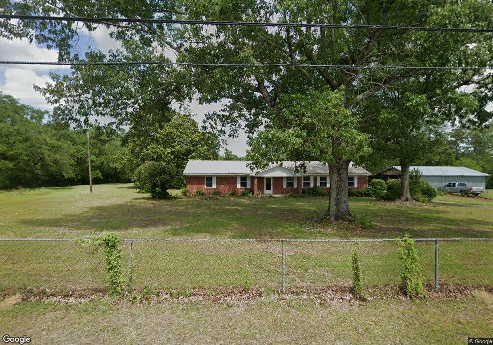
16201 Allie Byrd Rd Vancleave, MS 39565
Estimated Value: $292,616 - $344,000
--
Bed
2
Baths
2,088
Sq Ft
$151/Sq Ft
Est. Value
About This Home
This home is located at 16201 Allie Byrd Rd, Vancleave, MS 39565 and is currently estimated at $315,154, approximately $150 per square foot. 16201 Allie Byrd Rd is a home located in Jackson County with nearby schools including St Martin East Elementary School, St Martin North Elementary School, and St Martin Upper Elementary School.
Ownership History
Date
Name
Owned For
Owner Type
Purchase Details
Closed on
Aug 17, 2020
Sold by
Wilson Helen M
Bought by
Wilson Winston D
Current Estimated Value
Home Financials for this Owner
Home Financials are based on the most recent Mortgage that was taken out on this home.
Original Mortgage
$18,000
Outstanding Balance
$12,753
Interest Rate
2.9%
Mortgage Type
New Conventional
Estimated Equity
$302,401
Create a Home Valuation Report for This Property
The Home Valuation Report is an in-depth analysis detailing your home's value as well as a comparison with similar homes in the area
Home Values in the Area
Average Home Value in this Area
Purchase History
| Date | Buyer | Sale Price | Title Company |
|---|---|---|---|
| Wilson Winston D | -- | None Available |
Source: Public Records
Mortgage History
| Date | Status | Borrower | Loan Amount |
|---|---|---|---|
| Open | Wilson Winston D | $18,000 |
Source: Public Records
Tax History Compared to Growth
Tax History
| Year | Tax Paid | Tax Assessment Tax Assessment Total Assessment is a certain percentage of the fair market value that is determined by local assessors to be the total taxable value of land and additions on the property. | Land | Improvement |
|---|---|---|---|---|
| 2024 | $909 | $17,259 | $5,735 | $11,524 |
| 2023 | $909 | $17,259 | $5,735 | $11,524 |
| 2022 | $884 | $15,076 | $0 | $0 |
| 2021 | $883 | $15,076 | $15,076 | $0 |
| 2020 | $915 | $15,076 | $5,751 | $9,325 |
| 2019 | $905 | $15,076 | $5,751 | $9,325 |
| 2018 | $923 | $15,076 | $5,751 | $9,325 |
| 2017 | $939 | $15,076 | $5,751 | $9,325 |
| 2016 | $936 | $15,368 | $5,751 | $9,617 |
| 2015 | $636 | $128,200 | $40,690 | $87,510 |
| 2014 | $625 | $12,820 | $4,069 | $8,751 |
| 2013 | $604 | $12,820 | $4,069 | $8,751 |
Source: Public Records
Map
Nearby Homes
- 15655 Krohn Rd
- 3419 Stephen Earl Dr
- 0 Rivers Pointe Dr Unit 4114604
- 0 Rivers Pointe Rd Unit 4114609
- 3554 Rivers Point Rd
- 0 Wescovich Rd
- 0 Dobson Rd Unit 4114623
- 15469 Dobson Rd
- 15320 Old Highway 15
- 15021 Dobson Rd
- 0 Joe Batt Rd
- 14920 Pine Blvd
- 14342 Oak View Cir
- 4155 Tux River Cir
- 15566 Mississippi 15
- 17321 Avondale Cir Unit 1
- 15712 Poydras Cir
- 17264 Coventry Estates Blvd
- 5046 Fairbury Way
- 5216 Garden Ln
- 16208 Allie Byrd Rd
- 16113 Allie Byrd Rd
- 16200 Allie Byrd Rd
- 16220 Allie Byrd Rd
- 16480 Allie Byrd Rd
- 16105 Allie Byrd Rd
- 16505 Allie Byrd Rd
- 16215 Allie Byrd Rd
- 16401 Allie Byrd Rd
- 16000 Allie Byrd Rd
- 15917 Allie Byrd Rd
- 16531 Allie Byrd Rd
- 16219 Allie Byrd Rd
- 15915 Allie Byrd Rd
- 15701 Stanley Rd
- 15701 Stanley Rd
- 15914 Cruthirds Rd
- 15901 Allie Byrd Rd
- 15902 Cruthirds Rd
- 15904 Cruthirds Rd