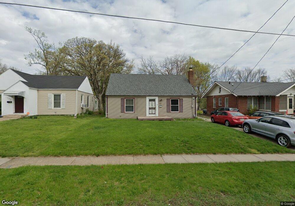
1621 Allison Ave Des Moines, IA 50314
Mondamin Presidential NeighborhoodEstimated Value: $156,000 - $182,000
3
Beds
1
Bath
1,328
Sq Ft
$129/Sq Ft
Est. Value
About This Home
This home is located at 1621 Allison Ave, Des Moines, IA 50314 and is currently estimated at $170,989, approximately $128 per square foot. 1621 Allison Ave is a home located in Polk County with nearby schools including Monroe Elementary School, Meredith Middle School, and Hoover High School.
Ownership History
Date
Name
Owned For
Owner Type
Purchase Details
Closed on
Feb 25, 2016
Sold by
Smith Jesse
Bought by
Smith Mary
Current Estimated Value
Purchase Details
Closed on
Sep 20, 2002
Sold by
Michael Mary E
Bought by
Spencer Mary L
Home Financials for this Owner
Home Financials are based on the most recent Mortgage that was taken out on this home.
Original Mortgage
$78,665
Outstanding Balance
$33,053
Interest Rate
6.32%
Mortgage Type
FHA
Estimated Equity
$137,936
Create a Home Valuation Report for This Property
The Home Valuation Report is an in-depth analysis detailing your home's value as well as a comparison with similar homes in the area
Home Values in the Area
Average Home Value in this Area
Purchase History
| Date | Buyer | Sale Price | Title Company |
|---|---|---|---|
| Smith Mary | -- | None Available | |
| Spencer Mary L | $79,500 | -- |
Source: Public Records
Mortgage History
| Date | Status | Borrower | Loan Amount |
|---|---|---|---|
| Open | Spencer Mary L | $78,665 |
Source: Public Records
Tax History Compared to Growth
Tax History
| Year | Tax Paid | Tax Assessment Tax Assessment Total Assessment is a certain percentage of the fair market value that is determined by local assessors to be the total taxable value of land and additions on the property. | Land | Improvement |
|---|---|---|---|---|
| 2025 | $2,388 | $131,900 | $11,700 | $120,200 |
| 2024 | $2,388 | $121,400 | $10,600 | $110,800 |
| 2023 | $2,270 | $121,400 | $10,600 | $110,800 |
| 2022 | $2,252 | $96,300 | $8,800 | $87,500 |
| 2021 | $2,178 | $96,300 | $8,800 | $87,500 |
| 2020 | $2,264 | $87,300 | $8,000 | $79,300 |
| 2019 | $2,104 | $87,300 | $8,000 | $79,300 |
| 2018 | $2,082 | $78,300 | $7,000 | $71,300 |
| 2017 | $2,078 | $78,300 | $7,000 | $71,300 |
| 2016 | $2,024 | $76,800 | $6,700 | $70,100 |
| 2015 | $2,024 | $76,800 | $6,700 | $70,100 |
| 2014 | $2,046 | $77,000 | $6,600 | $70,400 |
Source: Public Records
Map
Nearby Homes
- 1902 Francis Ave
- 1925 Francis Ave
- 1946 Franklin Ave
- 1608 Mondamin Ave
- 1716 Mondamin Ave
- 1334 Washington Ave
- 1656 Martin Luther King Junior Pkwy
- 1915 22nd St
- 1622 Martin Luther King Junior Pkwy
- 2103 Washington Ave
- 1534 18th St
- 2014 23rd St
- 1021 Franklin Ave
- 1603 Clark St
- 1605 22nd St
- 1457 17th St
- 1910 10th St
- 00 24th St
- 1341 Clark St
- 1609 12th St
- 1617 Allison Ave
- 1625 Allison Ave
- 1701 Allison Ave
- 1613 Allison Ave
- 1620 Lincoln Ave
- 1707 Allison Ave
- 1618 Lincoln Ave
- 1624 Lincoln Ave
- 1700 Lincoln Ave
- 1612 Lincoln Ave
- 1620 Allison Ave
- 1624 Allison Ave
- 1612 Allison Ave
- 1711 Allison Ave
- 1616 Allison Ave
- 1700 Allison Ave
- 1704 Lincoln Ave
- 1603 Allison Ave
- 2014 16th St
- 1704 Allison Ave