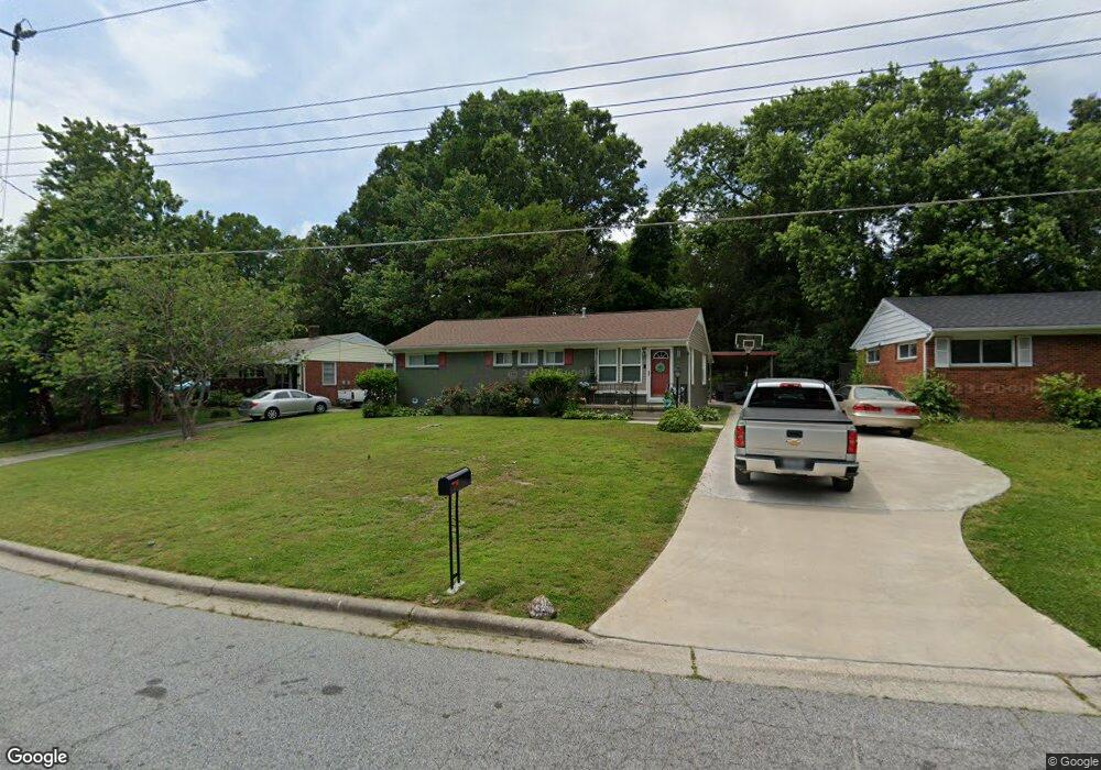
1621 Larkin St High Point, NC 27262
Greater High Point NeighborhoodEstimated Value: $140,000 - $162,520
3
Beds
1
Bath
1,056
Sq Ft
$144/Sq Ft
Est. Value
About This Home
This home is located at 1621 Larkin St, High Point, NC 27262 and is currently estimated at $151,630, approximately $143 per square foot. 1621 Larkin St is a home located in Guilford County with nearby schools including Johnson Street Global Studies, Welborn Academy of Science & Technology, and High Point Central High School.
Ownership History
Date
Name
Owned For
Owner Type
Purchase Details
Closed on
Sep 24, 2008
Sold by
Wachovia Bank National Association
Bought by
Brockington Tina A and Brown Mary E
Current Estimated Value
Home Financials for this Owner
Home Financials are based on the most recent Mortgage that was taken out on this home.
Original Mortgage
$64,153
Outstanding Balance
$42,609
Interest Rate
6.49%
Mortgage Type
FHA
Estimated Equity
$109,021
Purchase Details
Closed on
May 28, 2008
Sold by
Bryant Terry L
Bought by
Wachovia Bank Na
Create a Home Valuation Report for This Property
The Home Valuation Report is an in-depth analysis detailing your home's value as well as a comparison with similar homes in the area
Home Values in the Area
Average Home Value in this Area
Purchase History
| Date | Buyer | Sale Price | Title Company |
|---|---|---|---|
| Brockington Tina A | $65,000 | None Available | |
| Wachovia Bank Na | $8,527 | None Available |
Source: Public Records
Mortgage History
| Date | Status | Borrower | Loan Amount |
|---|---|---|---|
| Open | Brockington Tina A | $64,153 |
Source: Public Records
Tax History Compared to Growth
Tax History
| Year | Tax Paid | Tax Assessment Tax Assessment Total Assessment is a certain percentage of the fair market value that is determined by local assessors to be the total taxable value of land and additions on the property. | Land | Improvement |
|---|---|---|---|---|
| 2025 | $1,000 | $72,600 | $13,000 | $59,600 |
| 2024 | $1,000 | $72,600 | $13,000 | $59,600 |
| 2023 | $1,000 | $72,600 | $13,000 | $59,600 |
| 2022 | $979 | $72,600 | $13,000 | $59,600 |
| 2021 | $805 | $58,400 | $13,000 | $45,400 |
| 2020 | $805 | $58,400 | $13,000 | $45,400 |
| 2019 | $805 | $58,400 | $0 | $0 |
| 2018 | $801 | $58,400 | $0 | $0 |
| 2017 | $801 | $58,400 | $0 | $0 |
| 2016 | $935 | $66,700 | $0 | $0 |
| 2015 | $940 | $66,700 | $0 | $0 |
| 2014 | $956 | $66,700 | $0 | $0 |
Source: Public Records
Map
Nearby Homes
- 1714 N Hamilton St Unit A
- 1714 N Hamilton St Unit B
- 1740 N Hamilton St Unit G
- 1825 Johnson St Unit B
- 1704 N Hamilton St Unit D
- 1507 Larkin St
- 1433 Larkin St
- 1428 Futrelle Dr
- 1607 Bridges Dr
- 1700 Long St
- 435 Chester Woods Ct
- 1406 Bridges Dr
- 208 Northpoint Ave Unit I
- 1110 Forrest St
- 1108 Forrest St
- 1508 Wendover Dr
- 910 Charlotte Ave
- 321 Rockspring Rd
- 323 Rockspring Rd
- 325 Rockspring Rd
- 1623 Larkin St
- 1619 Larkin St
- 1625 Larkin St
- 1816 Johnson St
- 1617 Larkin St
- 1814 Johnson St
- 1620 Larkin St
- 1627 Larkin St
- 1628 Larkin St
- 1812 Johnson St
- 1622 Larkin St
- 1624 Larkin St
- 1810 Johnson St
- 1626 Larkin St
- 1818 Johnson St
- 1615 Larkin St
- 1629 Larkin St
- 1806 Johnson St
- 1616 Larkin St
- 1808 Johnson St