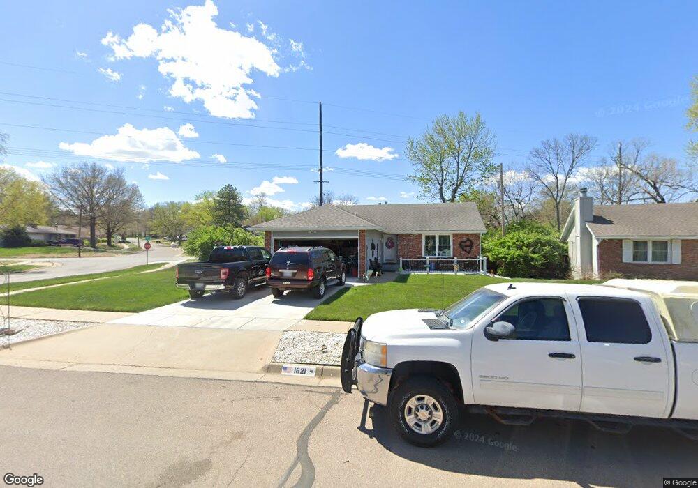
1621 SW Cheyenne Hills Rd Topeka, KS 66604
West Topeka NeighborhoodEstimated Value: $168,000 - $225,000
2
Beds
3
Baths
1,088
Sq Ft
$177/Sq Ft
Est. Value
About This Home
This home is located at 1621 SW Cheyenne Hills Rd, Topeka, KS 66604 and is currently estimated at $192,092, approximately $176 per square foot. 1621 SW Cheyenne Hills Rd is a home located in Shawnee County with nearby schools including McCarter Elementary School, Landon Middle School, and Topeka West High School.
Ownership History
Date
Name
Owned For
Owner Type
Purchase Details
Closed on
Nov 8, 2023
Sold by
Shelton Linda C
Bought by
Shelton Linda C and Alford Tina M
Current Estimated Value
Purchase Details
Closed on
Jun 5, 2017
Sold by
Shelton Linda Charlene and Stanley Linda
Bought by
Cloe Bradle Scott
Purchase Details
Closed on
Mar 3, 2011
Sold by
Stanley Linda and Wancura Linda
Bought by
Shelton Linda C and Shelton Jerry Jack
Home Financials for this Owner
Home Financials are based on the most recent Mortgage that was taken out on this home.
Original Mortgage
$94,400
Interest Rate
3.72%
Mortgage Type
New Conventional
Create a Home Valuation Report for This Property
The Home Valuation Report is an in-depth analysis detailing your home's value as well as a comparison with similar homes in the area
Home Values in the Area
Average Home Value in this Area
Purchase History
| Date | Buyer | Sale Price | Title Company |
|---|---|---|---|
| Shelton Linda C | -- | None Listed On Document | |
| Shelton Linda C | -- | None Listed On Document | |
| Cloe Bradle Scott | -- | None Available | |
| Shelton Linda C | -- | None Available |
Source: Public Records
Mortgage History
| Date | Status | Borrower | Loan Amount |
|---|---|---|---|
| Previous Owner | Shelton Linda C | $94,400 |
Source: Public Records
Tax History Compared to Growth
Tax History
| Year | Tax Paid | Tax Assessment Tax Assessment Total Assessment is a certain percentage of the fair market value that is determined by local assessors to be the total taxable value of land and additions on the property. | Land | Improvement |
|---|---|---|---|---|
| 2025 | $2,794 | $20,320 | -- | -- |
| 2023 | $2,794 | $19,341 | $0 | $0 |
| 2022 | $2,578 | $17,269 | $0 | $0 |
| 2021 | $2,422 | $15,418 | $0 | $0 |
| 2020 | $2,279 | $14,684 | $0 | $0 |
| 2019 | $2,225 | $14,257 | $0 | $0 |
| 2018 | $2,161 | $13,841 | $0 | $0 |
| 2017 | $2,101 | $13,438 | $0 | $0 |
| 2014 | $2,079 | $13,174 | $0 | $0 |
Source: Public Records
Map
Nearby Homes
- 1906 SW Village Dr
- 5802 SW Sterling Ln
- 1306 SW Glendale Dr
- 5618 SW 14th St
- 5518 SW Avalon Ln
- 1728 SW Fairlawn Rd
- 5452 SW 12th Terrace Unit 3
- 5859 SW 22nd Terrace Unit 3
- 0000 SW 22nd Terrace
- 1053 SW Harvey St
- 2124 SW Meadow Ln
- 5324 SW 24th St
- 1100 SW Amhurst Ct
- 1042 SW Amhurst Ct
- 1944 SW Quivira Dr
- 000 U S 75
- 2401 SW Crest Dr
- 1609 SW Burnett Rd
- 8008 SW 26th Terrace Unit Lot 8, Block B
- 8016 SW 26th Terrace Unit Lot 10, Block B
- 1617 SW Cheyenne Hills Rd
- 5818 SW 17th St
- 1613 SW Cheyenne Hills Rd
- 1620 SW Cheyenne Hills Rd
- 1701 SW Village Dr
- 1606 SW Village Dr
- 1609 SW Cheyenne Hills Rd
- 1612 SW Cheyenne Hills Rd
- 1700 SW Cheyenne Rd
- 5812 SW 17th St
- 1700 SW Village Dr
- 1601 SW Village Dr
- 1705 SW Village Dr
- 1605 SW Cheyenne Hills Rd
- 1602 SW Cheyenne Hills Rd
- 5805 SW 16th St
- 1706 SW Cheyenne Rd
- 5643 SW 17th St
- 1585 SW Village Dr
- 1601 SW Cheyenne Hills Rd