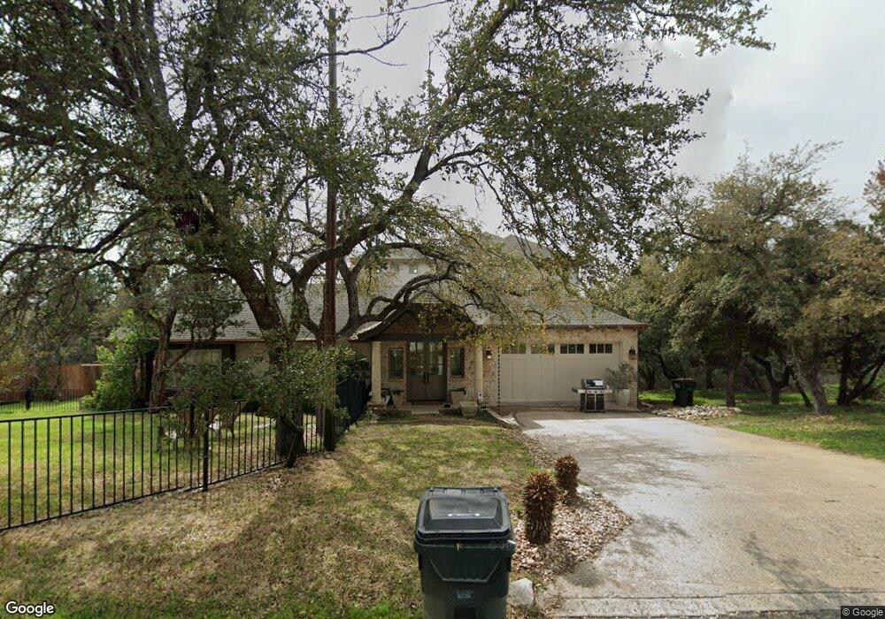
1621 the High Rd Unit B Austin, TX 78746
Westlake NeighborhoodEstimated Value: $1,064,000 - $1,656,000
4
Beds
4
Baths
2,087
Sq Ft
$684/Sq Ft
Est. Value
About This Home
This home is located at 1621 the High Rd Unit B, Austin, TX 78746 and is currently estimated at $1,426,641, approximately $683 per square foot. 1621 the High Rd Unit B is a home located in Travis County with nearby schools including Eanes Elementary School, Hill Country Middle School, and Westlake High School.
Ownership History
Date
Name
Owned For
Owner Type
Purchase Details
Closed on
Nov 15, 2006
Sold by
Pitner Stephen L and Pitner Mary C
Bought by
Pitner Austin M and Pitner Brooke S
Current Estimated Value
Home Financials for this Owner
Home Financials are based on the most recent Mortgage that was taken out on this home.
Original Mortgage
$160,000
Outstanding Balance
$94,907
Interest Rate
6.26%
Mortgage Type
Purchase Money Mortgage
Estimated Equity
$1,331,734
Purchase Details
Closed on
Jan 15, 2004
Sold by
Adams Richard N
Bought by
Pitner Stephen L and Pitner Mary C
Home Financials for this Owner
Home Financials are based on the most recent Mortgage that was taken out on this home.
Original Mortgage
$160,000
Interest Rate
5.01%
Mortgage Type
Purchase Money Mortgage
Create a Home Valuation Report for This Property
The Home Valuation Report is an in-depth analysis detailing your home's value as well as a comparison with similar homes in the area
Home Values in the Area
Average Home Value in this Area
Purchase History
| Date | Buyer | Sale Price | Title Company |
|---|---|---|---|
| Pitner Austin M | -- | None Available | |
| Pitner Stephen L | -- | Gracy Title Company |
Source: Public Records
Mortgage History
| Date | Status | Borrower | Loan Amount |
|---|---|---|---|
| Open | Pitner Austin M | $160,000 | |
| Previous Owner | Pitner Stephen L | $160,000 |
Source: Public Records
Tax History Compared to Growth
Tax History
| Year | Tax Paid | Tax Assessment Tax Assessment Total Assessment is a certain percentage of the fair market value that is determined by local assessors to be the total taxable value of land and additions on the property. | Land | Improvement |
|---|---|---|---|---|
| 2025 | $12,252 | $1,047,340 | -- | -- |
| 2023 | $10,790 | $865,570 | $0 | $0 |
| 2022 | $12,288 | $786,882 | $0 | $0 |
| 2021 | $12,075 | $715,347 | $228,690 | $1,131,593 |
| 2020 | $11,504 | $650,315 | $228,690 | $960,298 |
| 2018 | $9,924 | $537,450 | $228,690 | $970,579 |
| 2017 | $9,022 | $488,591 | $154,275 | $334,316 |
| 2016 | $9,087 | $492,110 | $154,275 | $337,835 |
| 2015 | $8,660 | $492,918 | $209,593 | $283,325 |
| 2014 | $8,660 | $495,838 | $209,593 | $286,245 |
Source: Public Records
Map
Nearby Homes
- 2005 Far Gallant Dr
- 2201 Far Gallant Dr
- 1501 Ridgecrest Dr
- 2547 Waymaker Way
- 2551 Waymaker Way
- 1357 the High Rd Unit 1
- 2004 Canonero Dr
- 2900 Waterbank Cove
- 2807 Round Table Rd
- 5304 Scenic View Dr
- 2800 Waymaker Way Unit 40
- 2308 Matador Cir
- 2906 Mill Reef Cove
- 1106 the High Rd
- 5205 Scenic View Dr
- 2419 Trail of the Madrones
- 2102 N Oak Canyon Rd
- 5425 Petticoat Ln
- 3107 Cavalcade Ct
- 907 the High Rd
- 1619 the High Rd Unit A
- 1610 the High Rd
- 1616 the High Rd
- 1615 the High Rd
- 1606 the High Rd
- 1604 the High Rd
- 1607 the High Rd
- 00 the High Rd
- 1628 the High Rd
- 1612 the High Rd
- 2401 Never Bend Cove
- 1605 the High Rd
- 1602 the High Rd
- 2404 Never Bend Cove
- 1603 the High Rd
- 2405 Never Bend Cove
- 1600 the High Rd
- 1601 the High Rd
- 2408 Never Bend Cove
- 1504 Ridgecrest Dr