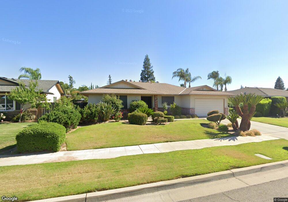
1621 W Fremont Ave Fresno, CA 93711
Bullard NeighborhoodEstimated Value: $431,328 - $500,000
3
Beds
2
Baths
2,005
Sq Ft
$234/Sq Ft
Est. Value
About This Home
This home is located at 1621 W Fremont Ave, Fresno, CA 93711 and is currently estimated at $469,332, approximately $234 per square foot. 1621 W Fremont Ave is a home located in Fresno County with nearby schools including Starr Elementary School, Tenaya Middle School, and Bullard High School.
Ownership History
Date
Name
Owned For
Owner Type
Purchase Details
Closed on
May 30, 2022
Sold by
Lim Shirley
Bought by
Shirley A Lim Revocable Trust and Lim
Current Estimated Value
Purchase Details
Closed on
May 23, 2005
Sold by
Lim Shirley
Bought by
Lim Shirley
Purchase Details
Closed on
Feb 25, 1997
Sold by
Sakaguchi Mae S
Bought by
Sakaguchi Mae S and Mae S Sakaguchi Family Trust
Purchase Details
Closed on
Jun 27, 1994
Sold by
Sakaguchi Sho and Sakaguchi Mae S
Bought by
Sakaguchi Sho and Sakaguchi Mae S
Create a Home Valuation Report for This Property
The Home Valuation Report is an in-depth analysis detailing your home's value as well as a comparison with similar homes in the area
Home Values in the Area
Average Home Value in this Area
Purchase History
| Date | Buyer | Sale Price | Title Company |
|---|---|---|---|
| Shirley A Lim Revocable Trust | -- | Istanboulian Flora | |
| Lim Shirley | -- | -- | |
| Sakaguchi Mae S | -- | -- | |
| Sakaguchi Sho | -- | -- |
Source: Public Records
Tax History Compared to Growth
Tax History
| Year | Tax Paid | Tax Assessment Tax Assessment Total Assessment is a certain percentage of the fair market value that is determined by local assessors to be the total taxable value of land and additions on the property. | Land | Improvement |
|---|---|---|---|---|
| 2025 | $2,324 | $185,000 | $35,890 | $149,110 |
| 2023 | $2,279 | $177,819 | $34,498 | $143,321 |
| 2022 | $2,248 | $174,333 | $33,822 | $140,511 |
| 2021 | $2,187 | $170,915 | $33,159 | $137,756 |
| 2020 | $2,178 | $169,163 | $32,819 | $136,344 |
| 2019 | $2,094 | $165,847 | $32,176 | $133,671 |
| 2018 | $2,049 | $162,596 | $31,546 | $131,050 |
| 2017 | $2,014 | $159,409 | $30,928 | $128,481 |
| 2016 | $1,947 | $156,284 | $30,322 | $125,962 |
| 2015 | $1,918 | $153,937 | $29,867 | $124,070 |
| 2014 | $1,880 | $150,922 | $29,282 | $121,640 |
Source: Public Records
Map
Nearby Homes
- 6569 N Teilman Ave
- 6671 N Channing Way
- 6753 N Durant Ave
- 7047 N Teilman Ave Unit 101
- 7047 N Teilman Ave Unit 102
- 6447 N Vagedes Ave
- 6518 N Dolores Ave
- 1654 W Vartikian Ave
- 6743 N Dolores Ave
- 1590 W Escalon Ave
- 6658 N Thorne Ave
- 1611 W Escalon Ave
- 2246 W Palo Alto Ave
- 1387 W Sample Ave
- 7166 N Fruit Ave Unit 160
- 7166 N Fruit Ave Unit 132
- 7166 N Fruit Ave Unit 133
- 7178 N Fruit Ave Unit 108
- 7166 N Fruit Ave Unit 127
- 6670 N Sequoia Ave
- 1623 W Fremont Ave
- 1609 W Fremont Ave
- 1620 W Palo Alto Ave
- 1632 W Palo Alto Ave
- 1606 W Palo Alto Ave
- 1597 W Fremont Ave
- 6634 N Durant Ave
- 1634 W Fremont Ave
- 1594 W Palo Alto Ave
- 1585 W Fremont Ave
- 6642 N Durant Ave
- 6607 N Durant Ave
- 6631 N Teilman Ave
- 1642 W Fremont Ave
- 1654 W Palo Alto Ave
- 6619 N Durant Ave
- 1582 W Palo Alto Ave
- 1623 W Palo Alto Ave
- 6625 N Durant Ave
- 1631 W Magill Ave