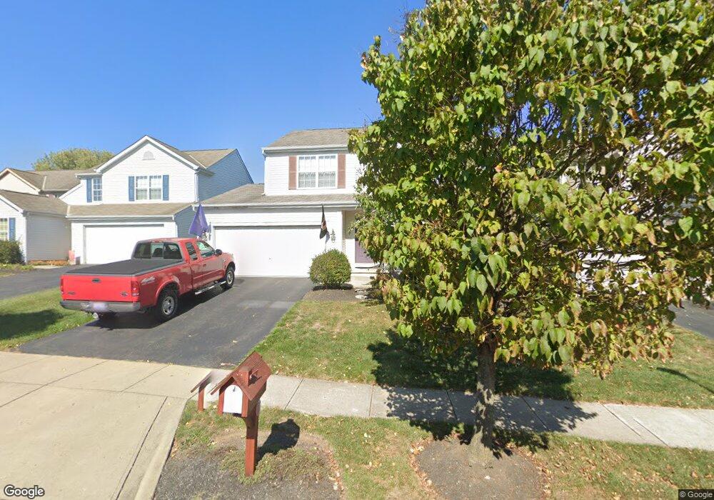
1622 Bristol Commons Place Columbus, OH 43240
Polaris North NeighborhoodEstimated Value: $432,000 - $464,000
4
Beds
3
Baths
1,968
Sq Ft
$228/Sq Ft
Est. Value
About This Home
This home is located at 1622 Bristol Commons Place, Columbus, OH 43240 and is currently estimated at $449,002, approximately $228 per square foot. 1622 Bristol Commons Place is a home located in Delaware County with nearby schools including Freedom Trail Elementary School, Olentangy Orange Middle School, and Orange High School.
Ownership History
Date
Name
Owned For
Owner Type
Purchase Details
Closed on
Dec 10, 2001
Sold by
M/I Schottenstein Homes
Bought by
Schetter Andrew B and Schetter Christina A
Current Estimated Value
Home Financials for this Owner
Home Financials are based on the most recent Mortgage that was taken out on this home.
Original Mortgage
$205,056
Outstanding Balance
$80,780
Interest Rate
6.68%
Mortgage Type
FHA
Estimated Equity
$368,222
Create a Home Valuation Report for This Property
The Home Valuation Report is an in-depth analysis detailing your home's value as well as a comparison with similar homes in the area
Home Values in the Area
Average Home Value in this Area
Purchase History
| Date | Buyer | Sale Price | Title Company |
|---|---|---|---|
| Schetter Andrew B | $208,275 | -- |
Source: Public Records
Mortgage History
| Date | Status | Borrower | Loan Amount |
|---|---|---|---|
| Open | Schetter Andrew B | $205,056 |
Source: Public Records
Tax History Compared to Growth
Tax History
| Year | Tax Paid | Tax Assessment Tax Assessment Total Assessment is a certain percentage of the fair market value that is determined by local assessors to be the total taxable value of land and additions on the property. | Land | Improvement |
|---|---|---|---|---|
| 2024 | $5,998 | $123,310 | $26,640 | $96,670 |
| 2023 | $6,023 | $123,310 | $26,640 | $96,670 |
| 2022 | $5,668 | $92,400 | $18,200 | $74,200 |
| 2021 | $5,700 | $92,400 | $18,200 | $74,200 |
| 2020 | $5,732 | $92,400 | $18,200 | $74,200 |
| 2019 | $4,613 | $78,410 | $16,560 | $61,850 |
| 2018 | $4,634 | $78,410 | $16,560 | $61,850 |
| 2017 | $4,579 | $71,820 | $14,700 | $57,120 |
| 2016 | $4,503 | $71,820 | $14,700 | $57,120 |
| 2015 | $4,040 | $71,820 | $14,700 | $57,120 |
| 2014 | $4,101 | $71,820 | $14,700 | $57,120 |
| 2013 | $4,095 | $70,140 | $14,700 | $55,440 |
Source: Public Records
Map
Nearby Homes
- 9291 Prestwick Green Dr
- 2715 Tucker Trail
- 3138 E Powell Rd
- 9182 Gramford St Unit 9182
- 9168 Tahoma St
- 1746 E Powell Rd
- 7631 Pleasant Colony Ct
- 3477 Birkland Cir
- 3694 Waverly Place Dr
- 3599 Birkland Cir
- 9165 Stream Pebble Dr
- 3679 Birkland Cir
- 975 Adara Dr Unit 6975
- 3737 Birkland Cir
- 974 Shaula Dr Unit 3974
- 2165 Ben Brush Place
- 7697 Bale Kenyon Rd
- 2363 Pleasant Colony Dr
- 1923 Myrtle St
- 2160 Pleasant Colony Dr
- 1628 Bristol Commons Place
- 1616 Bristol Commons Place
- 1610 Bristol Commons Place
- 9279 Prestwick Green Dr
- 9273 Prestwick Green Dr
- 9285 Prestwick Green Dr
- 1604 Bristol Commons Place
- 9146 Walker Park Dr
- 9297 Prestwick Green Dr
- 1621 Bristol Commons Place
- 9139 Walker Park Dr Unit 9139
- 1615 Bristol Commons Place
- 1627 Bristol Commons Place
- 9135 Walker Park Dr
- 1633 Bristol Commons Place
- 9131 Walker Park Dr
- 1609 Bristol Commons Place
- 9303 Prestwick Green Dr
- 8499 Greentree Dr
- 1639 Bristol Commons Place