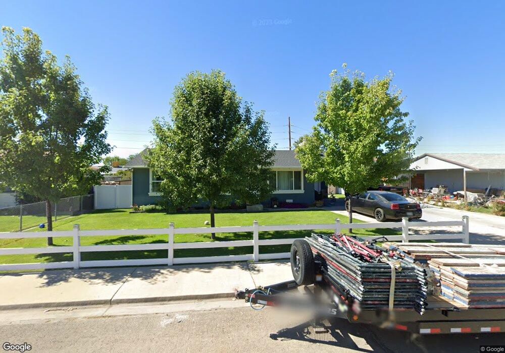
1622 S 450 W Provo, UT 84601
Franklin NeighborhoodEstimated Value: $411,000 - $417,834
3
Beds
2
Baths
1,205
Sq Ft
$344/Sq Ft
Est. Value
About This Home
This home is located at 1622 S 450 W, Provo, UT 84601 and is currently estimated at $413,945, approximately $343 per square foot. 1622 S 450 W is a home located in Utah County with nearby schools including Franklin Elementary School, Dixon Middle School, and Provo High School.
Ownership History
Date
Name
Owned For
Owner Type
Purchase Details
Closed on
Apr 26, 2013
Sold by
Maas Daniel A
Bought by
Mendez Santos
Current Estimated Value
Home Financials for this Owner
Home Financials are based on the most recent Mortgage that was taken out on this home.
Original Mortgage
$142,274
Outstanding Balance
$99,768
Interest Rate
3.25%
Mortgage Type
FHA
Estimated Equity
$314,177
Purchase Details
Closed on
Nov 16, 2010
Sold by
The Secretary Of Housing & Urban Develop
Bought by
Maas Daniel A
Home Financials for this Owner
Home Financials are based on the most recent Mortgage that was taken out on this home.
Original Mortgage
$133,794
Interest Rate
4.25%
Mortgage Type
FHA
Purchase Details
Closed on
Apr 26, 2010
Sold by
Wells Fargo Bank Na
Bought by
Secretary Of Housing & Urban Development
Purchase Details
Closed on
Mar 26, 2010
Sold by
Sant Jedediah T and Mortgage Electronic Registrati
Bought by
Wells Fargo Bank Na
Purchase Details
Closed on
Jul 7, 2008
Sold by
Bleak Craig A and Bleak Shirley J
Bought by
Sant Jedediah T
Home Financials for this Owner
Home Financials are based on the most recent Mortgage that was taken out on this home.
Original Mortgage
$171,311
Interest Rate
6.07%
Mortgage Type
FHA
Purchase Details
Closed on
Sep 11, 2006
Sold by
Perez Juventino Corona
Bought by
Dnd Enterprises Llc
Purchase Details
Closed on
Sep 8, 2005
Sold by
Workman Marla Rose and Nielsen Marla Rose
Bought by
Perez Juventino Corona
Purchase Details
Closed on
Jun 4, 1996
Sold by
Wootton William B and Wootton Deborah E
Bought by
Nielsen William J and Nielsen Marla Rose
Home Financials for this Owner
Home Financials are based on the most recent Mortgage that was taken out on this home.
Original Mortgage
$76,400
Interest Rate
7.96%
Create a Home Valuation Report for This Property
The Home Valuation Report is an in-depth analysis detailing your home's value as well as a comparison with similar homes in the area
Home Values in the Area
Average Home Value in this Area
Purchase History
| Date | Buyer | Sale Price | Title Company |
|---|---|---|---|
| Mendez Santos | -- | Greenbrier Title Insurance A | |
| Maas Daniel A | -- | Monument Title Insurance I | |
| Secretary Of Housing & Urban Development | -- | Backman Fptp | |
| Wells Fargo Bank Na | $180,548 | Etitle Insurance Agency | |
| Sant Jedediah T | -- | Equity Title Orem Blvd | |
| Dnd Enterprises Llc | $123,000 | None Available | |
| Perez Juventino Corona | -- | Metro National Title | |
| Nielsen William J | -- | -- |
Source: Public Records
Mortgage History
| Date | Status | Borrower | Loan Amount |
|---|---|---|---|
| Open | Mendez Santos | $142,274 | |
| Previous Owner | Maas Daniel A | $133,794 | |
| Previous Owner | Sant Jedediah T | $171,311 | |
| Previous Owner | Nielsen William J | $76,400 |
Source: Public Records
Tax History
| Year | Tax Paid | Tax Assessment Tax Assessment Total Assessment is a certain percentage of the fair market value that is determined by local assessors to be the total taxable value of land and additions on the property. | Land | Improvement |
|---|---|---|---|---|
| 2025 | $2,020 | $215,930 | -- | -- |
| 2024 | $2,020 | $198,880 | $0 | $0 |
| 2023 | $1,933 | $187,550 | $0 | $0 |
| 2022 | $2,074 | $202,950 | $0 | $0 |
| 2021 | $1,579 | $269,400 | $92,100 | $177,300 |
| 2020 | $1,531 | $244,900 | $83,700 | $161,200 |
| 2019 | $1,364 | $227,000 | $83,700 | $143,300 |
| 2018 | $1,194 | $201,400 | $76,800 | $124,600 |
| 2017 | $1,112 | $103,070 | $0 | $0 |
| 2016 | $1,046 | $90,365 | $0 | $0 |
| 2015 | $925 | $80,795 | $0 | $0 |
| 2014 | $866 | $78,870 | $0 | $0 |
Source: Public Records
Map
Nearby Homes
- 1094 S 450 W
- 588 W 1720 S
- 311 W 1610 S
- 1799 S 730 W
- 641 W 1280 S
- 655 W 1280 S
- 1163 S 680 W
- 1095 S 500 W Unit 11
- 1956 E 1700 S
- 1951 E 1700 S
- 991 S 500 W
- 933 S Blvd W
- 933 S Freedom Blvd Unit 7
- 914 W 1150 S Unit 2
- 340 W 920 S Unit 16
- 131 S Meadow Dr Unit 20
- 151 S Meadow Dr Unit 19
- 151 S Meadow Dr
- 747 S 500 W
- 784 W Heather Ln
Your Personal Tour Guide
Ask me questions while you tour the home.