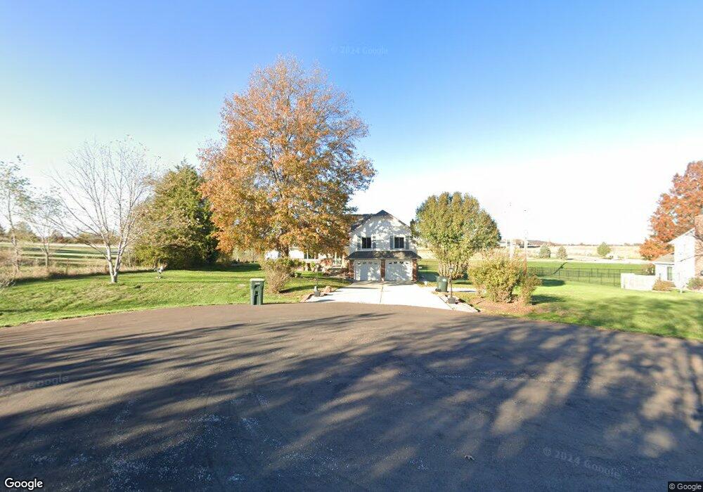
16226 Sloan Rd Leavenworth, KS 66048
Estimated Value: $378,517 - $540,000
4
Beds
3
Baths
1,776
Sq Ft
$240/Sq Ft
Est. Value
About This Home
This home is located at 16226 Sloan Rd, Leavenworth, KS 66048 and is currently estimated at $426,879, approximately $240 per square foot. 16226 Sloan Rd is a home located in Leavenworth County with nearby schools including Lansing Elementary School, Lansing Middle 6-8, and Lansing High 9-12.
Ownership History
Date
Name
Owned For
Owner Type
Purchase Details
Closed on
Aug 1, 1996
Bought by
Domke Gary David and Domke Adrienne L
Current Estimated Value
Home Financials for this Owner
Home Financials are based on the most recent Mortgage that was taken out on this home.
Original Mortgage
$204,534
Outstanding Balance
$74,954
Interest Rate
8.19%
Mortgage Type
VA
Estimated Equity
$351,925
Create a Home Valuation Report for This Property
The Home Valuation Report is an in-depth analysis detailing your home's value as well as a comparison with similar homes in the area
Home Values in the Area
Average Home Value in this Area
Purchase History
| Date | Buyer | Sale Price | Title Company |
|---|---|---|---|
| Domke Gary David | $133,000 | -- |
Source: Public Records
Mortgage History
| Date | Status | Borrower | Loan Amount |
|---|---|---|---|
| Open | Domke Gary David | $204,534 | |
| Closed | Domke Gary David | $141,500 |
Source: Public Records
Tax History Compared to Growth
Tax History
| Year | Tax Paid | Tax Assessment Tax Assessment Total Assessment is a certain percentage of the fair market value that is determined by local assessors to be the total taxable value of land and additions on the property. | Land | Improvement |
|---|---|---|---|---|
| 2025 | $4,869 | $36,754 | $6,420 | $30,334 |
| 2024 | $4,706 | $36,229 | $7,424 | $28,805 |
| 2023 | $4,706 | $36,229 | $7,424 | $28,805 |
| 2022 | $4,525 | $32,936 | $5,211 | $27,725 |
| 2021 | $4,544 | $31,545 | $4,316 | $27,229 |
| 2020 | $4,267 | $29,164 | $4,158 | $25,006 |
| 2019 | $4,079 | $27,853 | $3,813 | $24,040 |
| 2018 | $3,873 | $26,473 | $4,291 | $22,182 |
| 2017 | $3,771 | $25,726 | $4,291 | $21,435 |
| 2016 | $3,773 | $25,726 | $4,291 | $21,435 |
| 2015 | $3,486 | $23,863 | $4,291 | $19,572 |
| 2014 | $3,269 | $22,862 | $4,291 | $18,571 |
Source: Public Records
Map
Nearby Homes
- 0000 Eisenhower Rd
- 16055 W Eisenhower Rd
- 15915 Eisenhower Rd
- 1605 Shadow Dr
- 2151 Shenandoah Dr
- 2150 Shenandoah Dr
- 3703 Clayton Dr
- 17096 Eisenhower Rd
- 4421 Grand Ct
- 00000 Michals Rd
- 1023 Ironwood Ct
- 4301 Ironwood Dr
- 2100 Limit St
- 2105 Vilas St
- 1320 Independence Ct
- 4606 Park Ln
- 728 Eisenhower Rd
- 2248 Vilas St
- 1601 Holman St
- 2516 Kensington Place
- 16208 Sloan Rd
- 16227 Sloan Rd
- 16209 Sloan Rd
- 16259 Eisenhower Rd
- 0 Eisenhower Rd Unit 1493279
- 0 Eisenhower Rd Unit 1650326
- 0 Eisenhower Rd Unit 1773255
- 00000 Eisenhower Rd
- 0 Eisenhower Rd Unit 2185258
- 16228 Whispering Winds Rd
- 16210 Whispering Winds Rd
- 16212 Eisenhower Rd
- 16150 Eisenhower Rd
- 16229 Whispering Winds Rd
- 16211 Whispering Winds Rd
- 2109 Cottonwood St
- 2113 Cottonwood St
- 2105 Cottonwood St
- 2101 Cottonwood St
- 2121 Cottonwood St